Map of Lynnwood, Washington
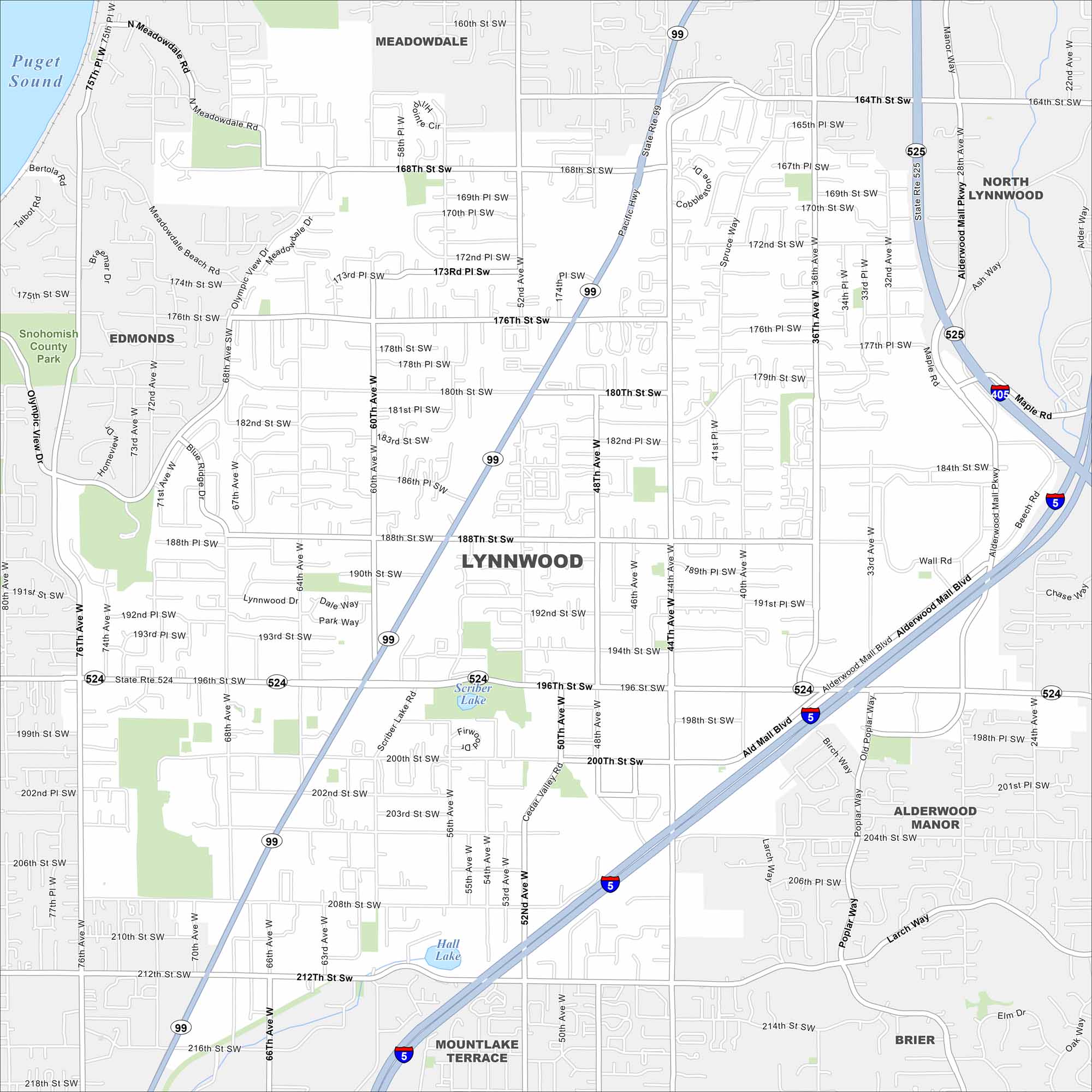
Our map of Lynnwood highlights its spot north of Seattle. Interstates and highways converge here. Shopping areas and neighborhoods spread out around the junctions.
Map Information
On the Map
Interstates/Highways: I-5, I-405, State Rte 99, State Rte 524, State Rte 525 Major Roads: 196th St SW, 44th Ave W, Alderwood Mall Blvd, 36th Ave W, 164th St SW, 212th St SW, 188th St SW, 200th St SW, 68th Ave W, Cypress Way, Larch Way, Poplar Way, 76th Ave W, 52nd Ave W, 60th Ave W, 176th St SW, 184th St SW, Maple Rd, Olympic View Dr, Manor Way Lakes and Reservoirs: Puget Sound, Scriber Lake, Hall Lake Parks and Preserves: Snohomish County Park Nearby Communities: Meadowdale, North Lynnwood, Edmonds, Alderwood Manor, Mountlake Terrace, BrierWashington State Maps
Move through the Evergreen State with our map collection.


City Maps of Washington
Check out our city maps of Washington


