Map of Mill Creek, Washington
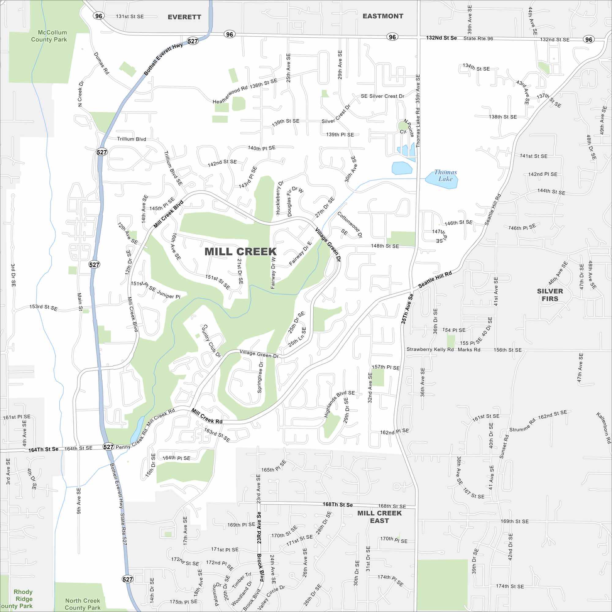
Mill Creek is north of Seattle and is in Snohomish County. Our map shows master-planned neighborhoods, parks, and major routes. The area has grown rapidly in recent decades.
Map Information
On the Map
Interstates/Highways: State Rte 527, State Rte 96 Major Roads: 164th St SE, Bothell Everett Hwy, Seattle Hill Rd, 35th Ave SE, Dumbas Rd, 132nd St SE, 175th St SE, Mill Creek Blvd, Village Green Dr, Brook Blvd, Trillium Blvd, Mill Creek Rd, 153rd St SE, 148th St SE, 156th St SE, 161st St SE, 139th St SE, 144th St SE, 18th Ave SE, 25th Ave SE Lakes and Reservoirs: Thomas Lake Parks and Preserves: McCollum County Park, North Creek County Park, Rhody Ridge County Park Nearby Communities: Everett, Eastmont, Silver Firs, Mill Creek EastWashington State Maps
Move through the Evergreen State with our map collection.


City Maps of Washington
Check out our city maps of Washington


