Map of Mobile, Alabama
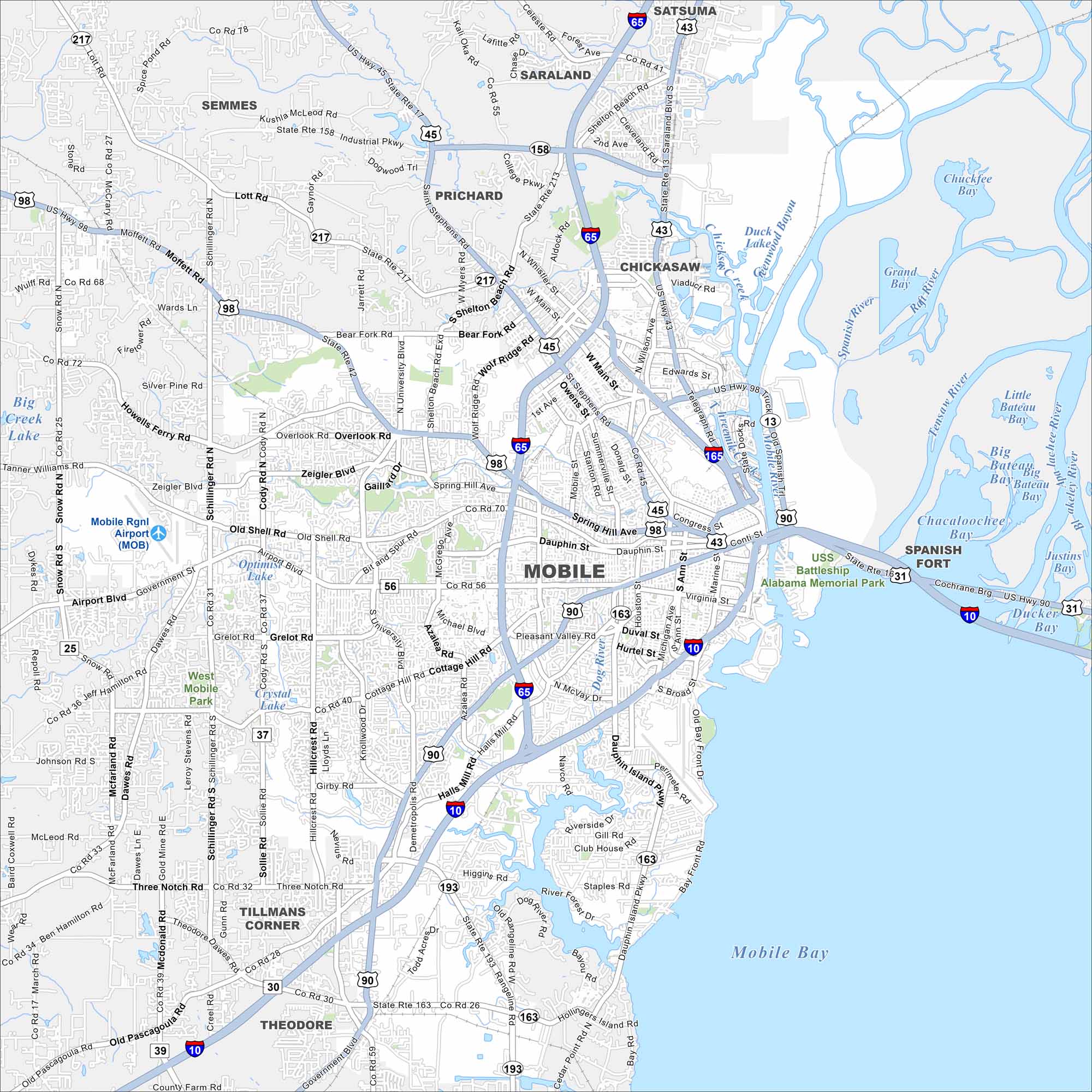
Check out our road map of Mobile, Alabama. The city spreads along Mobile Bay with a busy port at its heart. History, industry, and waterways all shape its layout along the Gulf Coast.


Map Information
On the Map
Interstates/Highways: I-10, I-65, I-165, US Hwy 31, US Hwy 43, US Hwy 45, US Hwy 90, US Hwy 98, State Rte 163 (Dauphin Island Pkwy), State Rte 193 (Rangeline Rd) Major Roads: Government Blvd, Airport Blvd, Dauphin St, Springhill Ave, Moffett Rd, Cottage Hill Rd, Grelot Rd, Hillcrest Rd, University Blvd, Schillinger Rd, Azalea Rd, Beltline Hwy, Water St, Broad St, Michigan Ave, Halls Mill Rd, Old Shell Rd, Saint Stephens Rd, Bay Bridge Rd, Hamilton Blvd Airports: Mobile Regional Airport (MOB) Lakes and Reservoirs: Mobile Bay, Tensaw Lake, Big Creek Lake, Bateau Bay, Ducket Bay, Rivers and Creeks: Mobile River, Tensaw River, Dog River Parks/Preserves/Forests: USS Battleship Alabama Memorial Park, West Mobile Park Nearby Communities: Prichard, Chickasaw, Saraland, Satsuma, Semmes, Theodore, Tillmans Corner, Spanish Fort, Daphne, FairhopeAlabama City Maps
Here are our city maps of Alabama


