Map of Mount Vernon, Washington
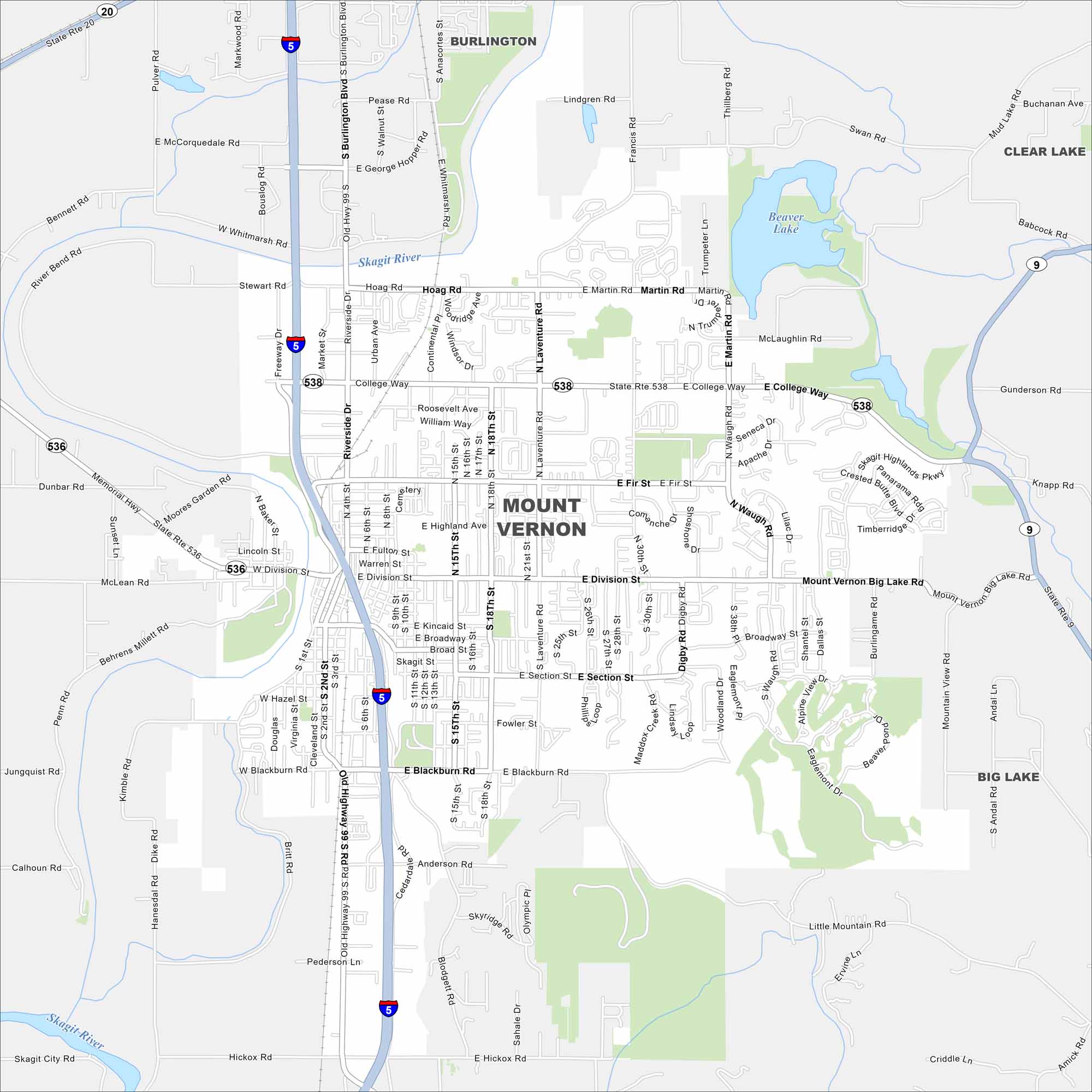
Take a look at Mount Vernon on our map. Located in Skagit County, you’ll notice the Skagit River running right through town. Farmland stretching in every direction. Tulip fields nearby make it especially known in spring.
Map Information
On the Map
Interstates/Highways: I-5, State Rte 536, State Rte 20, State Rte 9 Major Roads: College Way, Riverside Dr, Division St, Blackburn Rd, Kincaid St, Broad St, Section St, Laventure Rd, Waugh Rd, Digby Rd, Martin Rd, Hoag Rd, Freeway Dr, Old Hwy 99 S Rd, Skagit Highlands Pkwy, Little Mountain Rd, Hickox Rd, Anderson Rd, E McCorquedale Rd, Stewart Rd Lakes and Reservoirs: Beaver Lake Major Rivers: Skagit River Nearby Communities: Burlington, Clear Lake, Big LakeWashington State Maps
Move through the Evergreen State with our map collection.


City Maps of Washington
Check out our city maps of Washington


