Map of Yakima, Washington
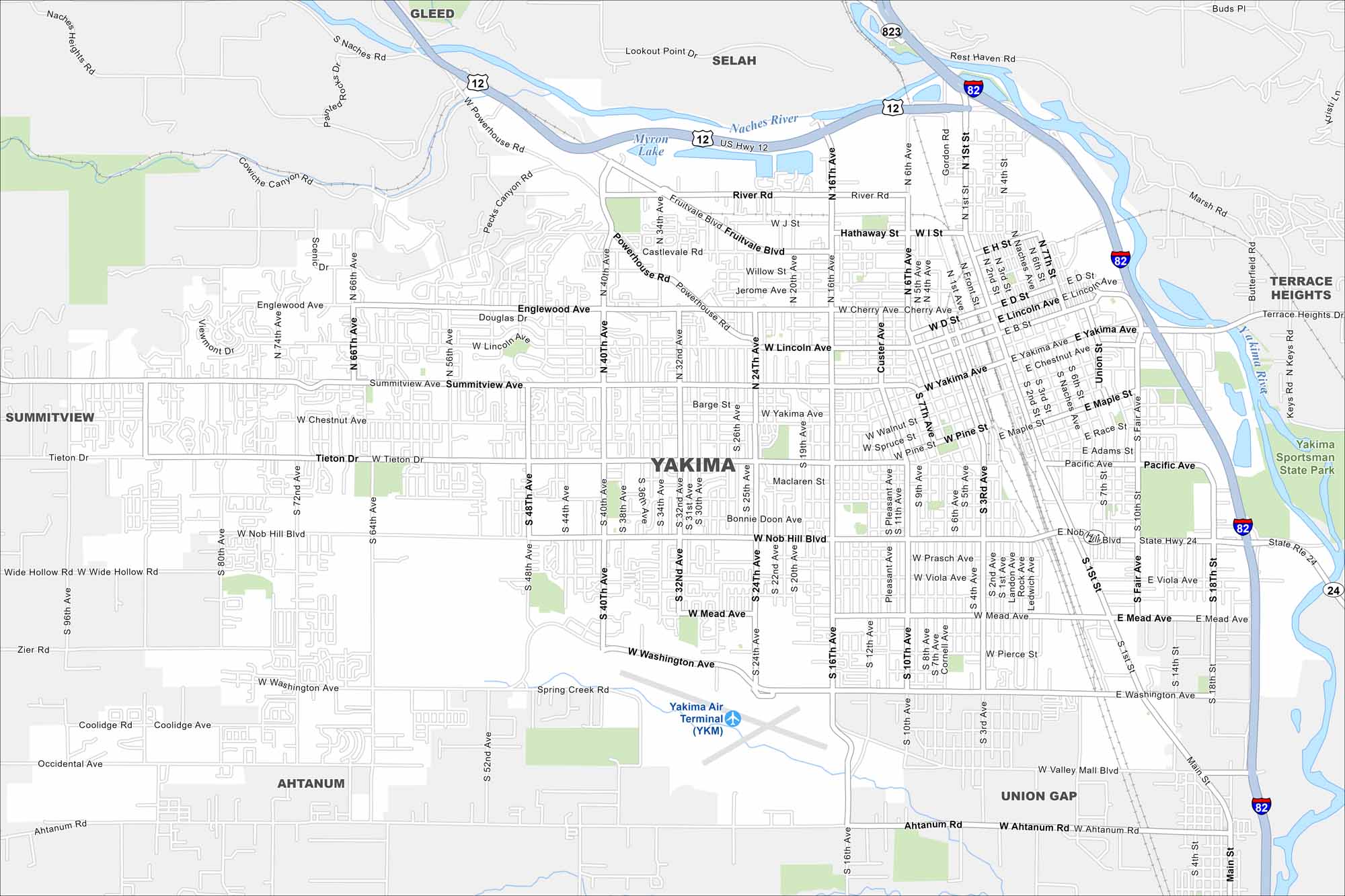
Get a snapshot of Yakima in the fertile Yakima Valley. Vineyards, orchards, and mountain views surround the city. Both the Yakima and Naches River define the region.
Map Information
On the Map
Interstates/Highways: I-82, US Hwy 12, State Rte 24 Major Roads: Yakima Ave, Nob Hill Blvd, Washington Ave, Mead Ave, Tieton Dr, Summitview Ave, Lincoln Ave, River Rd, Fruitvale Blvd, Powerhouse Rd, 1st St, 16th Ave, 24th Ave, 32nd Ave, 40th Ave, 48th Ave, 64th Ave, 72nd Ave, 80th Ave, Ahtanum Rd Airports: Yakima Air Terminal (YKM) Lakes and Reservoirs: Myron Lake Major Rivers: Naches River, Yakima River Parks and Preserves: Yakima Sportsman State Park Nearby Communities: Gleed, Selah, Terrace Heights, Union Gap, Ahtanum, SummitviewWashington State Maps
Move through the Evergreen State with our map collection.


City Maps of Washington
Check out our city maps of Washington


