Map of Port Orchard, Washington
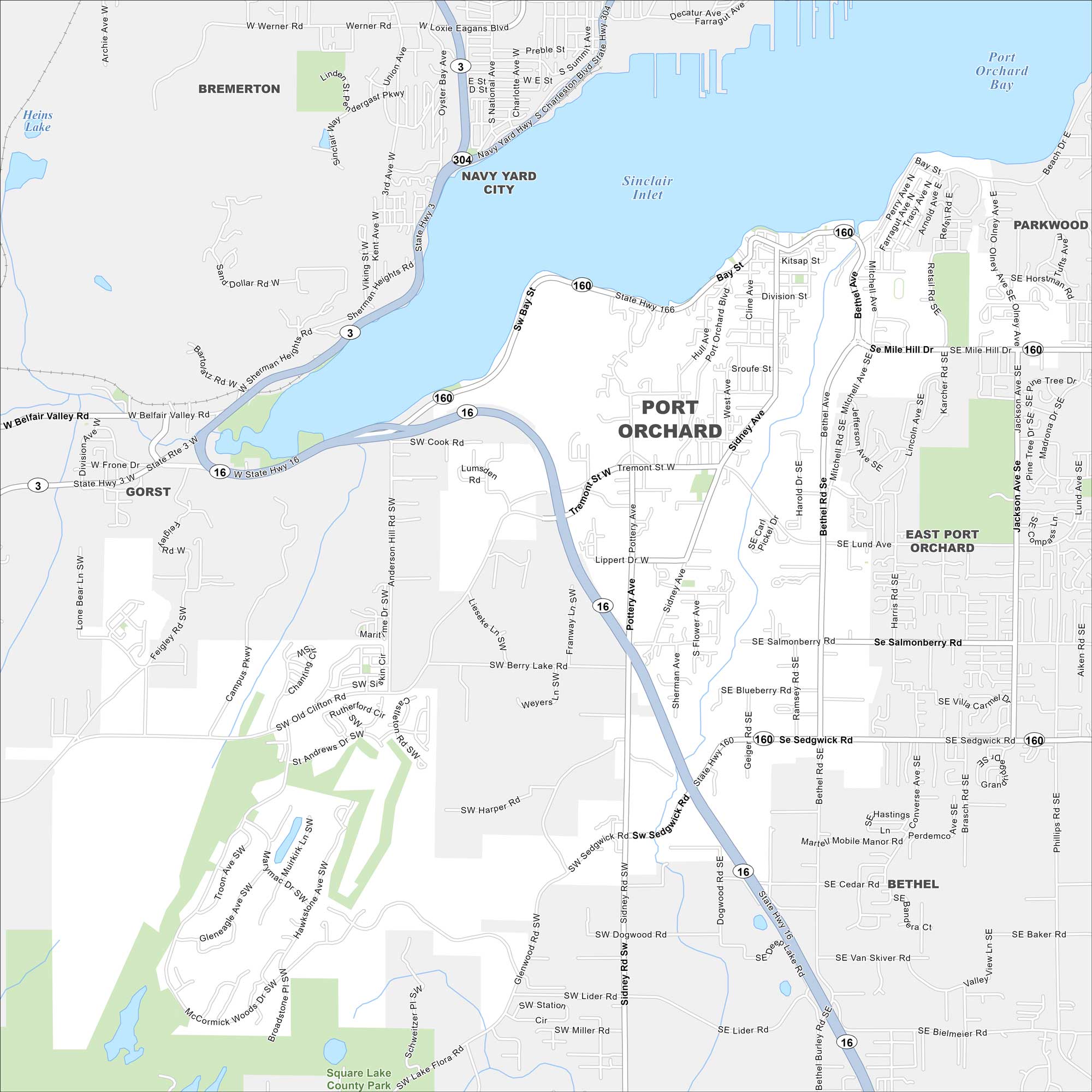
Set along Sinclair Inlet, Port Orchard faces the city of Bremerton across the water. Check out our map with streets clustered near the marina and ferry dock.
Map Information
On the Map
Interstates/Highways: State Rte 16, State Rte 160, State Rte 3, State Rte 304 Major Roads: Sedgwick Rd, Lund Ave, Mile Hill Dr, Bethel Rd, Bay St, Sidney Ave, Tremont St, Mullenix Rd, Glenwood Rd, Banner Rd, Pottery Ave, Jackson Ave, Harris Rd, Mitchell Rd, Burley Olalla Rd, Anderson Hill Rd, Feigley Rd, Lumsden Rd, Baby Doll Rd, Olney Rd Lakes and Reservoirs: Sinclair Inlet, Port Orchard Bay, Heins Lake Parks and Preserves: Square Lake County Park Nearby Communities: Bremerton, Navy Yard City, Gorst, East Port Orchard, Parkwood, BethelWashington State Maps
Move through the Evergreen State with our map collection.


City Maps of Washington
Check out our city maps of Washington


