Map of Puyallup, Washington
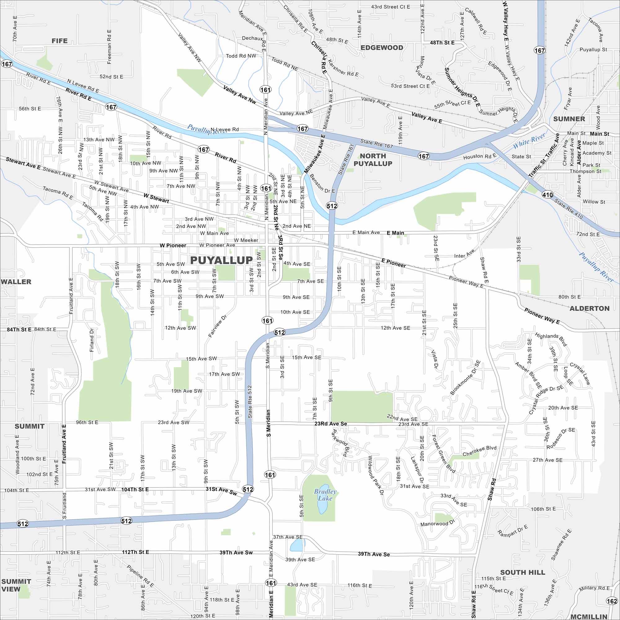
With our map of Puyallup, you can easily move between neighborhoods and farmland. You’ll be able to see the Puyallup River which winds its way right through the city. Puyallup is also famous for its state fair, one of the largest in the country.
Map Information
On the Map
Interstates/Highways: State Rte 167, State Rte 161, State Rte 512, State Rte 410, State Rte 162 Major Roads: Meridian Ave, Pioneer Way, Main St, Stewart Ave, Valley Ave, River Rd, Shaw Rd, Highlands Blvd, 31st Ave, 39th Ave, 112th St, 128th St, 176th St, Canyon Rd, Military Rd, 72nd St, 80th St, 114th Ave, 122nd Ave, 127th Ave Lakes and Reservoirs: Bradley Lake Major Rivers: Puyallup River, White River Nearby Communities: Fife, Edgewood, Sumner, North Puyallup, Alderton, South Hill, McMillin, Summit View, Summit, WallerWashington State Maps
Move through the Evergreen State with our map collection.


City Maps of Washington
Check out our city maps of Washington


