Map of Rainbow City, Alabama
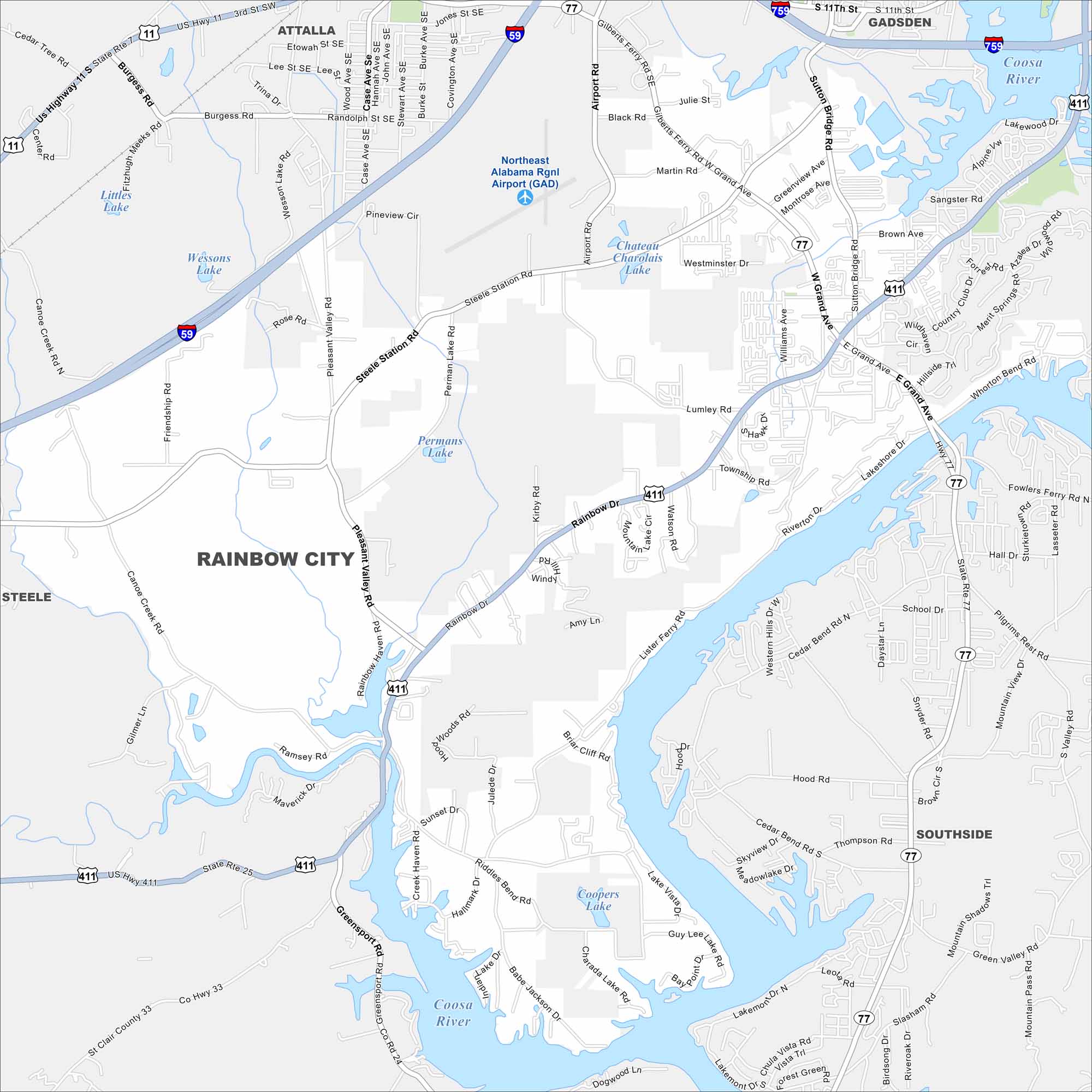
Named for its proximity to Rainbow Drive, the city grew alongside nearby Gadsden. The map highlights its residential areas and local routes. It’s a community tied closely to the Coosa River.


Map Information
On the Map
Interstates/Highways: I-59, I-759, US 411, US 11, AL 77 Major Roads: Rainbow Dr, Steele Station Rd, Pleasant Valley Rd, Co Hwy 35, Cleburne County Rd, Martin Rd, Lumley Rd, E Grand Ave, Williams Ave, Black Rd, Hood Rd, School Dr, Cedar Bend Rd, Thompson Rd, Lakemore Dr, Sunset Dr, Hall Dr, Little Fern Cv, Fowlers Ferry Rd Airports: Northeast Alabama Rgnl Airport (GAD) Lakes and Reservoirs: Littles Lake, Wessons Lake, Permans Lake, Chateau Charalaix Lake, Coopers Lake, Coosa River Rivers and Creeks: Coosa River Nearby Communities: Gadsden, Attalla, Steele, SouthsideAlabama City Maps
Here are our city maps of Alabama


