Map of Raleigh, North Carolina
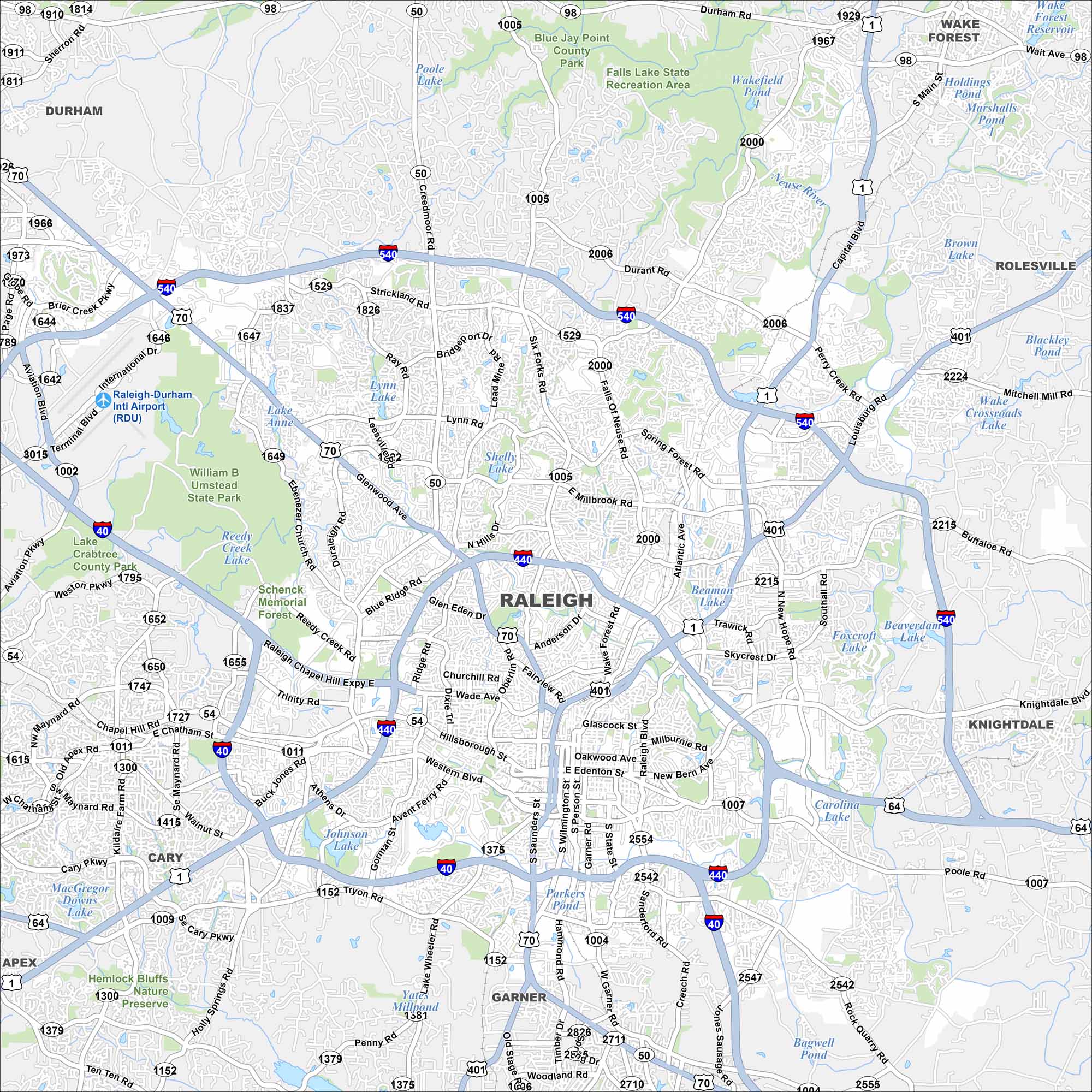
Raleigh is the capital of North Carolina and part of the state’s Research Triangle. Our map shows major highways, parks, and the downtown grid. The city is also known as the “City of Oaks”.
Map Information
On the Map
Interstates/Highways: I-40, I-440, I-540, US Hwy 1, US Hwy 64, US Hwy 70, US Hwy 401, State Rte 50, State Rte 54, State Rte 98 Major Roads: Glenwood Ave, Capital Blvd, Wade Ave, Western Blvd, New Bern Ave, Six Forks Rd, Falls Of Neuse Rd, Millbrook Rd, Atlantic Ave, Wake Forest Rd, Blue Ridge Rd, Edwards Mill Rd, Ebenezer Church Rd, Tryon Rd, Saunders St, Wilmington St, Person St, State St, Poole Rd, Rock Quarry Rd Airports: Raleigh-Durham Intl Airport (RDU) Lakes and Reservoirs: Brier Creek Reservoir, Lynn Lake, Shelley Lake, Lake Anne, Reedy Creek Lake, Lake Crabtree, Johnson Lake, Yates Millpond, Parkers Pond, Beaverdam Lake, Foxcroft Lake, Carolina Lake, Bagwell Pond, Holdings Pond, Marshalls Pond Parks and Preserves: William B Umstead State Park, Schenck Memorial Forest, Hemlock Bluffs Nature Preserve, Blue Jay Point County Park, Falls Lake State Recreation Area Nearby Communities: Durham, Wake Forest, Rolesville, Knightdale, Garner, Cary, Apex Neighborhoods: Downtown RaleighNorth Carolina State Maps
Get to know the mountains and coastlines of North Carolina.


City Maps of North Carolina
Journey through North Carolina with our city maps


