Map of Redmond, Washington
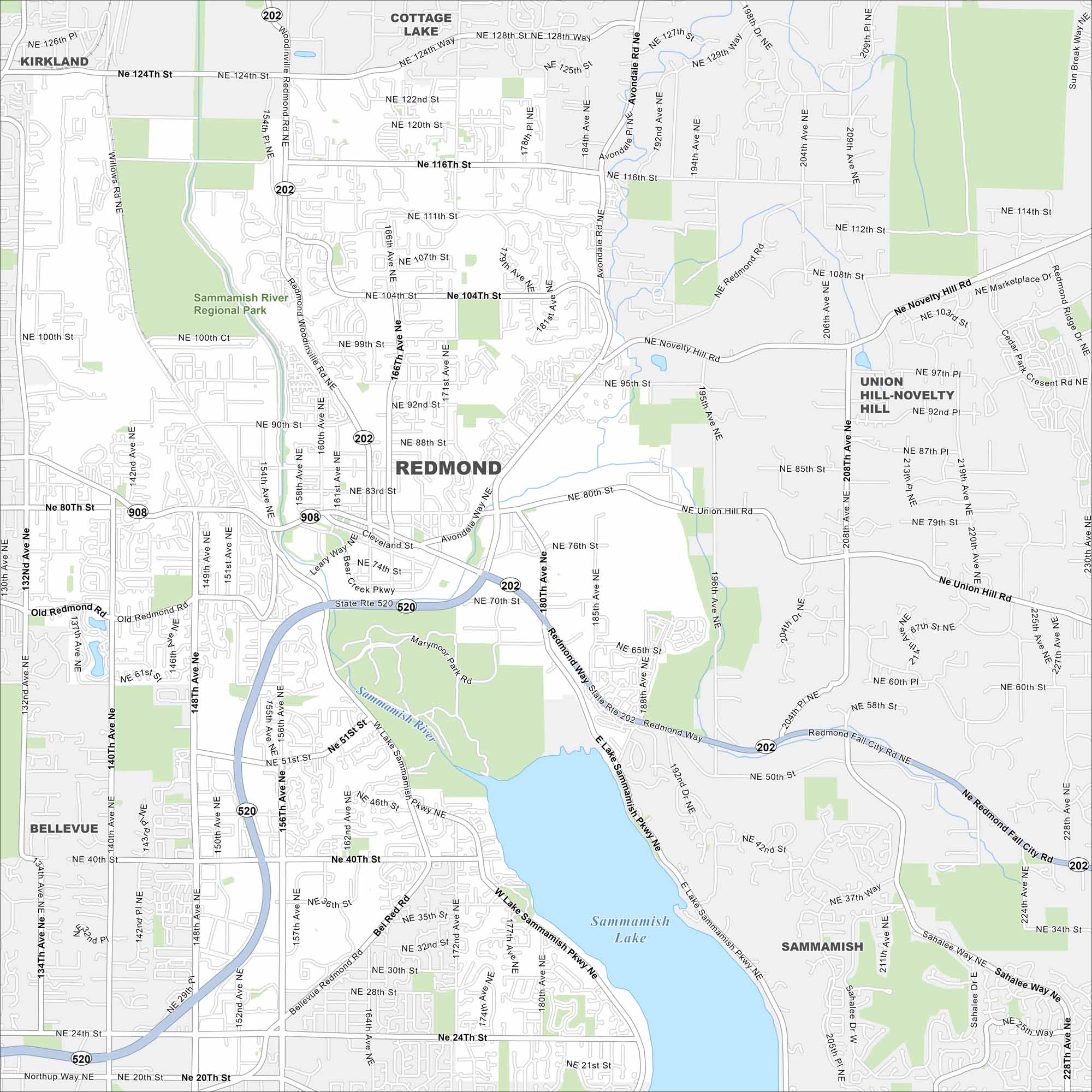
Best known as the home of Microsoft, Redmond balances tech campuses with leafy trails. Our road map helps you navigate between business districts and residential areas. The city also claims the title of “Bicycle Capital of the Northwest”.
Map Information
On the Map
Interstates/Highways: State Rte 520, State Rte 202 Major Roads: Redmond Way, Avondale Rd, Novelty Hill Rd, Union Hill Rd, Redmond Fall City Rd, 148th Ave, Willows Rd, Leary Way, Cleveland St, Bear Creek Pkwy, Bel Red Rd, Old Redmond Rd, Sahalee Way, 132nd Ave, 140th Ave, 156th Ave, 160th Ave, 166th Ave, 172nd Ave, 180th Ave Lakes and Reservoirs: Sammamish Lake Major Rivers: Sammamish River Parks and Preserves: Sammamish River Regional Park Nearby Communities: Kirkland, Cottage Lake, Union Hill-Novelty Hill, Sammamish, BellevueWashington State Maps
Move through the Evergreen State with our map collection.


City Maps of Washington
Check out our city maps of Washington


