Map of Renton, Washington
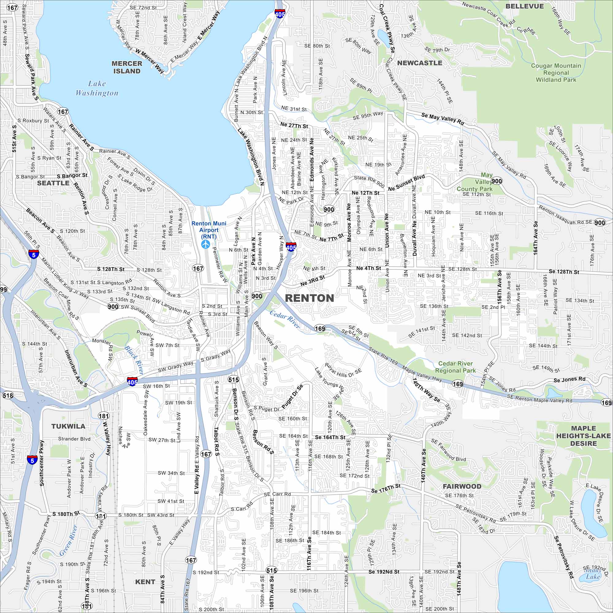
Renton sits along the southern edge of Lake Washington. The city is home to Boeing facilities and a growing waterfront district. Our map makes it simple to move from the lakefront into the city center.
Map Information
On the Map
Interstates/Highways: I-405, State Rte 167, State Rte 900, State Rte 169, State Rte 515, State Rte 181 Major Roads: Rainier Ave, Grady Way, Sunset Blvd, Benson Rd, Petrovitsky Rd, Carr Rd, 140th Way, Maple Valley Hwy, 196th St, 200th St, Park Ave, Logan Ave, Williams Ave, Main Ave, Wells Ave, Talbot Rd, Oakesdale Ave, Valley Hwy, Lind Ave, Monster Rd Airports: Renton Muni Airport (RNT) Lakes and Reservoirs: Lake Washington, Shady Lake Major Rivers: Black River, Green River Parks and Preserves: May Valley County Park, Cedar River Regional Park, Cougar Mountain Regional Wildland Park Nearby Communities: Seattle, Mercer Island, Newcastle, Bellevue, Maple Heights-Lake Desire, Fairwood, Kent, TukwilaWashington State Maps
Move through the Evergreen State with our map collection.


City Maps of Washington
Check out our city maps of Washington


