Oregon Wine Country Map
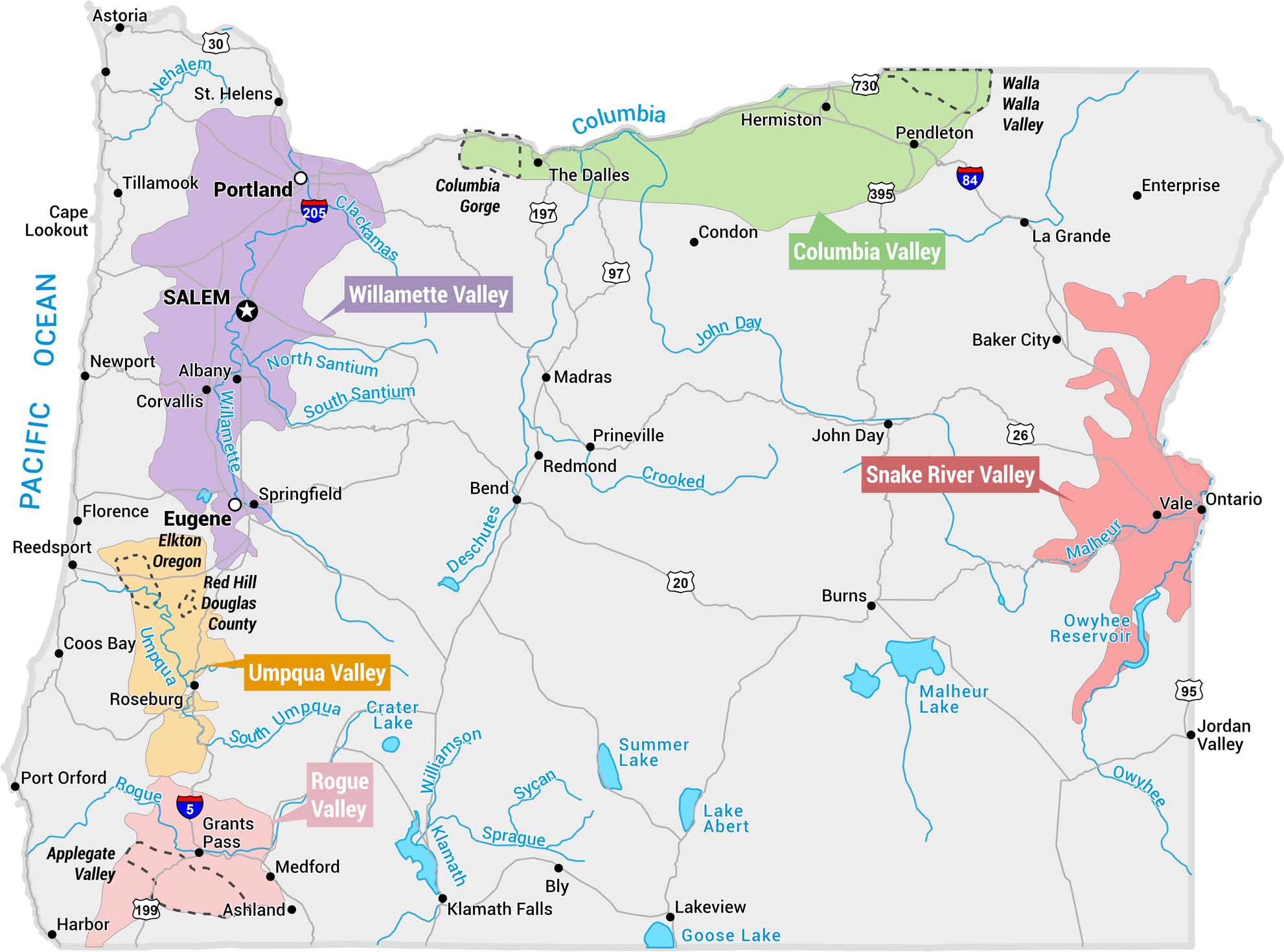
This map displays Oregon’s major wine regions (AVAs – American Viticultural Areas). Each one is shaded in a distinct color across the state. It includes major cities, highways, rivers, and lakes for geographic context.
Map Information
On the Map
Wine Regions (AVAs): Willamette Valley, Columbia Valley, Walla Walla Valley, Umpqua Valley, Rogue Valley, Snake River Valley, Applegate Valley, Elkton Oregon, Red Hill Douglas County, Columbia Gorge Cities/Towns: Portland, Salem, Eugene, Astoria, Tillamook, Newport, Corvallis, Albany, Springfield, Roseburg, Grants Pass, Medford, Ashland, The Dalles, Bend, Redmond, Prineville, Hermiston, Pendleton, La Grande, Baker City, Ontario, Klamath Falls, Lakeview, Burns, John Day Highways: I-5, I-84, US-97, US-395, US-26, US-20, US-199, US-95, US-730, OR-197, I-205 Rivers: Columbia, Willamette, Clackamas, North Santium, South Santium, Umpqua, South Umpqua, Rogue, Deschutes, Crooked, John Day, Malheur, Owyhee, Klamath, Williamson, Sprague, Sycan Lakes/Water Bodies: Crater Lake, Malheur Lake, Summer Lake, Lake Abert, Goose Lake, Owyhee Reservoir, Pacific OceanEconomic Region Maps
Regions defined by farming, industry, production, or economic identities.