Map of Salem, Oregon
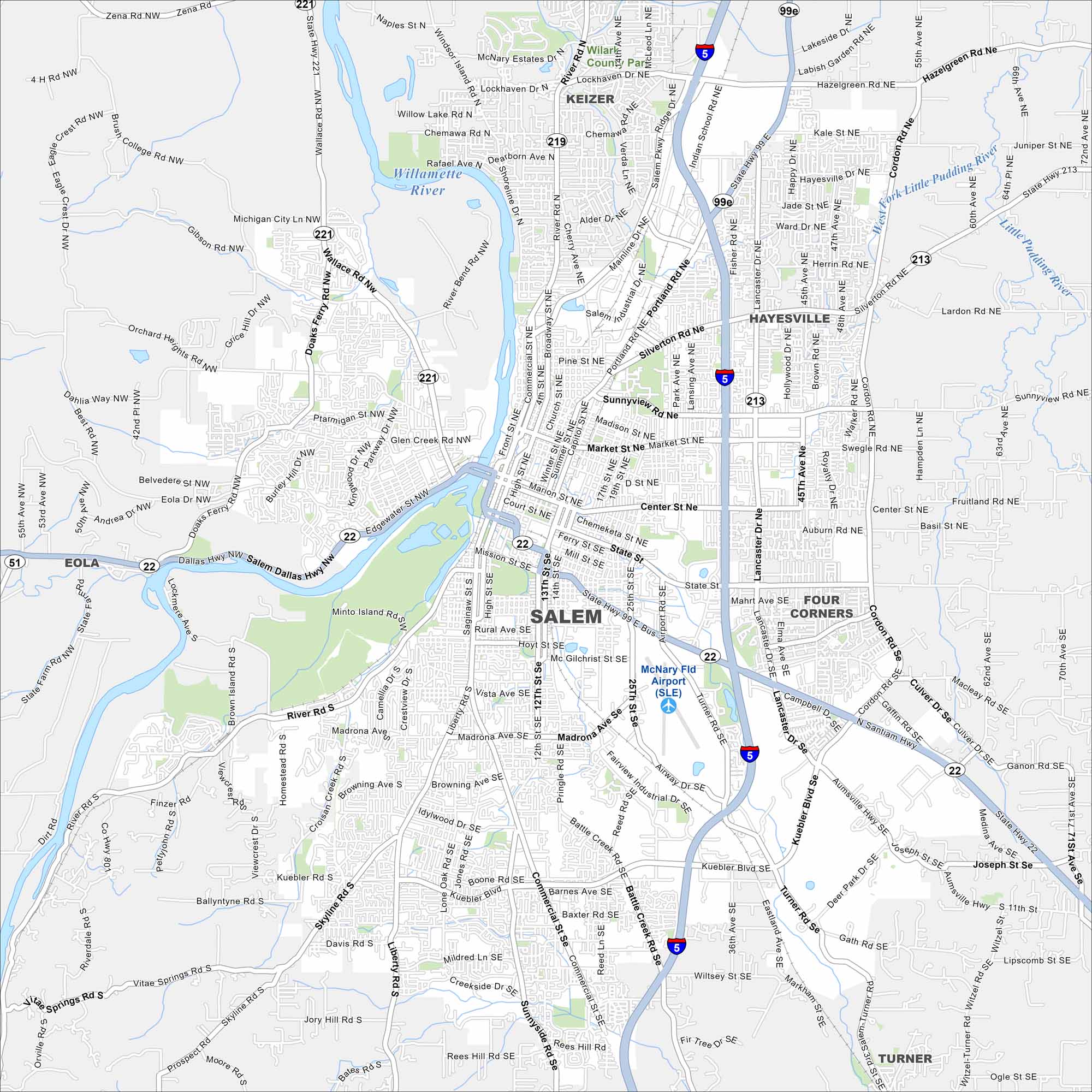
Our map of Salem puts the state capitol at the center. You’ll see parks, neighborhoods, and easy roads to the river. It’s our map to Oregon’s capital city.
Map Information
On the Map
Interstates/Highways: I-5, State Hwy 22, State Hwy 51, State Hwy 99E, State Hwy 213, State Hwy 219, State Hwy 221 Major Roads: Commercial St, Lancaster Dr, Mission St, Market St, Center St, State St, Kuebler Blvd, Wallace Rd, Silverton Rd, Portland Rd, River Rd, Liberty St, 12th St, 13th St, 25th St, Pringle Rd, Madrona Ave, Sunnyside Rd, Cordon Rd, Turner Rd Airports: McNary Fld Airport (SLE) Major Rivers: Willamette River, North Santiam River, West Fork Little Pudding River Nearby Communities: Keizer, Hayesville, Four Corners, Eola, TurnerOregon State Maps
Here is our state map collection of Oregon.


City Maps of Oregon
Get to know Portland and Oregon’s urban areas.


