Map of Sammamish, Washington
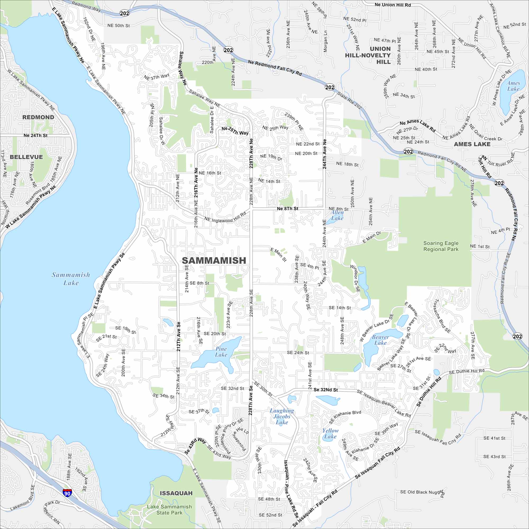
Get oriented with our Sammamish map. It highlights the neighborhoods along the plateau and the lakes nearby. Sammamish Lake is also a standout on the west side.
Map Information
On the Map
Interstates/Highways: I-90, State Rte 202 Major Roads: Sahalee Way, Redmond Fall City Rd, 228th Ave, Issaquah-Pine Lake Rd, Issaquah-Fall City Rd, Main St, 244th Ave, Duthie Hill Rd, Trossachs Blvd, Inglewood Hill Rd, Pine Lake Rd, Klahanie Blvd, 212th Ave, 240th Ave, Thompson Hill Rd, Ames Lake Rd, Union Hill Rd, Louis Thompson Rd, Black Nugget Rd, Providence Point Dr Lakes and Reservoirs: Sammamish Lake, Ames Lake, Pine Lake, Beaver Lake, Yellow Lake, Laughing Jacobs Lake, Allen Lake Parks and Preserves: Soaring Eagle Regional Park, Lake Sammamish State Park Nearby Communities: Redmond, Bellevue, Union Hill-Novelty Hill, Ames Lake, IssaquahWashington State Maps
Move through the Evergreen State with our map collection.


City Maps of Washington
Check out our city maps of Washington


