Map of Slidell, Louisiana
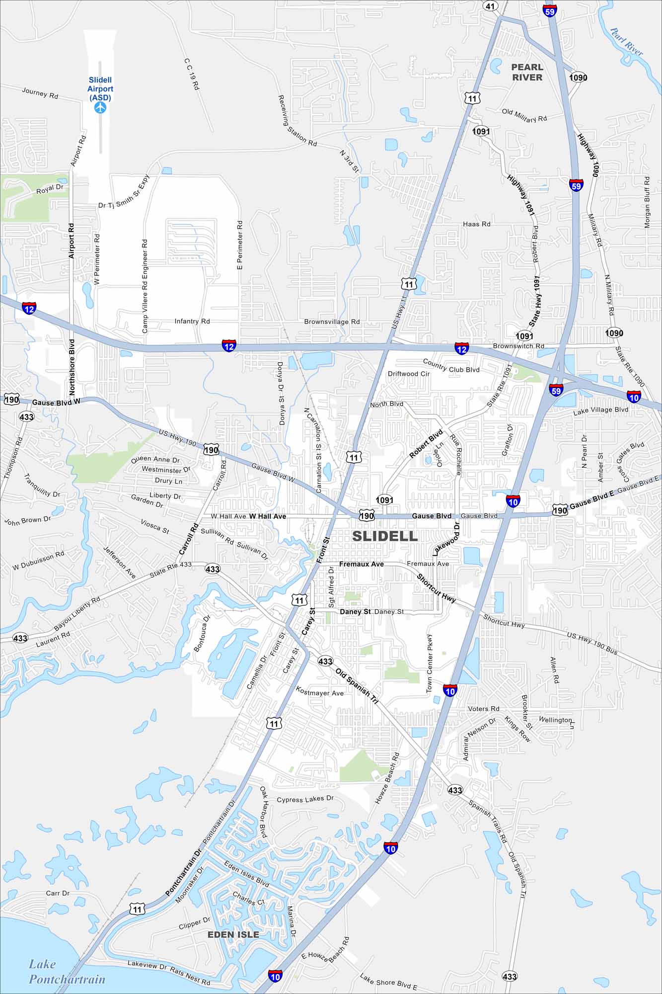
Our map of Slidell highlights its location on the north shore of Lake Pontchartrain. The city is known for fishing, marshes, and a relaxed pace.
Louisiana State Maps
Here are maps showcasing the state of Louisiana


Map Information
On the Map
Interstates/Highways: I-10, I-12, I-59, US Hwy 11, US Hwy 190, State Rte 433, State Rte 1090, State Rte 1091 Major Roads: Gause Blvd, Front St, Pontchartrain Dr, Old Spanish Trail, Fremaux Ave, Robert Blvd, Military Rd, Northshore Blvd, Airport Rd, Thompson Rd, Carroll Rd, West Hall Ave, Shortcut Hwy, Kings Row, Voters Rd, Admiral Nelson Dr, Town Center Pkwy, Daney St, Brownswitch Rd, Independence Dr Airports: Slidell Airport (ASD) Lakes and Reservoirs: Lake Pontchartrain Major Rivers: Pearl River Nearby Communities: Pearl River, Eden IsleCity Maps of Louisiana
Explore New Orleans and Louisiana’s urban centers with our city maps