Map of South Bend, Indiana
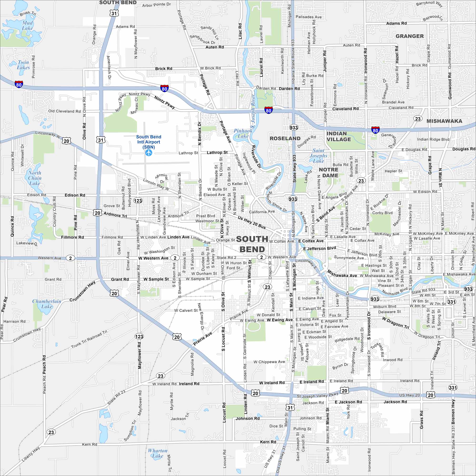
Get to know South Bend, Indiana with our road map. The city is home to the University of Notre Dame and a lively downtown area.
Indiana State Maps
Study about Indiana with our map collection


Map Information
On the Map
Interstates/Highways: I-80, US Hwy 20, US Hwy 31, State Rte 2, State Rte 23, State Rte 331, State Rte 933 Major Roads: Michigan St, Main St, Western Ave, Jefferson Blvd, Washington St, Colfax Ave, Sample St, Ironwood Rd, Mishawaka Ave, Twyckenham Dr, Ireland Rd, Miami St, Portage Ave, Riverside Dr, Bendix Dr, Mayflower Rd, Cleveland Rd, Darden Rd, Auten Rd, Brick Rd Airports: South Bend Intl Airport (SBN) Lakes and Reservoirs: Pinhook Lake, Saint Josephs Lake, Twin Lakes, Mud Lake, Chamberlain Lake, Wharton Lake Major Rivers: Saint Joseph River Nearby Communities: Roseland, Notre Dame, Indian Village, Mishawaka, GrangerIndiana City Maps
Here are our maps of Indianapolis and Indiana cities


