Map of Tacoma, Washington
Get around Tacoma with our detailed map. The city sits on Puget Sound with views of Mount Rainier and museums on the waterfront.
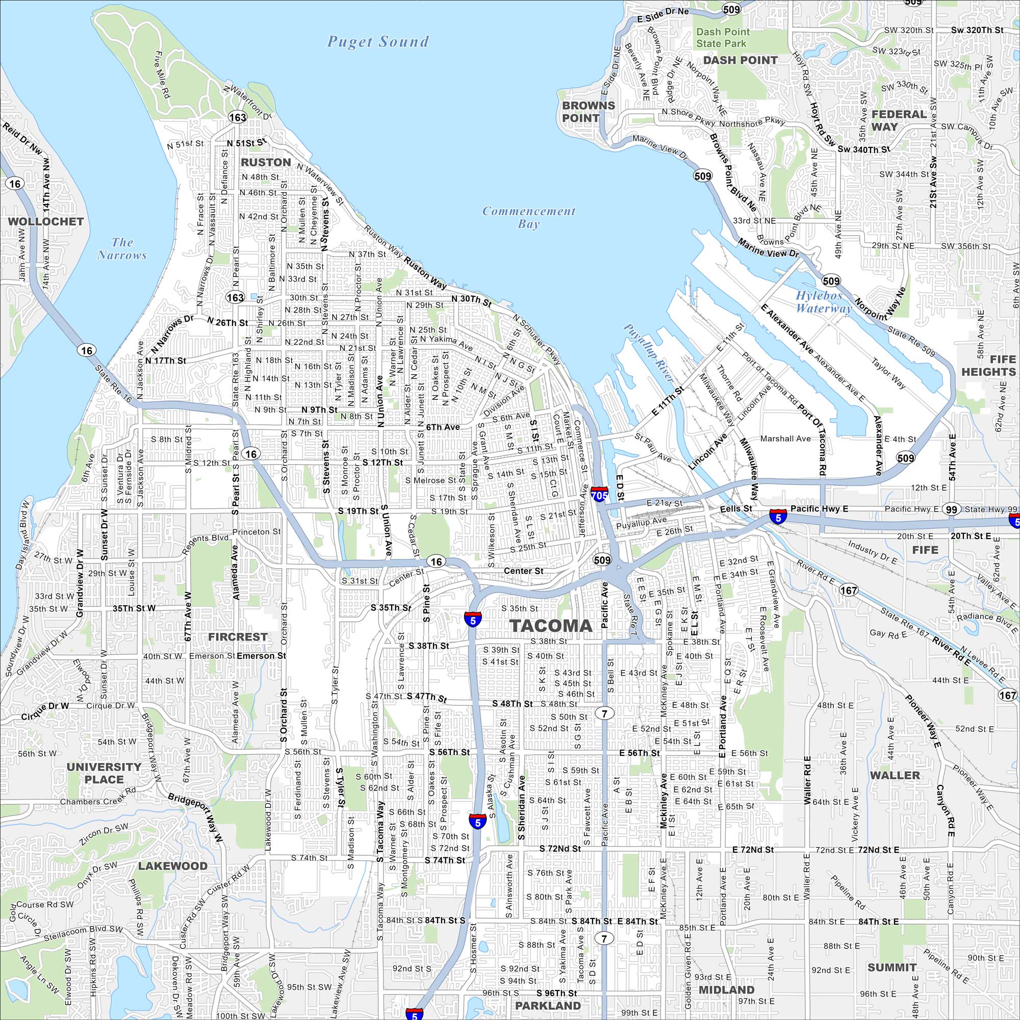
Map Information
On the Map
Interstates/Highways: I-5, I-705, US Hwy 99, State Rte 16, State Rte 163, State Rte 167, State Rte 509 Major Roads: Pacific Hwy, Ruston Way, Schuster Pkwy, Center St, Mildred St, Pearl St, Orchard St, Tyler St, Pine St, Alaska St, Sheridan Ave, Yakima Ave, Thompson Ave, Portland Ave, Waller Rd, 6th Ave, 11th St, 30th St, 56th St, 72nd St Lakes and Reservoirs: Puget Sound, Commencement Bay Major Rivers: The Narrows, Hylebos Waterway Parks and Preserves: Dash Point State Park Nearby Communities: Ruston, Browns Point, Dash Point, Federal Way, Fife Heights, Fife, Waller, Summit, Midland, Parkland, Lakewood, University Place, Fircrest, WollochetWashington State Maps
Move through the Evergreen State with our map collection.


City Maps of Washington
Check out our city maps of Washington


