Map of Terre Haute, Indiana
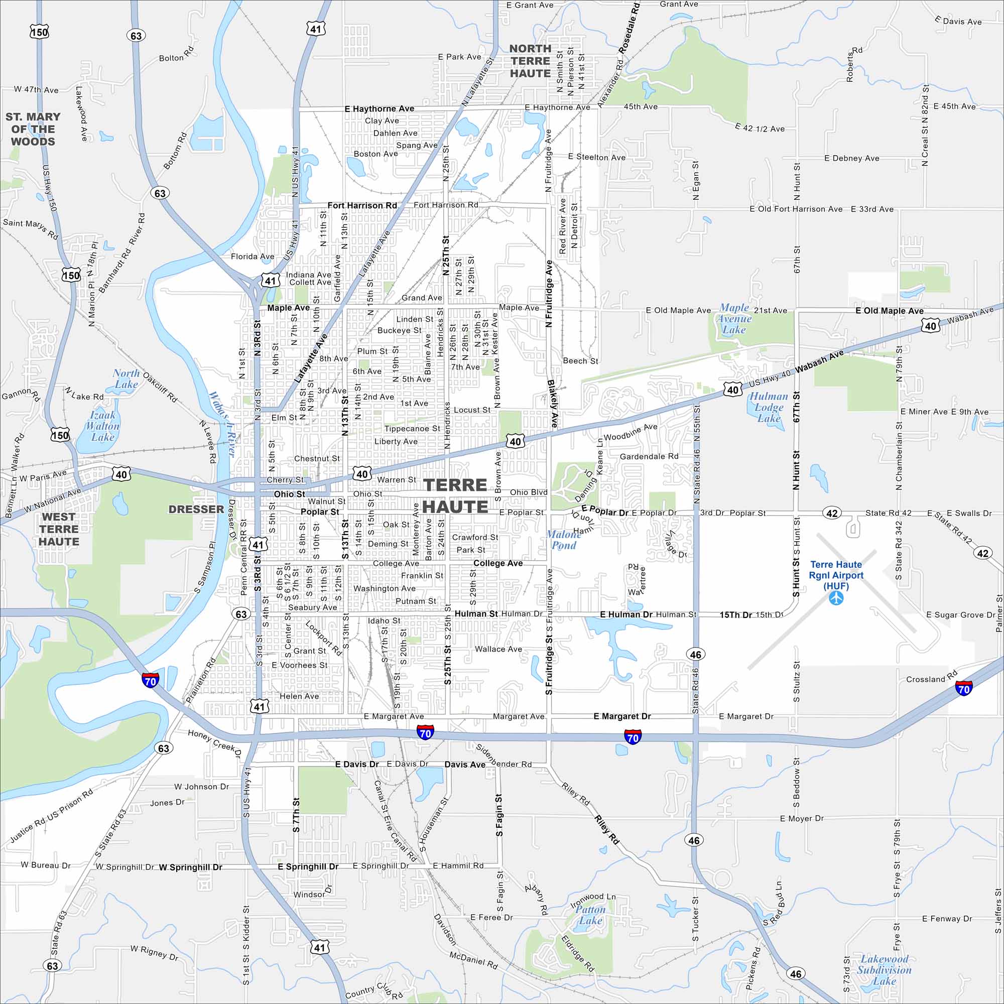
Our road map of Terre Haute shows this Wabash River city. It’s home to Indiana State University, museums, and historic districts.
Indiana State Maps
Study about Indiana with our map collection


Map Information
On the Map
Interstates/Highways: I-70, US Hwy 40, US Hwy 41, US Hwy 150, State Rte 42, State Rte 46, State Rte 63 Major Roads: Wabash Ave, Lafayette Ave, Margaret Dr, 3rd St, 7th St, 13th St, 25th St, Fruitridge Ave, Poplar St, Ohio St, College Ave, Hulman St, Springhill Dr, Fort Harrison Rd, Maple Ave, Brown Ave, 19th St, 1st St, Locust St, Davis Ave Airports: Terre Haute Rgnl Airport (HUF) Lakes and Reservoirs: Maple Avenue Lake, Hulman Lodge Lake, Izaak Walton Lake, North Lake, Oakcliff Lake, Malooley Pond, Patton Lake, Lakewood Subdivision Lake Major Rivers: Wabash River Nearby Communities: West Terre Haute, North Terre Haute, St. Mary of the WoodsIndiana City Maps
Here are our maps of Indianapolis and Indiana cities


