Virginia Wine Country Map
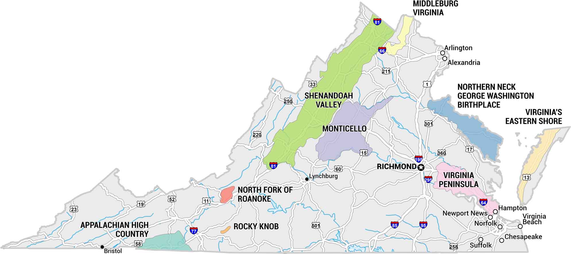
Virginia Wine Country rolls through the foothills of the Blue Ridge. Our map shows the 9 clusters of wineries in Virginia. Use our map to find this long stretch of countryside made for slow drives and long tastings.
Map Information
On the Map
Wine Regions (AVAs & Districts): Appalachian High Country, Middleburg Virginia, Monticello, North Fork of Roanoke, Northern Neck George Washington Birthplace, Rocky Knob, Shenandoah Valley, Virginia Peninsula, Virginia’s Eastern Shore Cities/Towns: Alexandria, Arlington, Bristol, Chesapeake, Hampton, Lynchburg, Newport News, Norfolk, Richmond, Suffolk, Virginia Beach Major Highways: US Hwy 1, US Hwy 11, US Hwy 13, US Hwy 15, US Hwy 17, US Hwy 19, US Hwy 23, State Rte 33, US Hwy 52, US Hwy 58, US Hwy 60, I-64, I-66, I-77, I-81, I-85, I-95, I-195, US Hwy 211, US Hwy 250, US Hwy 258, I-295, US Hwy 301, US Hwy 360, US Hwy 501Economic Region Maps
Regions defined by farming, industry, production, or economic identities.