Map of Tukwila, Washington
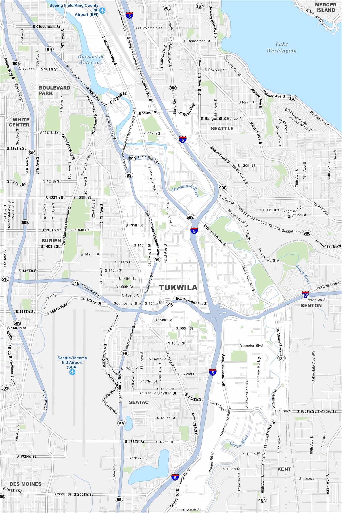
Get oriented with our Tukwila map in the Seattle metro. It’s a hub for shopping, transit, and easy connections to the airport. It’s also close to Lake Washington, the second largest natural lake in Washington.
Map Information
On the Map
Interstates/Highways: I-5, I-405, US Hwy 99, State Rte 167, State Rte 181, State Rte 509, State Rte 518, State Rte 599, State Rte 900 Major Roads: International Blvd, Southcenter Blvd, West Valley Hwy, Interurban Ave, Military Rd, Des Moines Memorial Dr, Tukwila International Blvd, Marginal Way, Boeing Rd, Beacon Ave, Renton Ave, 51st Ave, 42nd Ave, 24th Ave, 14th Ave, 8th Ave, 188th St, 178th St, 154th St, 128th St Airports: Seattle-Tacoma Intl Airport (SEA), Boeing Field/King County Intl Airport (BFI) Lakes and Reservoirs: Lake Washington Major Rivers: Duwamish Waterway, Black River, Green River Nearby Communities: Seattle, Mercer Island, Renton, Kent, Seatac, Des Moines, Burien, White Center, Boulevard ParkWashington State Maps
Move through the Evergreen State with our map collection.


City Maps of Washington
Check out our city maps of Washington


