Home » State Maps » Satellite Map of Delaware

Satellite Map of Delaware

Delaware Satellite Map

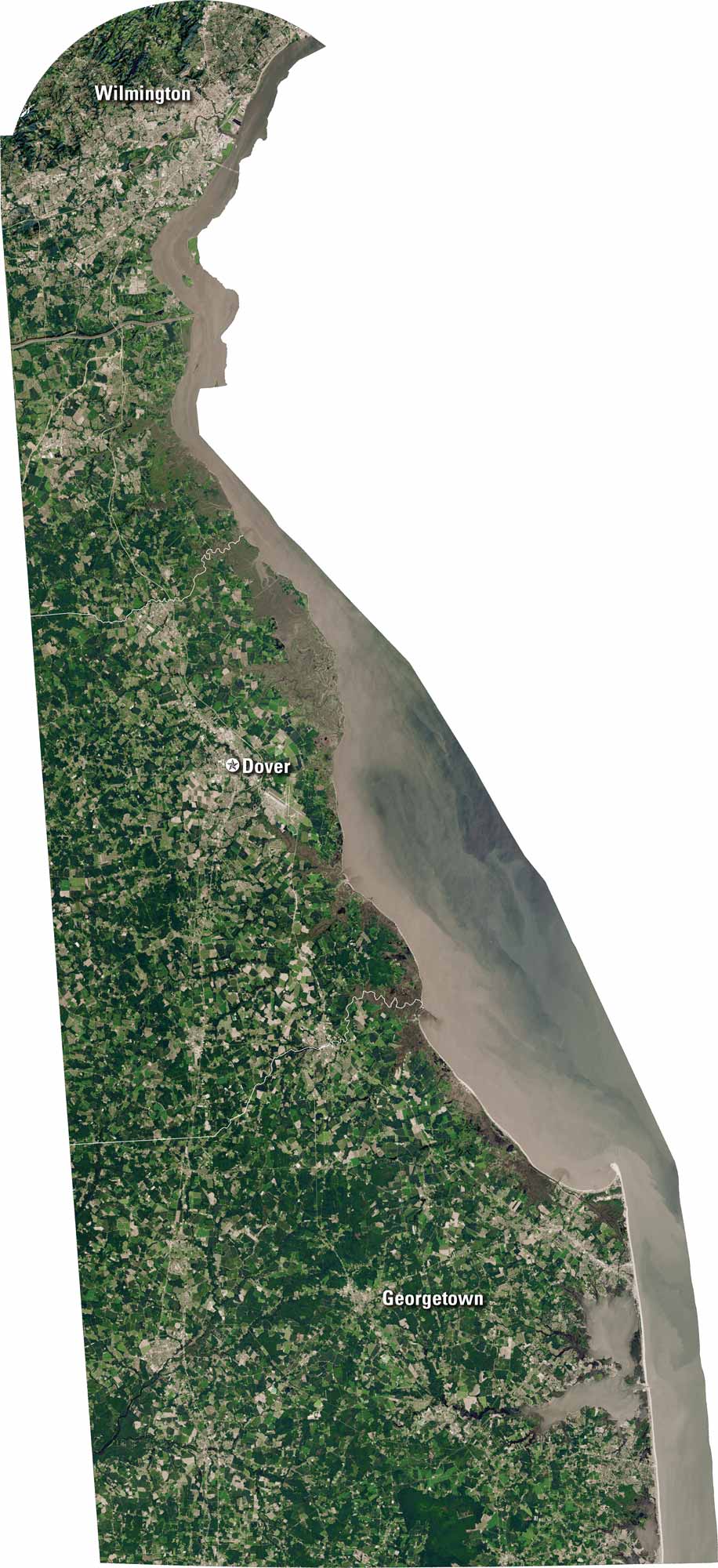
Delaware is small but full of detail. Our satellite map shows the coastline, rivers, and farmland. You’ll spot Wilmington, Dover, and coastal beaches along the Delaware Bay. The state sits between Pennsylvania and Maryland, making it a quiet but important connector.

Map Information

  • State of Delaware
  • Satellite Map of Delaware with Landsat-8 Imagery
  • Free for personal and commercial purpose. Attribution is required. How to attribute?

On the Map

Delaware Location Map
Cities/Towns (Labels): Wilmington, Dover, Georgetown Major Rivers: Delaware River (northern border), Christina River (near Wilmington) Bays: Delaware Bay (large body of water to the east) State Borders: Pennsylvania (north), New Jersey (northeast), Maryland (west and south) Islands: Pea Patch Island (in the Delaware River)

References

  1. NASA Worldview Earthdata
  2. USGS State Mosaics

Leave a Reply

Your email address will not be published. Required fields are marked *