Map of Zephyrhills, Florida
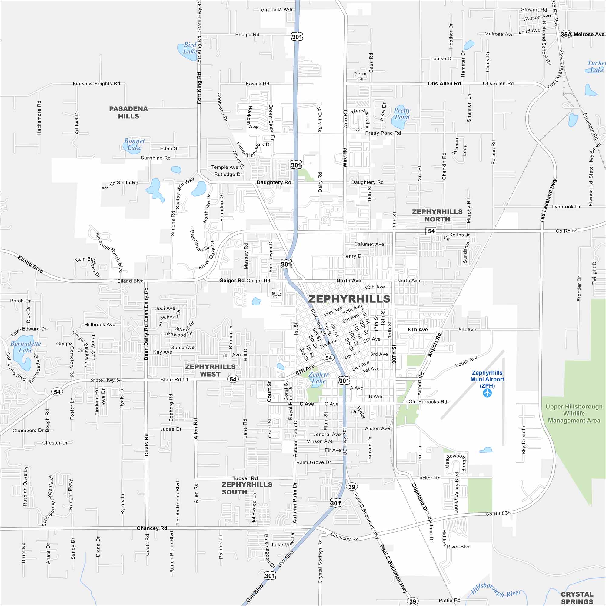
Our map of Zephyrhills highlights this small city north of Tampa. Famous for its pure spring water, it’s also a popular skydiving destination.
Florida State Maps
Discover Florida through our state maps


Map Information
On the Map
Interstates/Highways: US Hwy 301, State Rte 54, State Rte 39 Major Roads: 5th Ave, 6th Ave, North Ave, Eiland Blvd, Fort King Rd, Gall Blvd, Paul S Buchman Hwy, Chancey Rd, Wire Rd, 20th St, 23rd St, Pretty Pond Rd, Daughtery Rd, Geiger Rd, 10th St, Airport Rd, Tucker Rd, Copeland Dr, 12th St, Simons Rd Airports: Zephyrhills Muni Airport (ZPH) Lakes and Reservoirs: Pretty Pond, Zephyr Lake, Bird Lake, Blue Lagoon, Tucker Lake, Bernadette Lake Major Rivers: Hillsborough River Parks and Preserves: Upper Hillsborough Wildlife Management Area Nearby Communities: Pasadena Hills, Zephyrhills West, Zephyrhills South, Zephyrhills North, Crystal SpringsFlorida City Maps
Chart your course through Miami and Florida’s cities


