Map of Yuma, Arizona
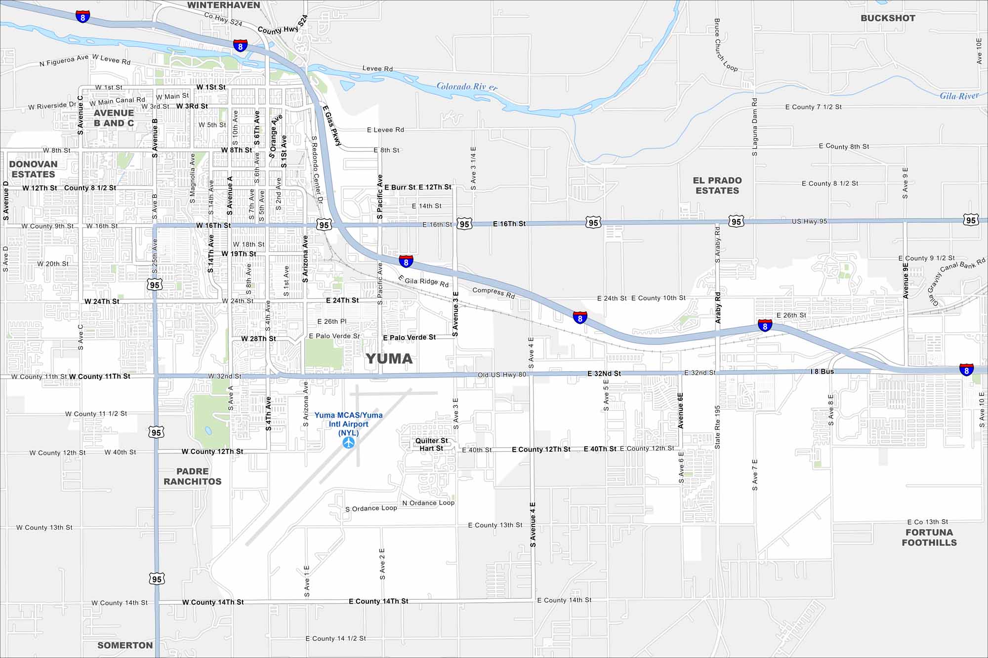
Step into Yuma, Arizona, located on the Colorado River. Known for its sunshine and desert history, it’s one of the sunniest spots in the U.S.
Arizona State Maps
Check out our Arizona state maps we’ve put together


Map Information
On the Map
Interstates/Highways: I-8, US Hwy 95, State Rte 195 Major Roads: 16th St, 24th St, 32nd St, Araby Rd, Giss Pkwy, Arizona Ave, Main St, 8th St, 4th Ave, Avenue B, Avenue A, Avenue C, Avenue 3E, Avenue 4E, Avenue 6E, Avenue 8E, Avenue 9E, Avenue 10E, County 12th St, County 14th St Airports: Yuma Intl Airport (NYL) Rivers and Creeks: Colorado River, Gila River Nearby Communities: Somerton, Fortuna Foothills, Winterhaven, El Prado Estates, Donovan Estates, Avenue B and C, Padre Ranchitos, BuckshotArizona City Maps
Here’s our full batch of Arizona city maps


