Yosemite National Park Map
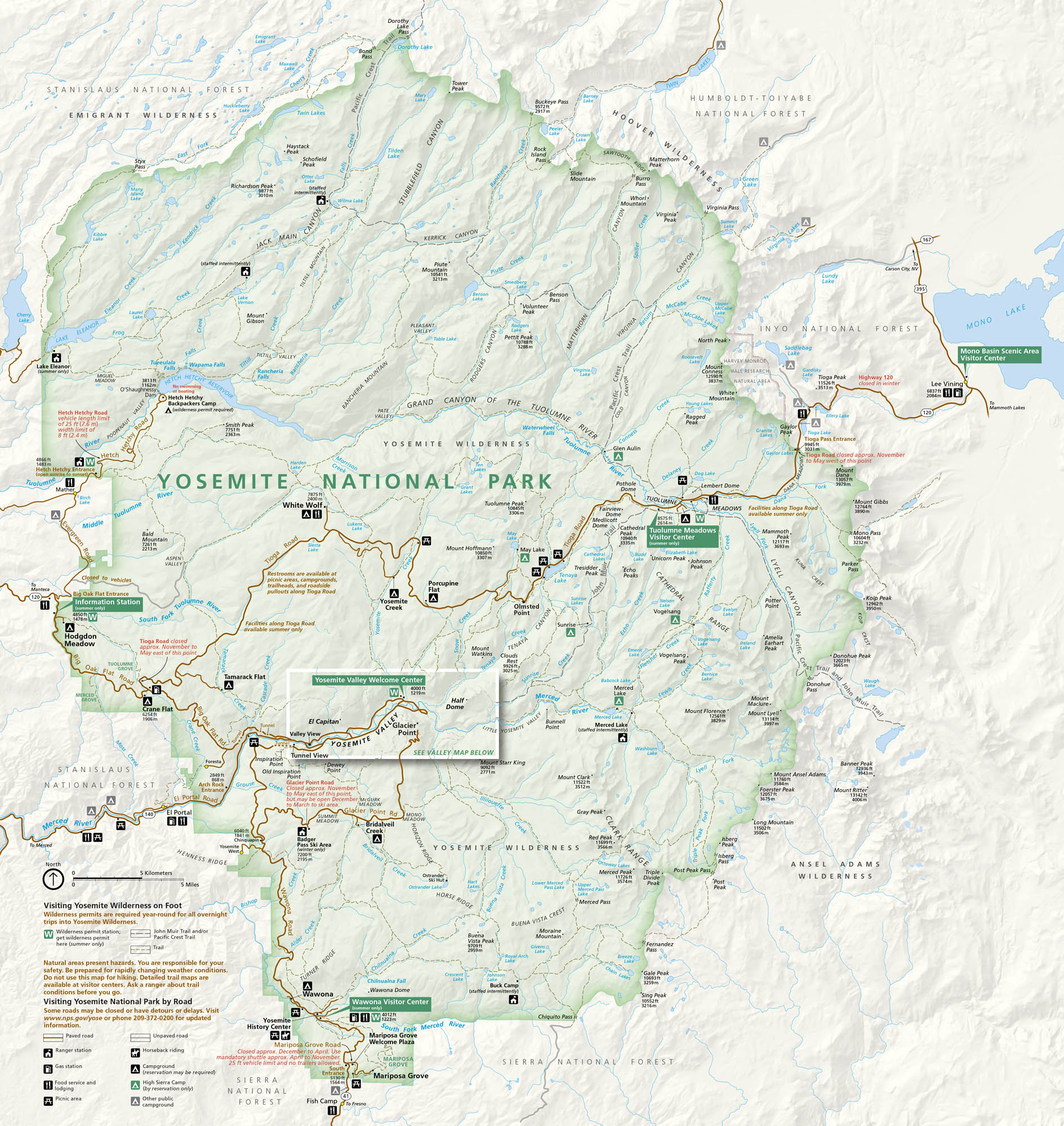
Yosemite National Park feels larger than life. From El Capitan to Half Dome, the landmarks rise like legends. Our map of Yosemite National Park follows the valleys, rivers, and forest roads. Get your bearings and find its visitor centers.
Map Information
On the Map
Parks: Yosemite National Park, Stanislaus National Forest, Toiyabe National Forest, Inyo National Forest, Sierra National Forest Visitor Centers: Yosemite Valley Welcome Center, Tuolumne Meadows Visitor Center, Wawona Visitor Center, Big Oak Flat Information Station, Mono Basin Scenic Area Visitor Center Major Roads: State Rte 120, State Rte 140, State Rte 41, Tioga Rd, Big Oak Flat Rd, Glacier Point Rd, El Portal Rd, Wawona Rd, Hetch Hetchy Rd Rivers/Reservoirs: Tuolumne River, Merced River, Hetch Hetchy Reservoir, Tenaya Lake, Mono Lake, Eleanor Lake, Lyell Canyon, Dana Fork, Lyell Fork Cities/Towns: Yosemite Village, El Portal, Wawona, Lee Vining, Foresta Campgrounds/Park Sites: White Wolf, Crane Flat, Hodgdon Meadow, Tamarack Flat, Porcupine Flat, Yosemite Creek, Tuolumne Meadows, Bridalveil Creek, Wawona, Mariposa Grove Other Landmarks: El Capitan, Half Dome, Glacier Point, Yosemite Falls, Tunnel View, Olmsted Point, Cathedral Range, Mount Dana, Mount Lyell, Hetch Hetchy DomeNational Park Maps
Find maps of green spaces and national parks near you.


