Map of Yonkers, New York
See the streets of Yonkers along the Hudson River. From riverfront parks to historic neighborhoods, our map lays it all out.
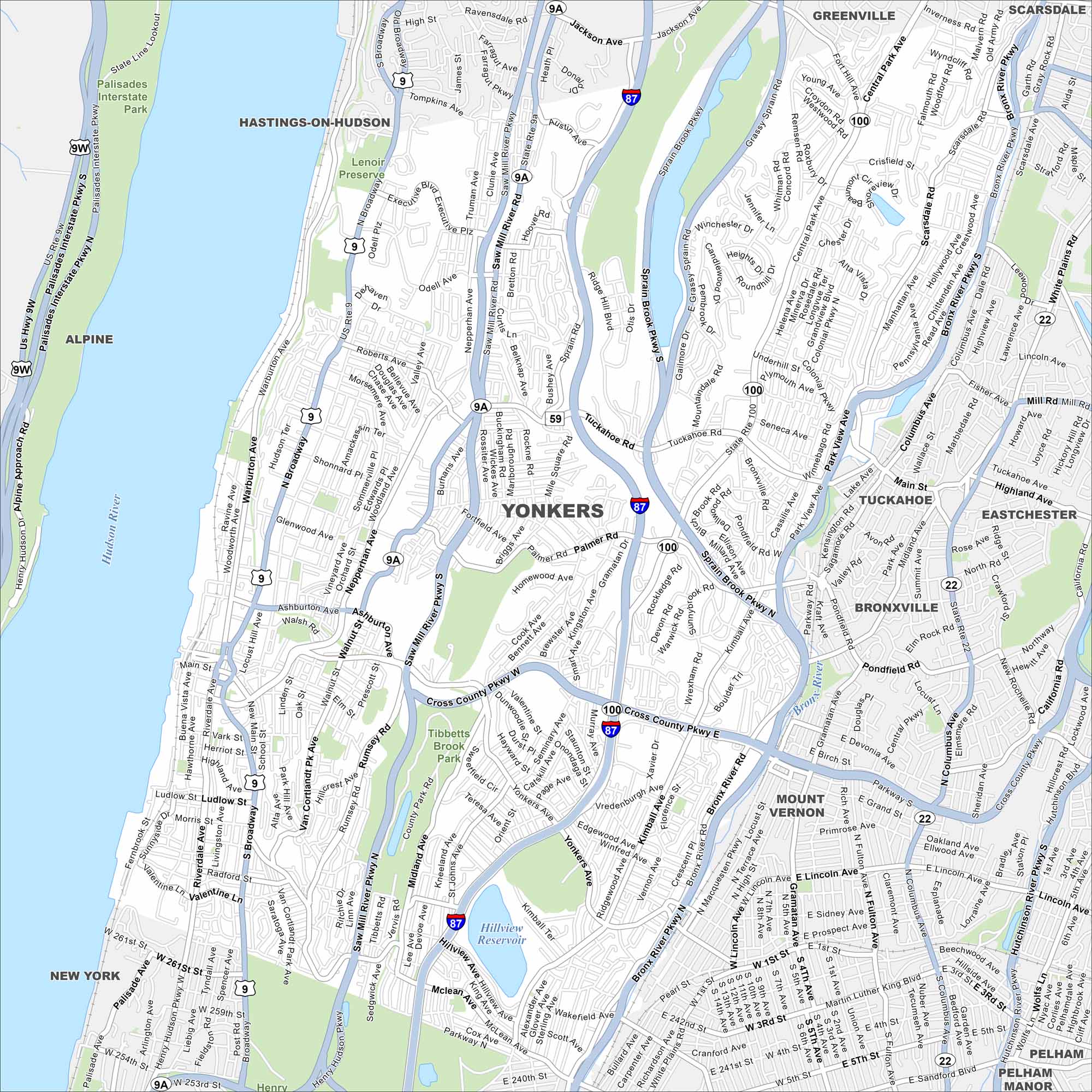
Map Information
On the Map
Interstates/Highways: I-87, US Hwy 9, State Rte 9A, State Rte 100, State Rte 22, State Rte 59 Major Roads: Saw Mill River Pkwy, Sprain Brook Pkwy, Cross County Pkwy, Bronx River Pkwy, Hutchinson River Pkwy, Central Park Ave, Yonkers Ave, Riverdale Ave, Broadway, Warburton Ave, Nepperhan Ave, Tuckahoe Rd, Palmer Rd, McLean Ave, Midland Ave, Ashburton Ave, Walnut St, Elm St, Rumsey Rd, Park Hill Ave Lakes and Reservoirs: Hillview Reservoir Major Rivers: Hudson River, Bronx River Parks and Preserves: Tibbetts Brook Park, Palisades Interstate Park, Lenoir Preserve Nearby Communities: Hastings-On-Hudson, Greenville, Scarsdale, Tuckahoe, Eastchester, Bronxville, Mount Vernon, Pelham, Pelham ManorNew York State Maps
Find state maps of the Empire State.


City Maps of New York
Here are the city maps that define New York


