Map of Winter Garden, Florida
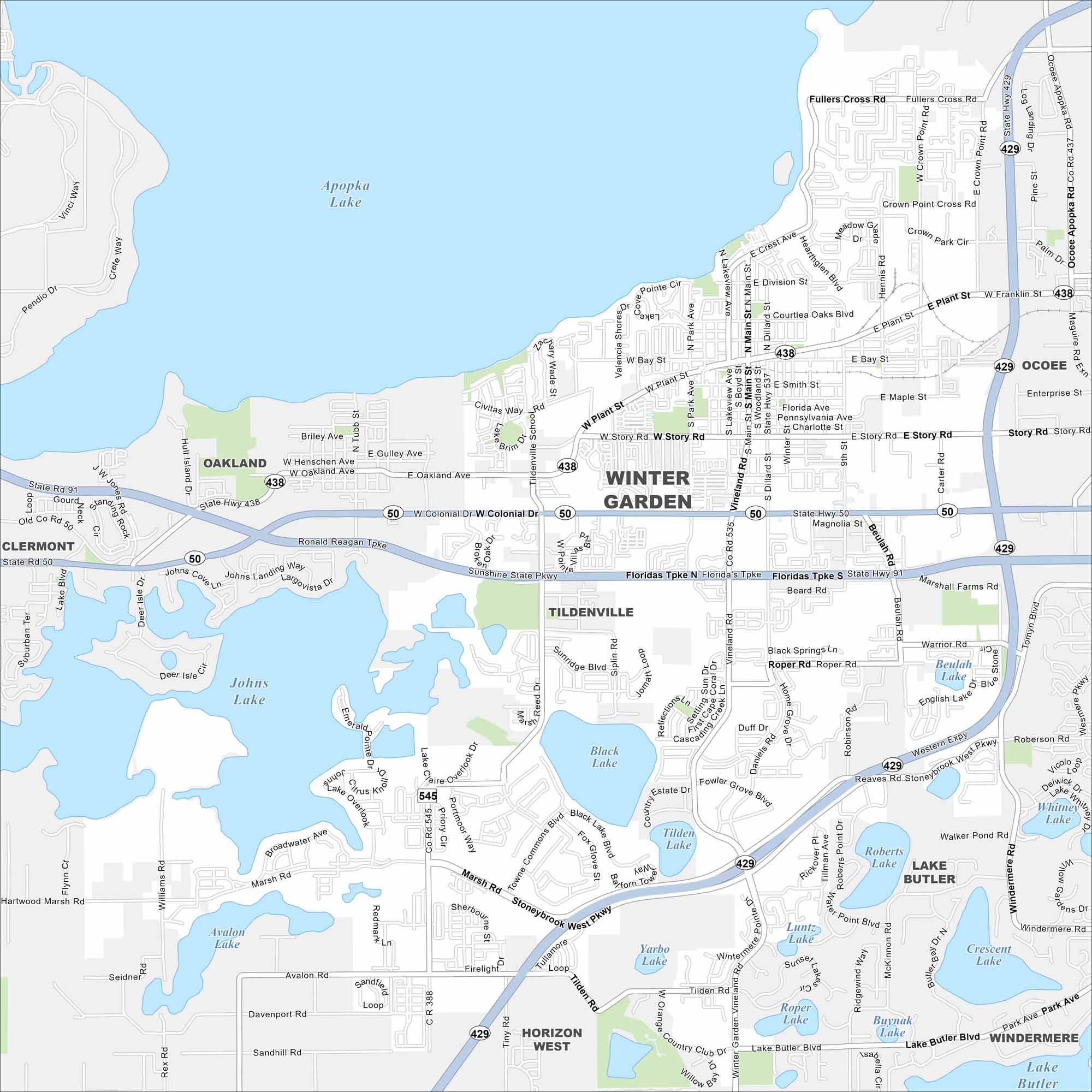
Get a snapshot of Winter Garden, just west of Orlando. Its historic downtown and bike trails make it a favorite stop. Don’t forget Apopka Lake, found in the north.
Florida State Maps
Discover Florida through our state maps


Map Information
On the Map
Interstates/Highways: I-4, US Hwy 27, State Rte 429, State Rte 50, Florida’s Tpke Major Roads: W Colonial Dr, W Plant St, Story Rd, Marsh Rd, Stoneybrook West Pkwy, Winter Garden Vineland Rd, Avalon Rd, Tilden Rd, Windermere Rd, Dillard St, Main St, Park Ave, Lake Butler Blvd, Beulah Rd, Reaves Rd, Daniels Rd, Roper Rd, Fullers Cross Rd, Crown Point Cross Rd, Oakland Ave Lakes and Reservoirs: Apopka Lake, Johns Lake, Black Lake, Tilden Lake, Roberts Lake, Lake Butler, Whitney Lake, Crescent Lake, Luntz Lake, Roper Lake, Buyank Lake, Sun Lake, Yarbo Lake, Black Lake Belle, Lake Claire, Lake Prima, Lake Brim, Fox Lake, Gourd Lake Nearby Communities: Oakland, Clermont, Tildenville, Horizon West, Windermere, Ocoee, Crown PointFlorida City Maps
Chart your course through Miami and Florida’s cities


