Map of Wilson, North Carolina
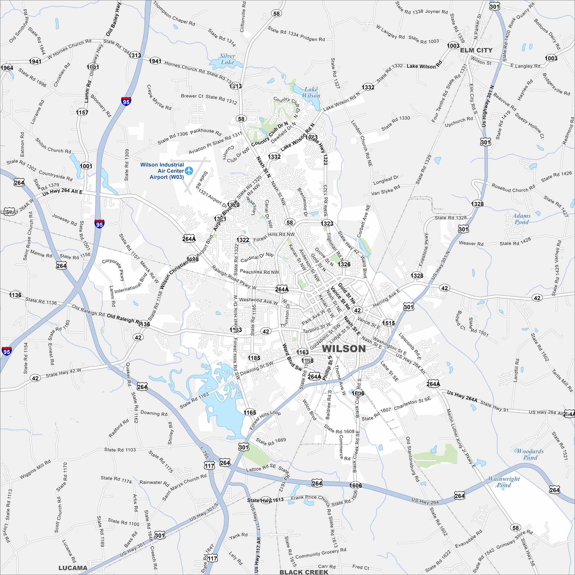
Step into Wilson, North Carolina, once a major tobacco market. Today it’s known for Whirligig Park and a lively and historic downtown. Our map shows its major highways and waterways.
Map Information
On the Map
Interstates/Highways: I-95, US Hwy 264, US Hwy 264 Alt, US Hwy 301, US Hwy 117 Alt, State Rte 42, State Rte 58 Major Roads: Ward Blvd, Raleigh Rd, Nash St, Tarboro St, Hines St, Forest Hills Rd, Airport Blvd, Bloomery Rd, Hornes Church Rd, Lamm Rd, Old Raleigh Rd, Merck Rd, London Church Rd, Lake Wilson Rd, Corbett Ave, Firestone Pkwy, Lipscomb Rd, Martin Luther King Jr Pkwy, Wiggins Mill Rd, Black Creek Rd Airports: Wilson Industrial Air Center Airport (W03) Lakes and Reservoirs: Lake Wilson, Silver Lake, Adams Pond, Woodards Pond, Wainwright Pond Nearby Communities: Elm City, Lucama, Black CreekNorth Carolina State Maps
Get to know the mountains and coastlines of North Carolina.


City Maps of North Carolina
Journey through North Carolina with our city maps


