Map of Westland, Michigan
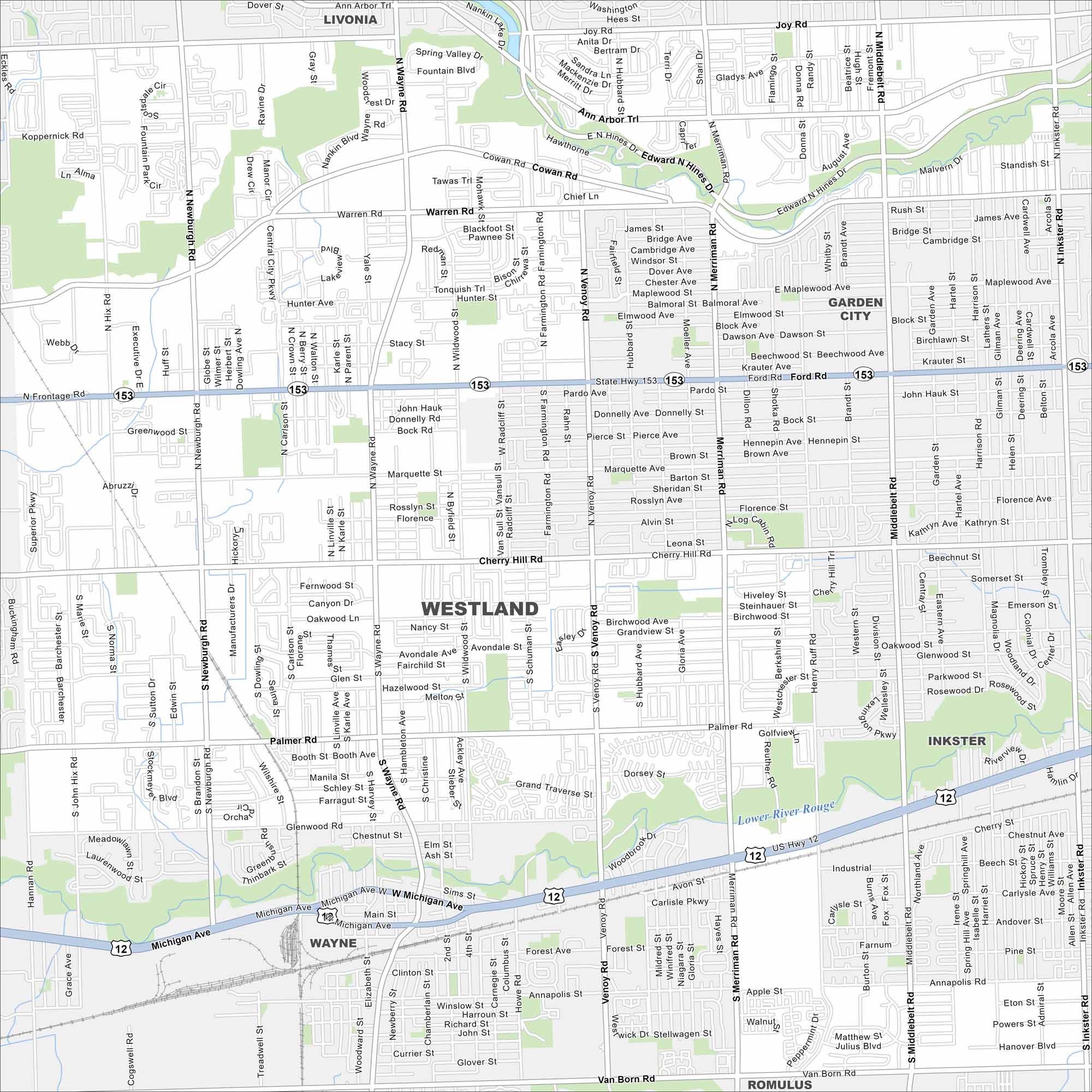
Our map of Westland highlights this Detroit suburb’s neighborhoods and shopping centers. The city is part of the western metro area in Wayne County.
Map Information
On the Map
Interstates/Highways: US Hwy 12, State Hwy 153 Major Roads: Michigan Ave, Ford Rd, Wayne Rd, Merriman Rd, Warren Rd, Newburgh Rd, Venoy Rd, Middlebelt Rd, Cherry Hill Rd, Palmer Rd, Glenwood Rd, Wildwood Rd, Inkster Rd, Ann Arbor Trl, Marquette St, Cowan Rd, Hunter Ave, Avondale Ave, Annapolis Rd, Van Born Rd Major Rivers: Lower River Rouge Nearby Communities: Livonia, Garden City, Westland, Wayne, Inkster, RomulusMichigan State Maps
Get to know Michigan with our detailed maps


City Maps of Michigan
Check out our maps of Detroit and other cities in Michigan


