Map of Warren, Michigan
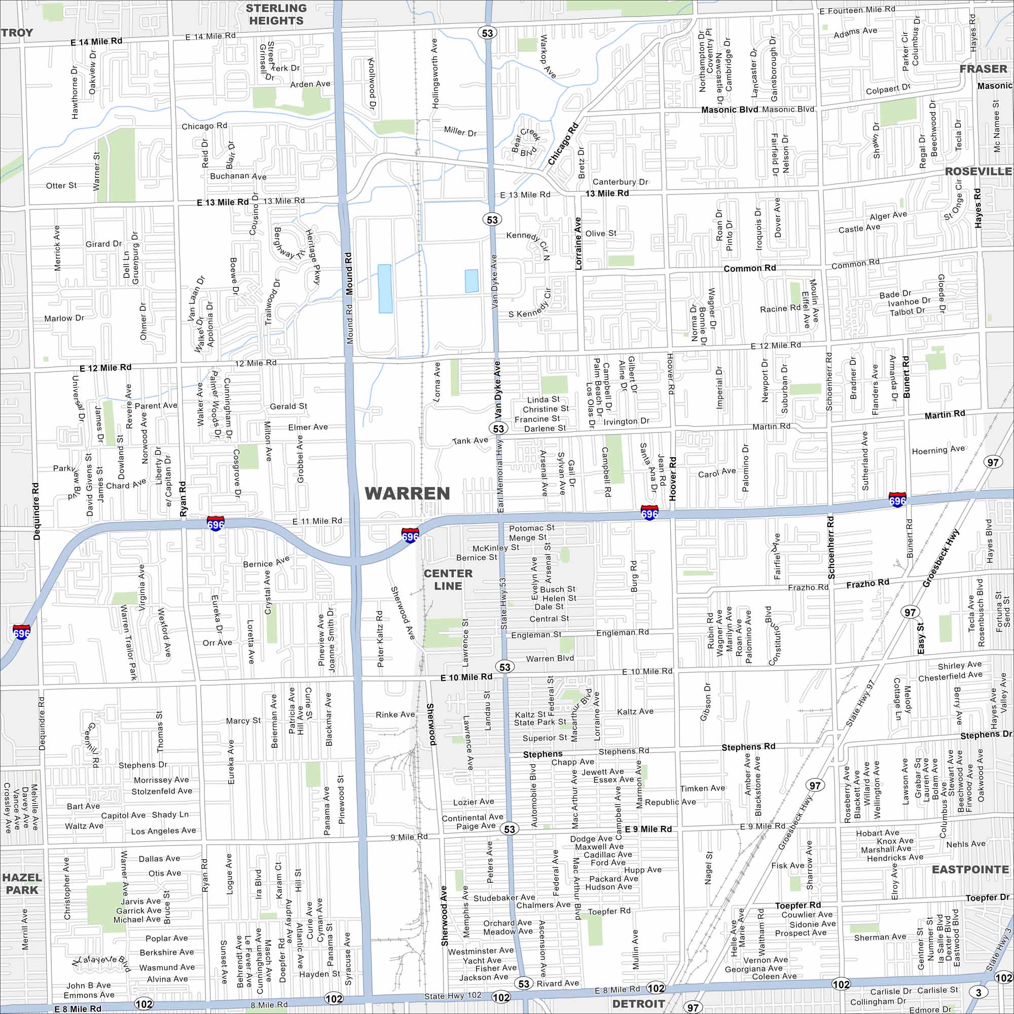
Our road map of Warren guides you through Detroit’s largest suburb. The city is home to industry, neighborhoods, and major auto history.
Map Information
On the Map
Interstates/Highways: I-696, State Hwy 53, State Hwy 97, State Hwy 102 Major Roads: 8 Mile Rd, 10 Mile Rd, 12 Mile Rd, 14 Mile Rd, Van Dyke Ave, Mound Rd, Dequindre Rd, Ryan Rd, Hoover Rd, Schoenherr Rd, Groesbeck Hwy, 13 Mile Rd, 9 Mile Rd, 11 Mile Rd, Stephens Rd, Common Rd, Masonic Blvd, Chicago Rd Nearby Communities: Sterling Heights, Fraser, Roseville, Warren, Center Line, Detroit, Eastpointe, Hazel ParkMichigan State Maps
Get to know Michigan with our detailed maps


City Maps of Michigan
Check out our maps of Detroit and other cities in Michigan


