Map of Vero Beach, Florida
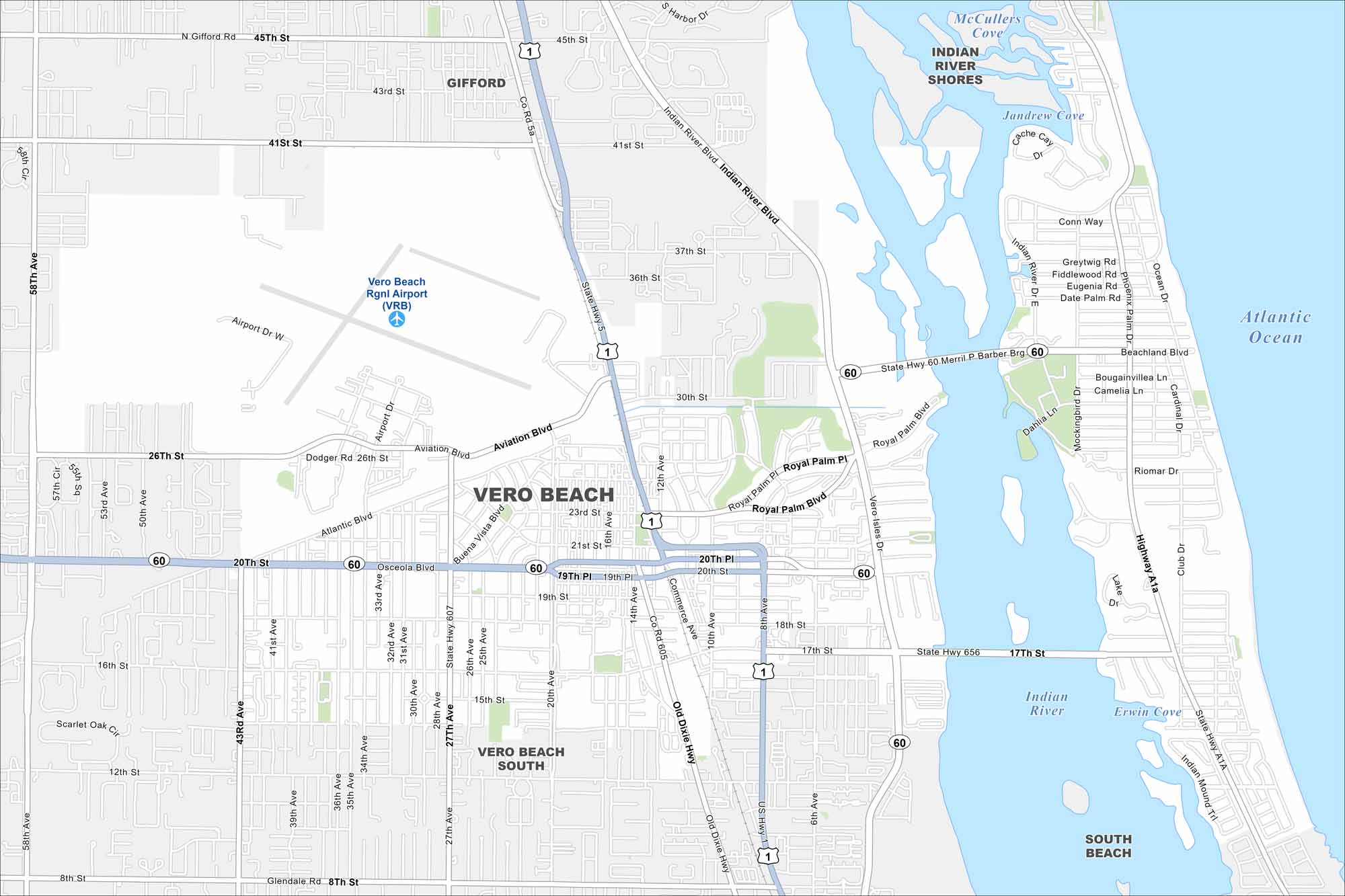
Our road map of Vero Beach highlights its Atlantic shoreline. The city blends quiet beaches, art, and Indian River Lagoon views.
Florida State Maps
Discover Florida through our state maps


Map Information
On the Map
Interstates/Highways: US Hwy 1, State Hwy 60, State Hwy 5, State Hwy 656, State Hwy A1A Major Roads: 20th St, 21st St, 17th St, 4th St, 8th St, 12th St, 16th St, 43rd Ave, 58th Ave, Indian River Blvd, Aviation Blvd, Royal Palm Blvd, Beachland Blvd, Ocean Dr, Old Dixie Hwy, 27th Ave, 33rd Ave, 37th St, 41st St, 45th St Airports: Vero Beach Rgnl Airport (VRB) Lakes and Reservoirs: Atlantic Ocean, Indian River, Erwin Cove, Jandrew Cove, Cache Cay, McCullers Cove Major Rivers: Indian River Nearby Communities: Gifford, Indian River Shores, Vero Beach South, South BeachFlorida City Maps
Chart your course through Miami and Florida’s cities


