USA Detailed Map
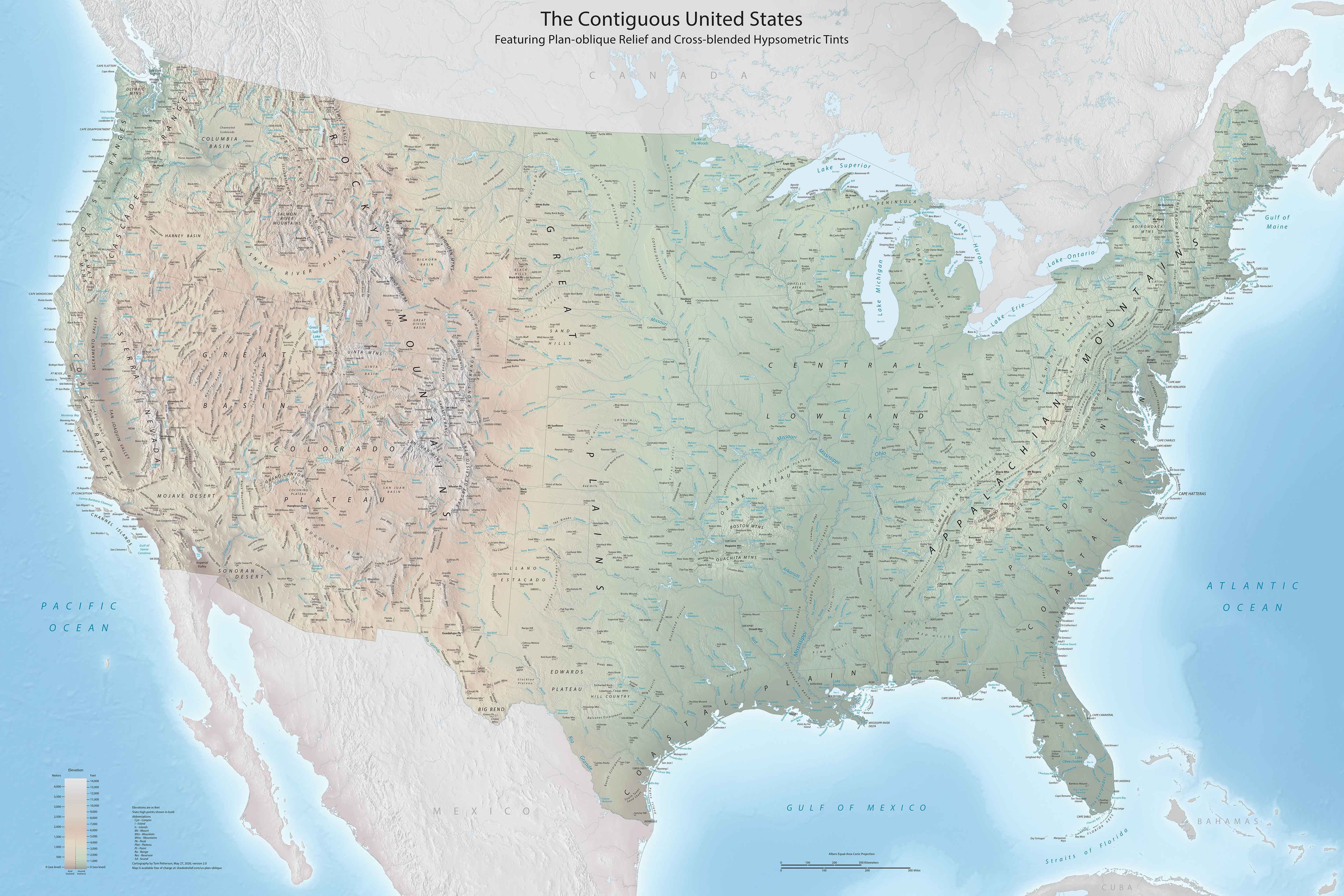
This is a high-resolution map with every detail you could need. Our USA detailed map has cities, physical features, state outlines, and more. It’s pretty big on detail, so you’ll probably want to download it.
Map Information
On the Map
Mountain Ranges: Appalachian Mountains, Blue Ridge Mountains, Cascade Range, Coast Ranges, Ozark Plateau, Rocky Mountains, Sierra Nevada, White Mountains Physical Features: Atlantic Coastal Plain, Badlands, Black Hills, Central Lowland, Colorado Plateau, Columbia Plateau, Death Valley, Edwards Plateau, Florida Peninsula, Great Basin, Great Plains, Gulf Coastal Plain, Mojave Desert, Piedmont, Snake River Plain, Sonoran Desert Mountain Peaks: Mount Elbert, Mount Hood, Mount Rainier, Mount Shasta, Mount Whitney, Pikes Peak Major Rivers: Arkansas River, Brazos River, Colorado River, Columbia River, Gila River, Hudson River, Illinois River, Missouri River, Mississippi River, Ohio River, Pecos River, Platte River, Potomac River, Red River, Rio Grande River, Sacramento River, Snake River, St. Lawrence River, Tennessee River Lakes/Reservoirs: Great Salt Lake, Lake Erie, Lake Huron, Lake Michigan, Lake Okeechobee, Lake Ontario, Lake Superior, Lake TahoeCountry Maps
Explore the geography that defines this nation.


