US Wildfire Map
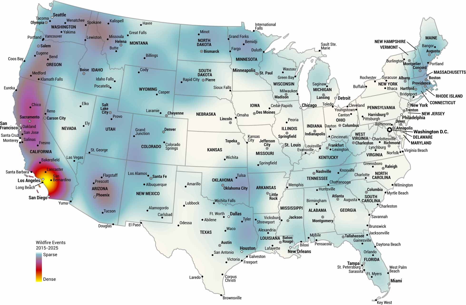
Where have wildfires hit hardest over the past decade? This US wildfire map tracks hotspots from 2015 to 2025, with California lighting up the chart. The data speaks for itself about where fire risk runs highest.
Map Information
Country Maps
Explore the geography that defines this nation.


