US Terrain Map
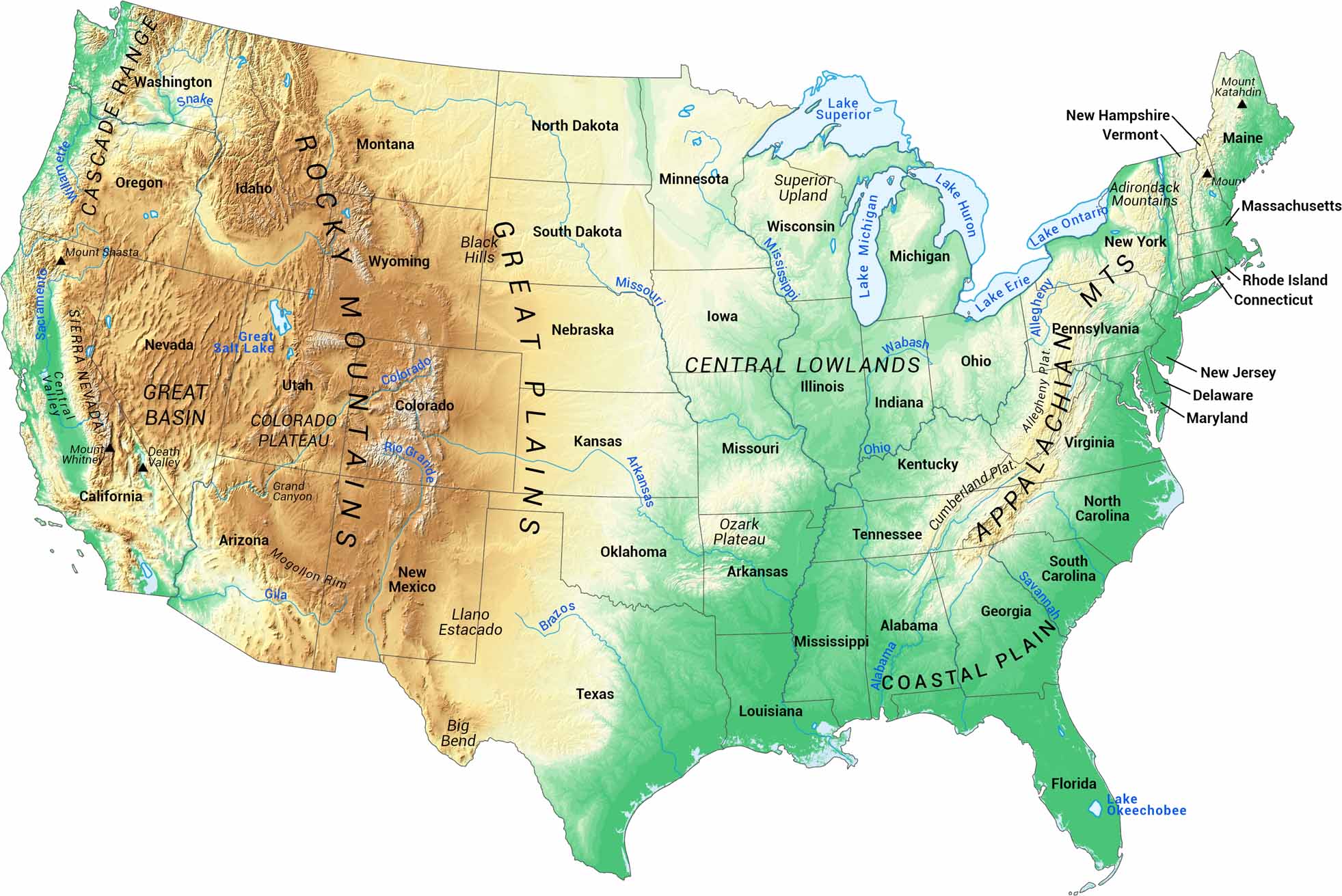
Our map of U.S. terrain covers all 48 contiguous states. It highlights major landforms, from mountain ranges to broad plains. You can also spot state outlines, lakes, and rivers.
Map Information
Country Maps
Explore the geography that defines this nation.


