US Population Density Map
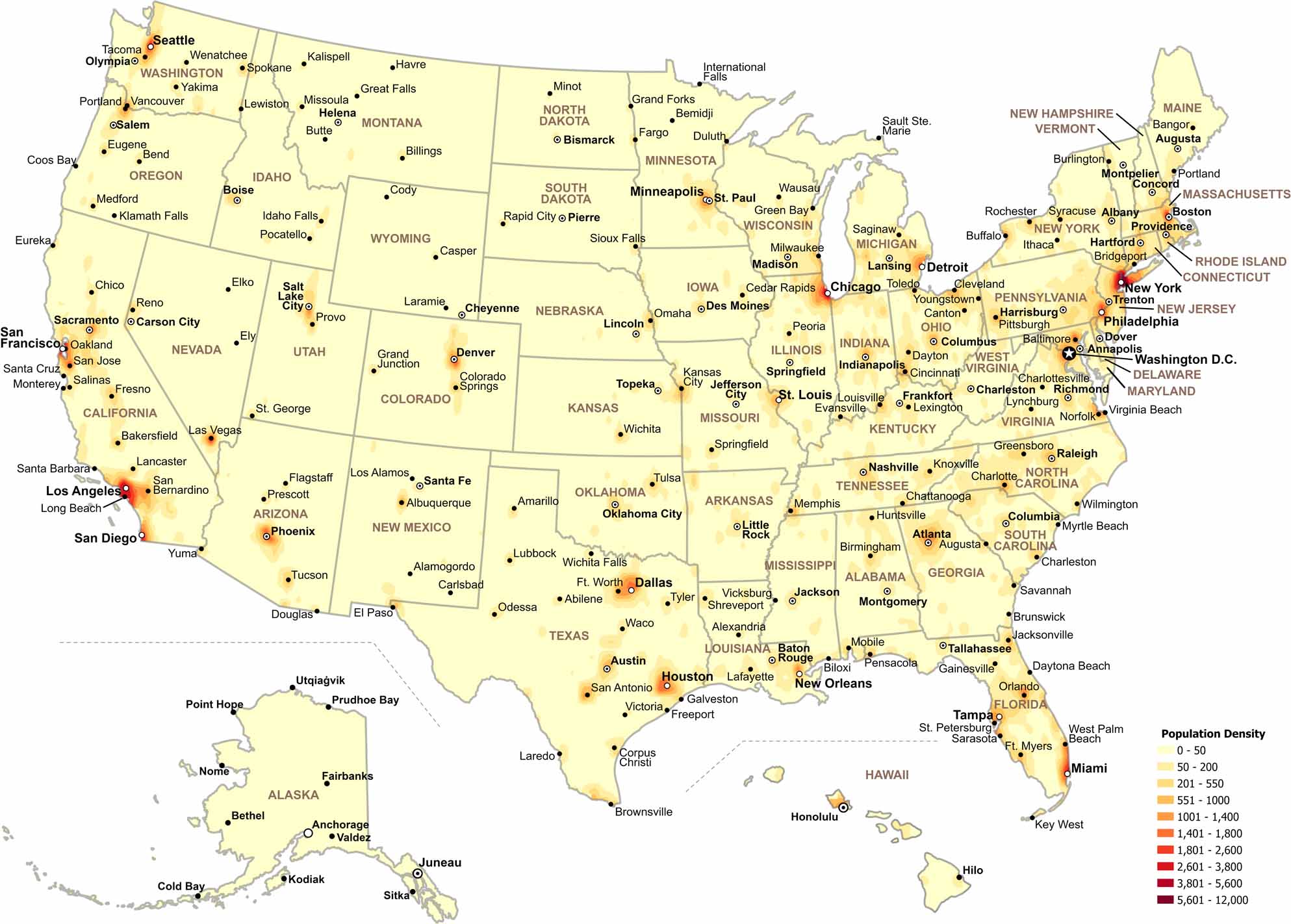
Our map shows how population density changes across the United States. Check out our map to see where people are most concentrated. You’ll notice most of the country appears as less dense, especially mountainous areas and the Great Plains.
Map Information
Population Density State Maps
Select any state map below to view its population density map.


Country Maps
Explore the geography that defines this nation.


