US Mean Annual Length Freeze Free Period Map
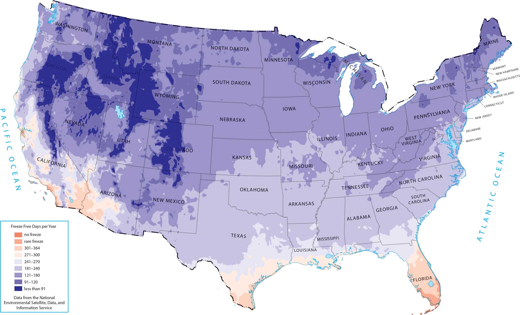
Our map reflects how latitude and ocean influence control growing seasons. The freeze-free period grows longer as you move south and toward the coasts. Southern states and coastal zones show the longest stretches without freezing. But for the northern interior region, it shortens rather quickly.
Map Information
Country Maps
Explore the geography that defines this nation.


