US Air Quality Map
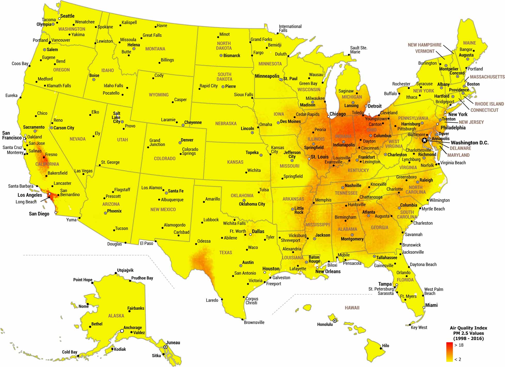
Air quality in the United States varies widely by region. Our map of US air quality shows PM 2.5 concentrations over nearly two decades. For this one, we’ve mapped long-term patterns, instead of daily noise.
Map Information
Country Maps
Explore the geography that defines this nation.


