Map of Tucson, Arizona
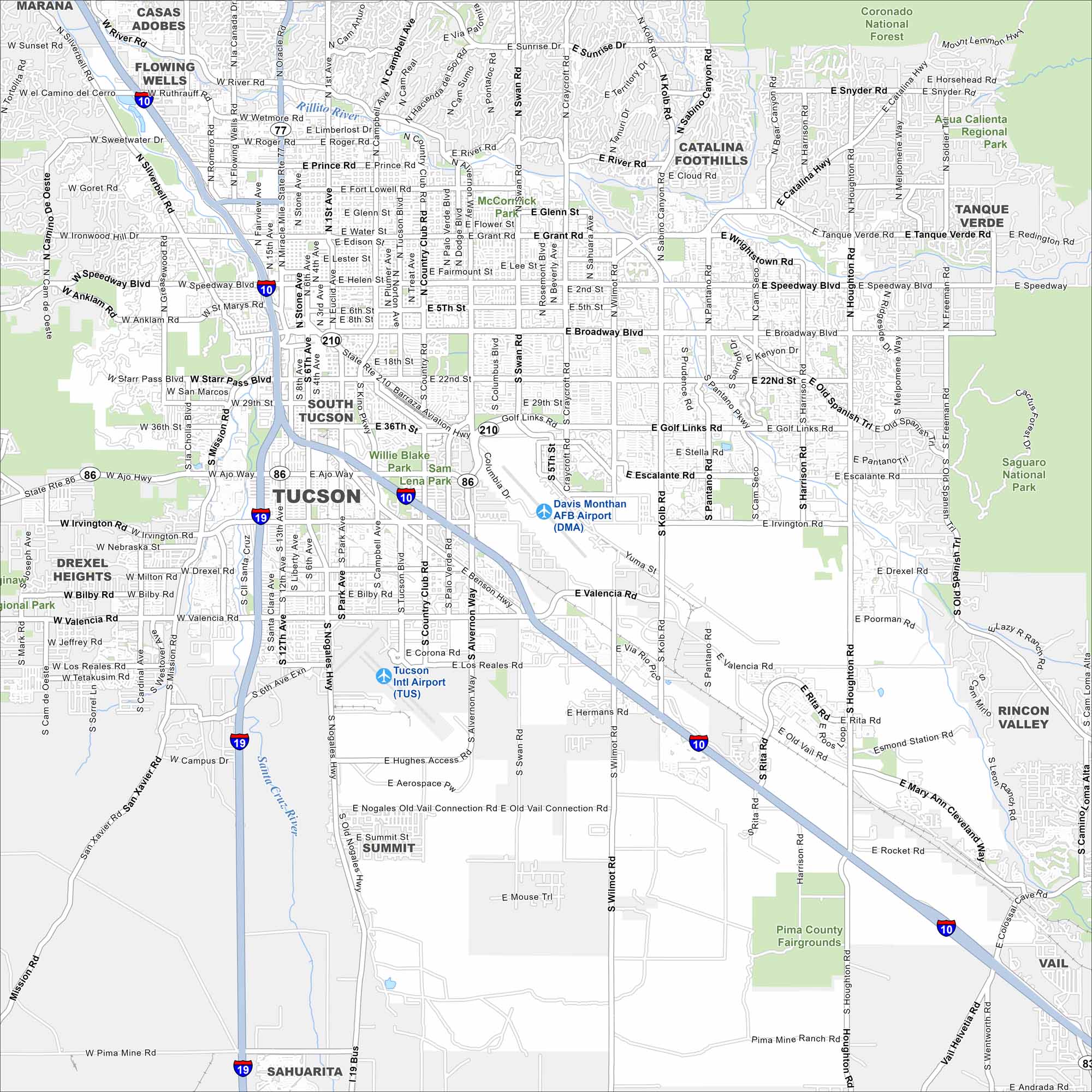
This street map of Tucson shows the desert city ringed by mountains. It’s home to the University of Arizona and also has a rich cultural scene.
Arizona State Maps
Check out our Arizona state maps we’ve put together


Map Information
On the Map
Interstates/Highways: I-10, I-19, State Rte 86, State Rte 77, State Rte 210, Barraza-Aviation Hwy, State Rte 83 Major Roads: Broadway Blvd, Speedway Blvd, Oracle Rd, Campbell Ave, Alvernon Way, Swan Rd, Craycroft Rd, Kolb Rd, Valencia Rd, Irvington Rd, Ajo Way, Grant Rd, Glenn St, Prince Rd, Miracle Mile, Stone Ave, 22nd St, Golf Links Rd, Wilmot Rd, Houghton Rd Airports: Tucson Intl Airport (TUS), Davis Monthan AFB Airport (DMA) Rivers and Creeks: Santa Cruz River, Rillito River Parks/Preserves/Forests: Coronado National Forest, Saguaro National Park, Aqua Caliente Regional Park, Tucson Mountain Park, Willie Blake Park, Sam Lena Park Nearby Communities: South Tucson, Drexel Heights, Flowing Wells, Casas Adobes, Catalina Foothills, Tanque Verde, Rincon Valley, Vail, Summit, SahuaritaArizona City Maps
Here’s our full batch of Arizona city maps


