Treaty of 1818 Map
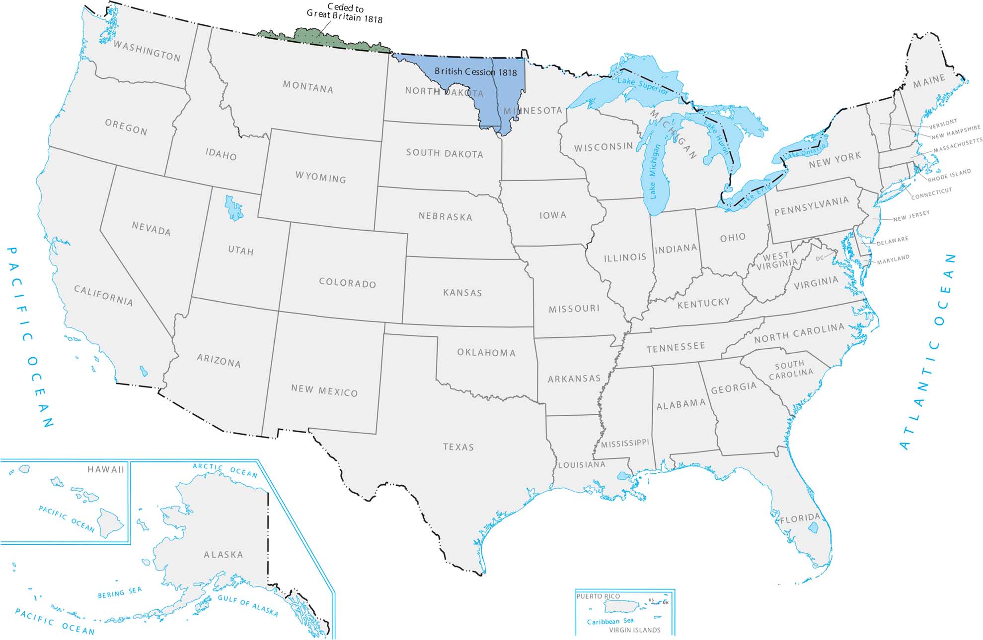
The Treaty of 1818 set the northern border at the 49th parallel. This is why states like North Dakota and Montana have that perfectly flat top edge. It basically split up the northern plains between the US and Canada. Our Treaty of 1818 map shows land that came from a deal with Britain in 1818.
Map Information
Country Maps
Explore the geography that defines this nation.


