Map of Tempe, Arizona
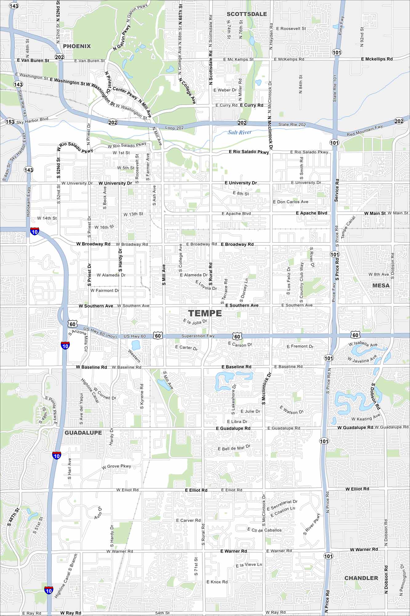
Our Tempe map highlights this lively desert city. It’s home to Arizona State University, Tempe Town Lake, and a busy Mill Avenue scene. It’s also fairly close to Phoenix, Arizona.
Arizona State Maps
Check out our Arizona state maps we’ve put together


Map Information
On the Map
Interstates/Highways: I-10, US Hwy 60 (Superstition Fwy), Loop 202, Red Mountain Fwy, Loop 101, State Rte 101, State Rte 143, Hohokam Expy, State Rte 153, Sky Harbor Blvd Major Roads: Broadway Rd, University Dr, Southern Ave, Baseline Rd, Elliot Rd, Warner Rd, Rural Rd, McClintock Dr, Mill Ave, Priest Dr, Hardy Dr, Kyrene Rd, Price Rd, Ray Rd, Apache Blvd, Rio Salado Pkwy, Washington St, Van Buren St, Guadalupe Rd, Smith Rd Rivers and Creeks: Salt River Nearby Communities: Phoenix, Scottsdale, Mesa, Guadalupe, ChandlerArizona City Maps
Here’s our full batch of Arizona city maps


