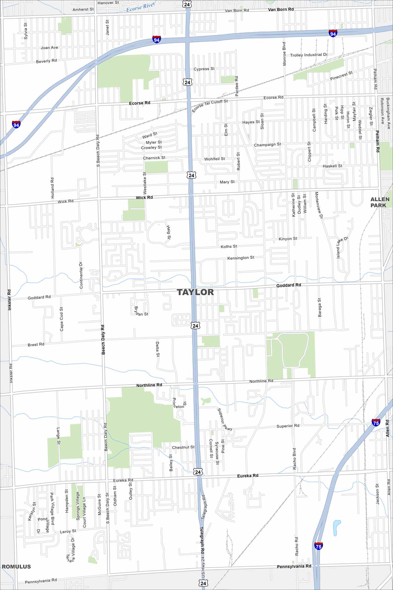
Map of Taylor, Michigan
Want to explore Taylor, Michigan? Located near Detroit, our map highlights its neighborhoods, highways, and parks like Heritage Park.
Map Information
On the Map
Interstates/Highways: I-94, I-75, US Hwy 24 Major Roads: Telegraph Rd, Eureka Rd, Goddard Rd, Northline Rd, Wick Rd, Ecorse Rd, Pennsylvania Rd, Beech Daly Rd, Inkster Rd, Pelham Rd, Allen Rd, Superior Pkwy, Van Born Rd, Pardee Rd, Haig St, Monroe Blvd, Racho Blvd Major Rivers: Ecorse River Nearby Communities: Taylor, Allen Park, RomulusMichigan State Maps
Get to know Michigan with our detailed maps


City Maps of Michigan
Check out our maps of Detroit and other cities in Michigan


