Map of Tarpon Springs, Florida
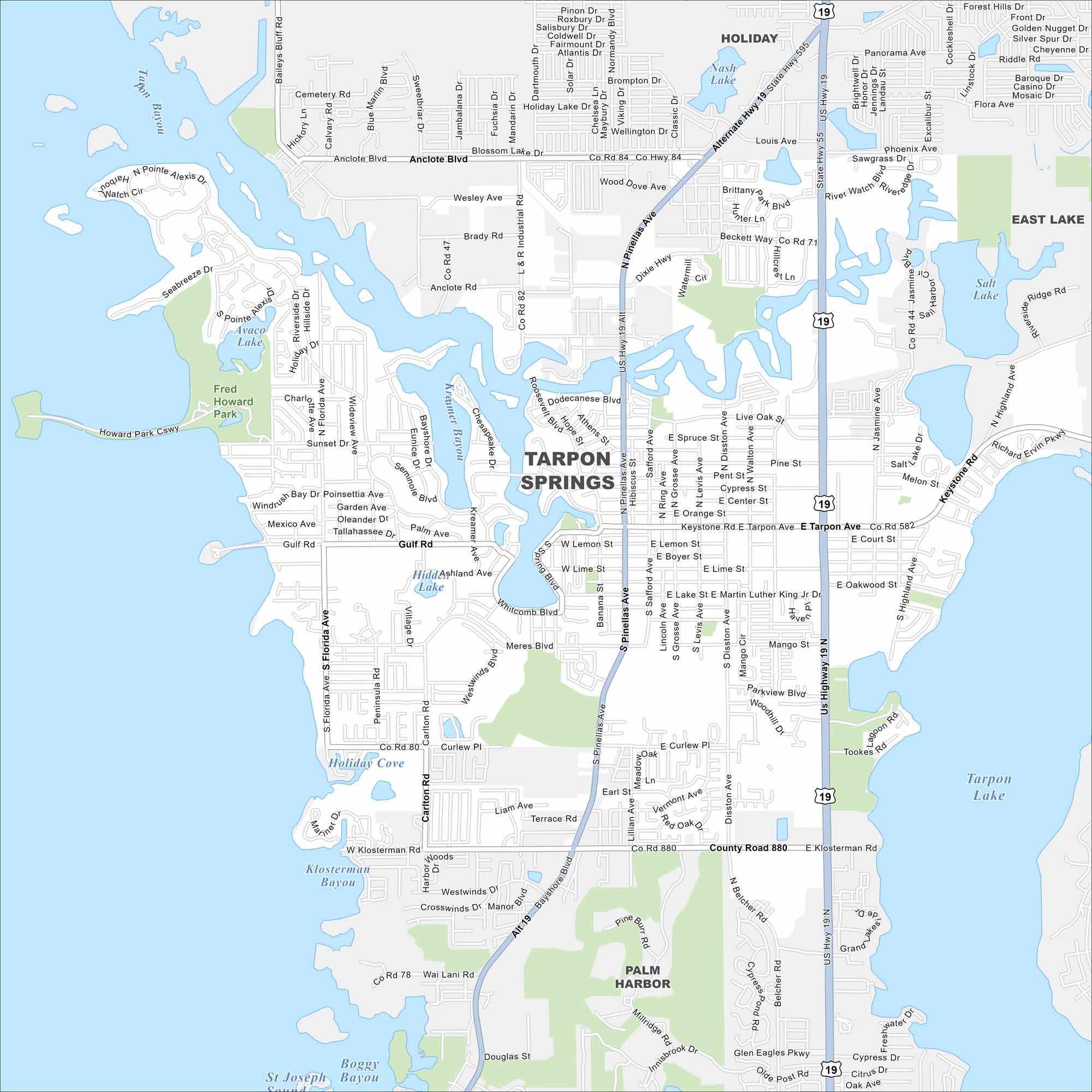
Here’s a simple map of Tarpon Springs. The town is famous for sponge diving, Greek heritage, and waterfront dining. It’s situated next to Lake Tarpon, the largest freshwater lake in the Tampa Bay area.
Florida State Maps
Discover Florida through our state maps


Map Information
On the Map
Interstates/Highways: US Hwy 19, State Rte 595 Major Roads: Tarpon Ave, Pinellas Ave, Keystone Rd, Klosterman Rd, Anclote Blvd, Gulf Rd, Meres Blvd, Florida Ave, Jasmine Ave, Disston Ave, Riverside Dr, Hibiscus St, Grosse Ave, Safford Ave, Lemon St, Boyer St, Lime St, Orange St, Cypress St, Center St Lakes and Reservoirs: Lake Tarpon, St. Joseph Sound, Boggy Bayou, Klosterman Bayou, Holiday Cove, Whitcomb Bayou, Kreamer Bayou, Avaco Lake, Salt Lake, Nash Lake Parks and Preserves: Fred Howard Park Nearby Communities: Holiday, East Lake, Palm HarborFlorida City Maps
Chart your course through Miami and Florida’s cities


