Map of Tampa, Florida
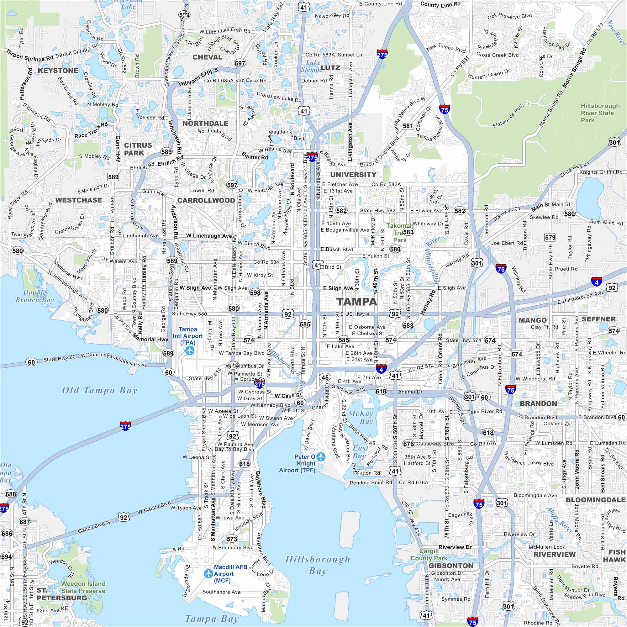
Our map of Tampa shows you the Gulf Coast city. From the Riverwalk to Ybor City and nearby beaches, this city is full of life.
Florida State Maps
Discover Florida through our state maps


Map Information
On the Map
Interstates/Highways: I-75, I-275, I-4, US Hwy 41, US Hwy 92, US Hwy 301, State Hwy 589, State Hwy 60, State Hwy 580, State Hwy 574 Major Roads: Kennedy Blvd, Gandy Blvd, Hillsborough Ave, Dale Mabry Hwy, Fowler Ave, Fletcher Ave, Bearss Ave, Busch Blvd, Sligh Ave, Waters Ave, Linebaugh Ave, Gunn Hwy, Sheldon Rd, Bruce B Downs Blvd, Adamo Dr, Causeway Blvd, Bayshore Blvd, West Shore Blvd, Manhattan Ave, 22nd St Airports: Tampa Intl Airport (TPA), Peter O Knight Airport (TPF), Macdill AFB Airport (MCF) Lakes and Reservoirs: Old Tampa Bay, Hillsborough Bay, Tampa Bay, McKay Bay, Lake Lutz, Lake Stemper Major Rivers: Hillsborough River, New River Parks and Preserves: Hillsborough River State Park, Cargill County Park, Weedon Island State Preserve Nearby Communities: Lutz, Keystone, Citrus Park, Westchase, Town ‘N’ Country, Carrollwood, University, Temple Terrace, Seffner, Mango, Brandon, Bloomingdale, Riverview, Gibsonton Neighborhoods: Downtown TampaFlorida City Maps
Chart your course through Miami and Florida’s cities


