Map of Tallahassee, Florida
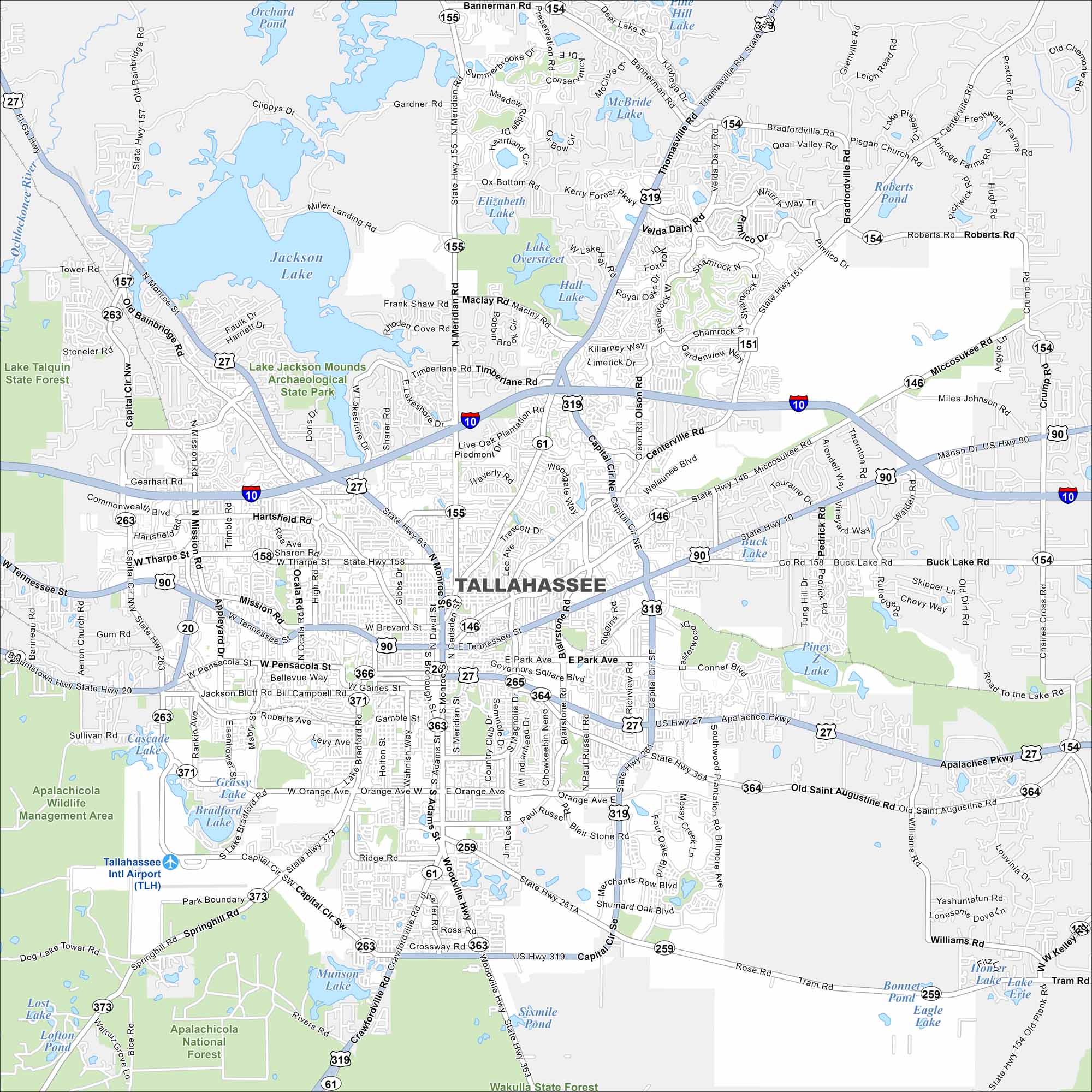
Our road map of Tallahassee shows Florida’s capital city. It’s home to Florida State University and plenty of history. The city is also great for walking with lots of parks and lakes.
Florida State Maps
Discover Florida through our state maps


Map Information
On the Map
Interstates/Highways: I-10, US Hwy 27, US Hwy 90, US Hwy 319, State Hwy 61, State Hwy 20, State Hwy 263, State Hwy 155, State Hwy 158, State Hwy 366, State Hwy 371, State Hwy 373, State Hwy 363, State Hwy 364 Major Roads: Tennessee St, Monroe St, Capital Cir, Apalachee Pkwy, Thomasville Rd, Meridian Rd, Pensacola St, Tharpe St, Mission Rd, Adams St, Blairstown Rd, Miccosukee Rd, Mahan Dr, Centerville Rd, Hartsfield Rd, Orange Ave, Lake Bradford Rd, Jackson Bluff Rd, Bannerman Rd, Old Bainbridge Rd Airports: Tallahassee Intl Airport (TLH) Lakes and Reservoirs: Lake Jackson, Lake Lafayette, Lake Overstreet, McBride Lake, Elizabeth Lake, Moore Lake, Orchard Pond, Miller Landing Rd, Grassy Lake, Munson Lake, Sixmile Pond, Bonnet Pond, Eagle Lake, Lake Erie, Buck Lake Major Rivers: Ochlockonee River Parks and Preserves: Lake Jackson Mounds Archaeological State Park, Apalachicola Wildlife Management Area, Apalachicola National Forest, Wakulla State Forest, Maclay Gardens State Park Nearby Communities: Perkins, Felkel, Capitola, LloydFlorida City Maps
Chart your course through Miami and Florida’s cities


