Map of Charleston, South Carolina
Our map of Charleston highlights the peninsula, waterways, and historic districts. It sits where the Ashley and Cooper Rivers meet.
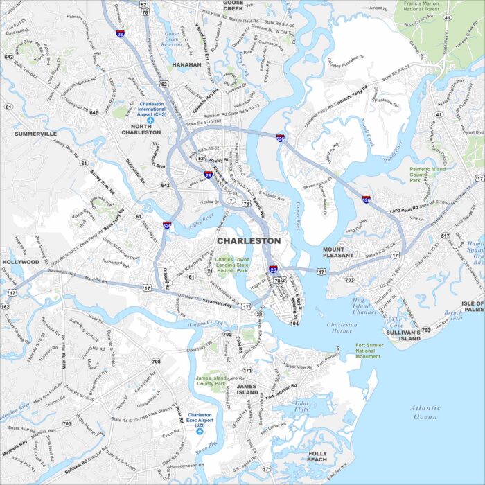
Our map of Charleston highlights the peninsula, waterways, and historic districts. It sits where the Ashley and Cooper Rivers meet.
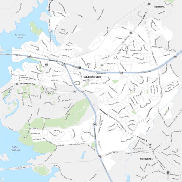
Our map of Clemson shows the city’s streets, highways, and lakefront. Home to Clemson University, it sits on the shores of Lake Hartwell.
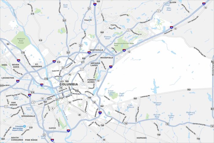
See our map of Columbia with its highways and rivers. As South Carolina’s capital, it sits where the Broad and Saluda Rivers join.
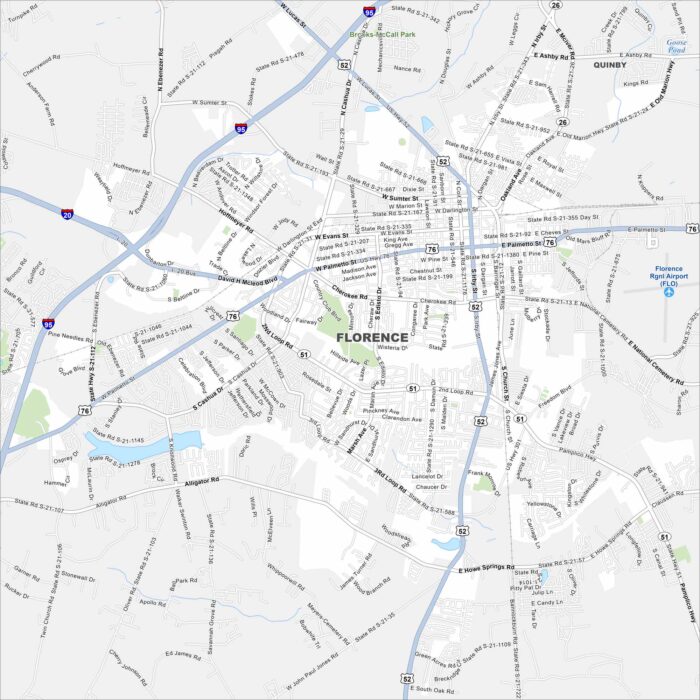
Florence, South Carolina is in the Pee Dee region of the state. Rail lines and highways cross here, giving it a hub-like feel.
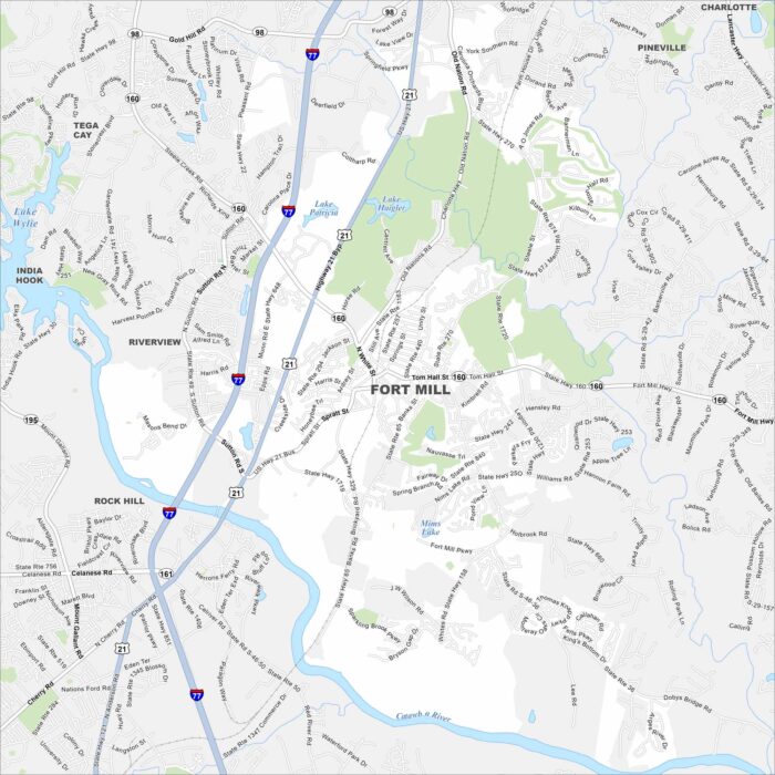
Explore our map of Fort Mill just south of Charlotte. The Catawba River flows nearby, giving the area a natural border.
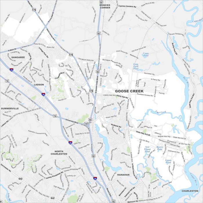
Goose Creek is outside Charleston, with rivers and creeks running nearby. It feels suburban but stays connected to the larger metro.
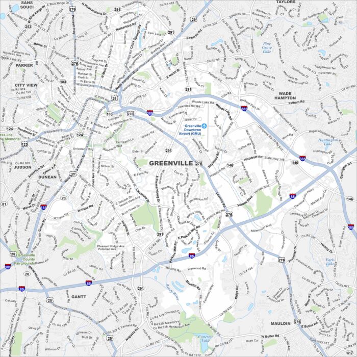
Check out our map of Greenville in the foothills of the Blue Ridge Mountains. The Reedy River cuts through downtown.
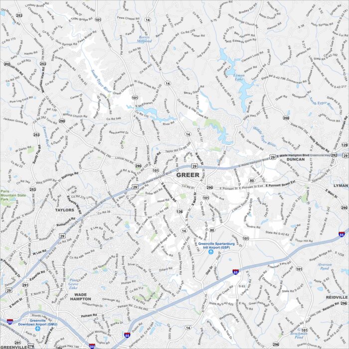
Take a look at our map of Greer between Greenville and Spartanburg. Its location is near Greenville-Spartanburg International Airport.
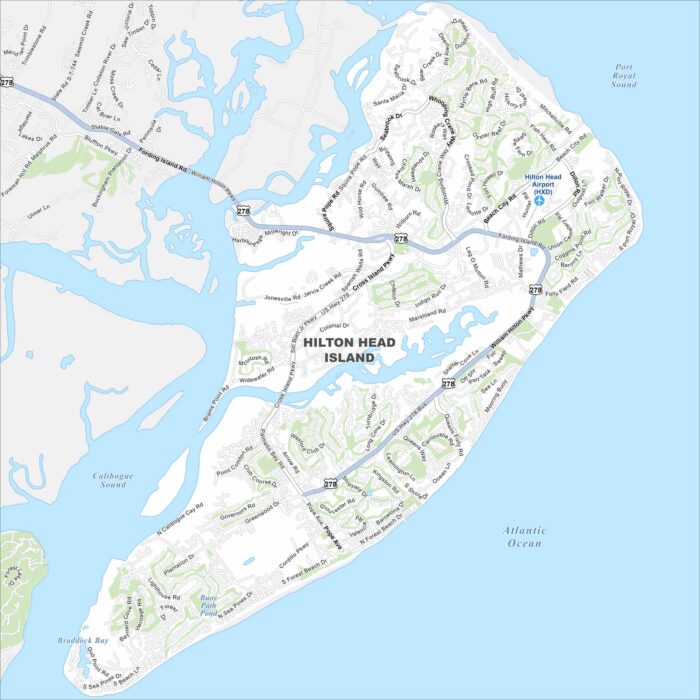
Explore our map of Hilton Head Island on the Atlantic coast. You’ll notice beaches, green spaces, and lagoons scattered across the island.
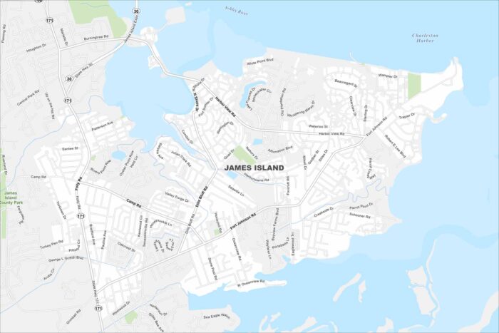
James Island sits between Charleston Harbor and Folly Beach. This map shows marshes and tidal creeks occupying across the island.
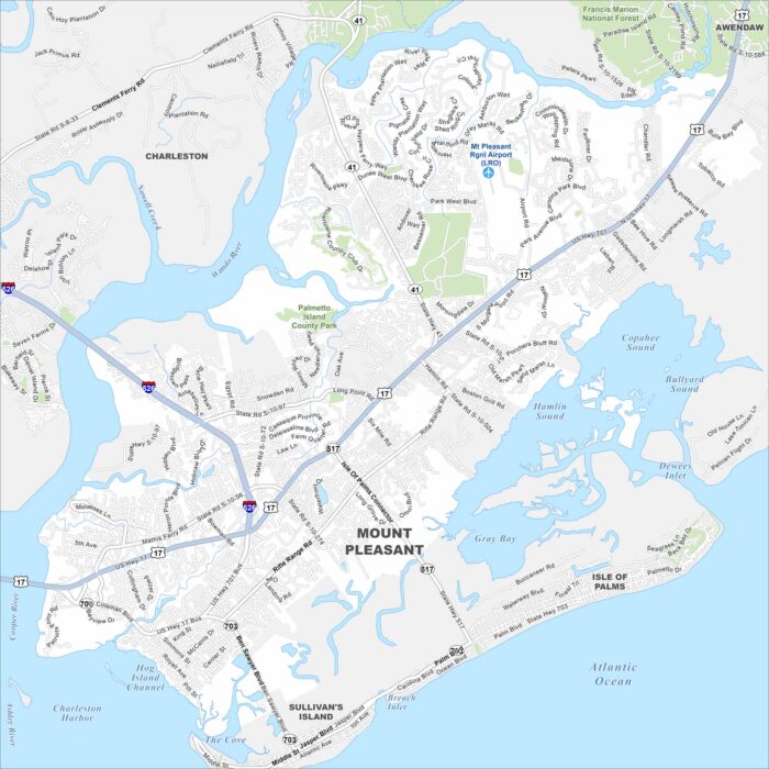
Our map of Mount Pleasant highlights its spot along Charleston Harbor. Bridges, waterways, and neighborhoods define the city’s layout.
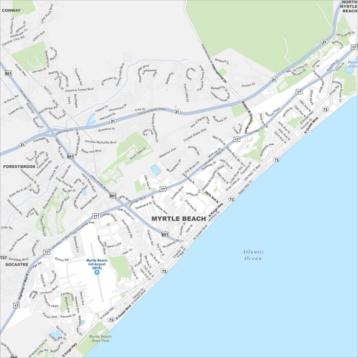
Our map of Myrtle Beach highlights a resort city on the Atlantic coast. Tourism drives nearly everything here.
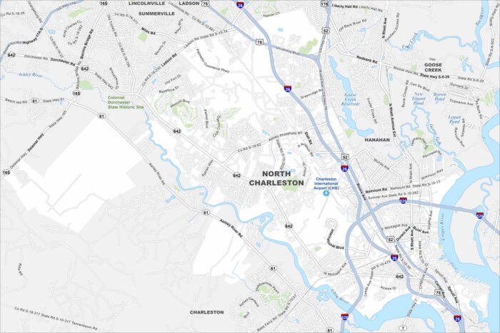
North Charleston lies just outside downtown Charleston. Check out our map to see its rivers and the Charleston International Airport.
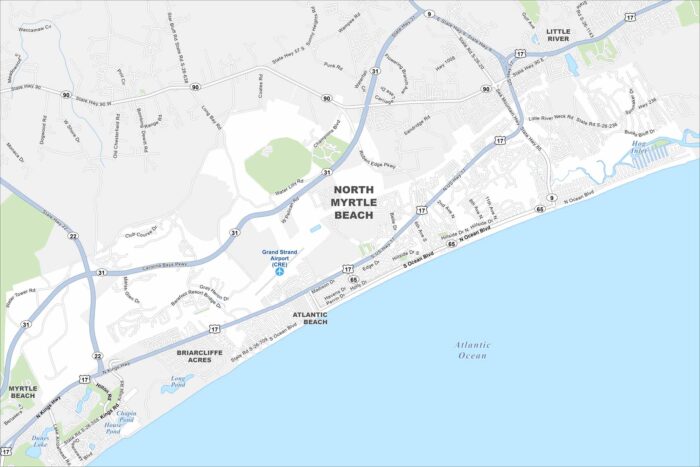
North Myrtle Beach lines the Atlantic coast just above Myrtle Beach. Use our map to see beachfront neighborhoods and highways leading inland.
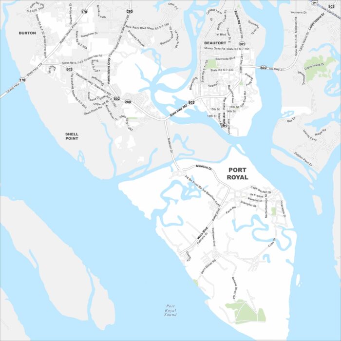
Port Royal spreads along the Beaufort River in the Lowcountry. Our map displays its streets near the waterfront and historic district.