Map of Pittsburgh, Pennsylvania
Pittsburgh sits at the confluence of three rivers, with bridges everywhere you look. Our map shows how hills and valleys shape Pittsburgh.
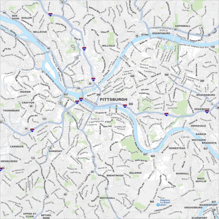
Pittsburgh sits at the confluence of three rivers, with bridges everywhere you look. Our map shows how hills and valleys shape Pittsburgh.
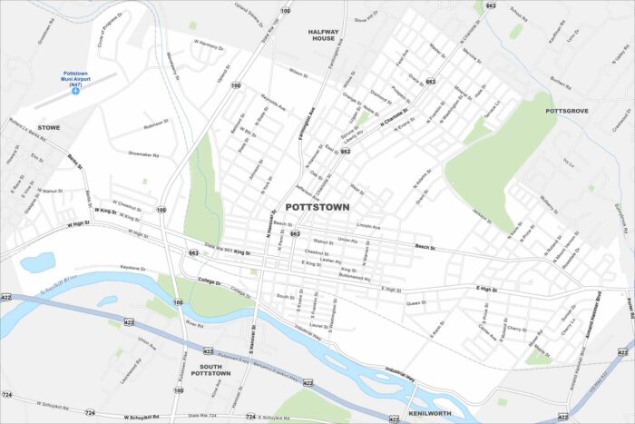
Pottstown hugs the Schuylkill River with a compact downtown layout. Rolling hills and farmland surround the town.
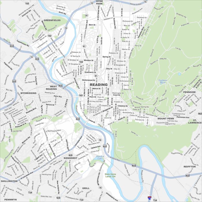
Reading sits along the Schuylkill River and has a strong industrial past. This map highlights its main roads, parks, and surrounding hills.
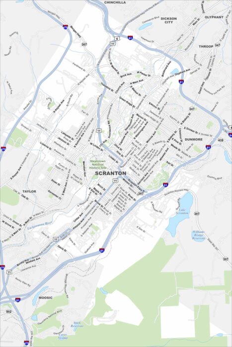
Get to know Scranton with our road map. From the Steamtown National Historic Site to downtown blocks, learn more about this valley city.
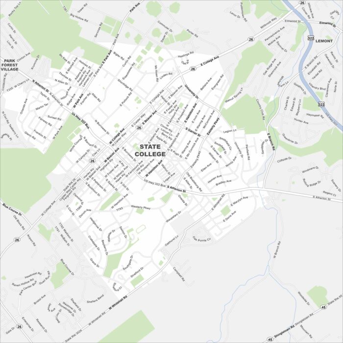
Our map of State College helps you find your way around this classic college town. Penn State’s campus sits right at the center.
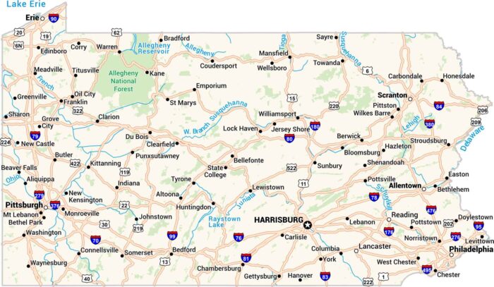
Our Pennsylvania map shows highways and rivers. Cities like Pittsburgh and Philadelphia anchor each end. It’s a state built on history.
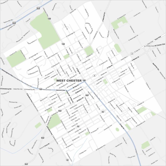
Our map of West Chester highlights its brick-lined streets and historic downtown. As the Chester County seat, it’s filled with culture.
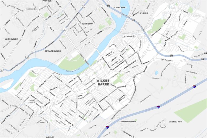
This map of Wilkes-Barre shows its pristine location along the Susquehanna River. It’s a historic city tied to coal mining and industry.
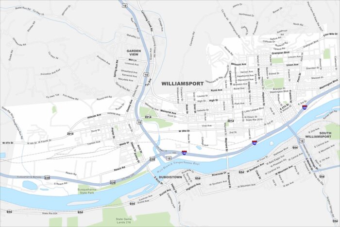
Our Williamsport map puts you in the home of Little League Baseball. The Susquehanna River also runs right through the city to the south.
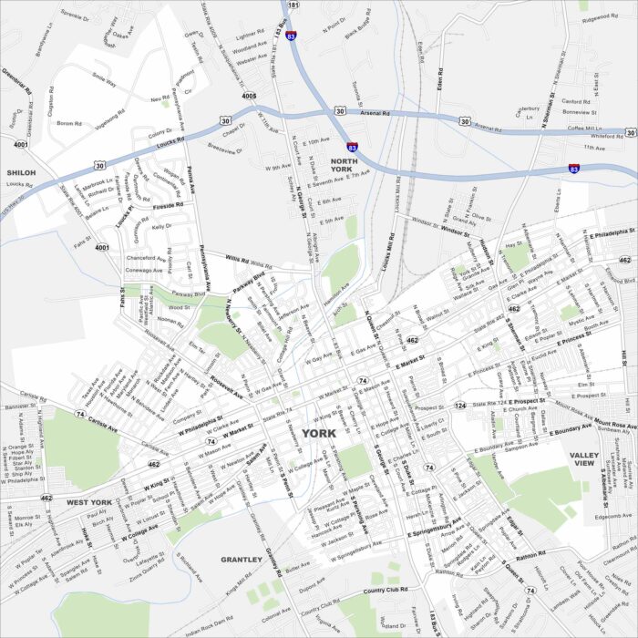
Our road map of York highlights the city’s colonial heritage. It’s a historic hub with ties to early American independence.