Map of Altoona, Pennsylvania
Built in the shadow of the railroad, Altoona spreads around the famous Horseshoe Curve. Streets wind through old neighborhoods on our map.
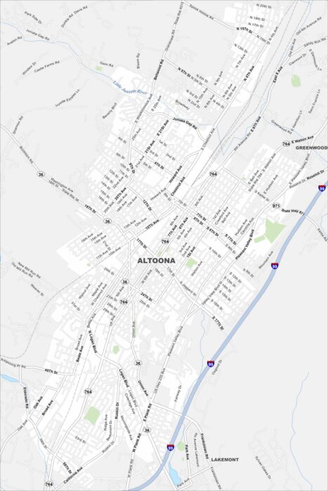
Built in the shadow of the railroad, Altoona spreads around the famous Horseshoe Curve. Streets wind through old neighborhoods on our map.
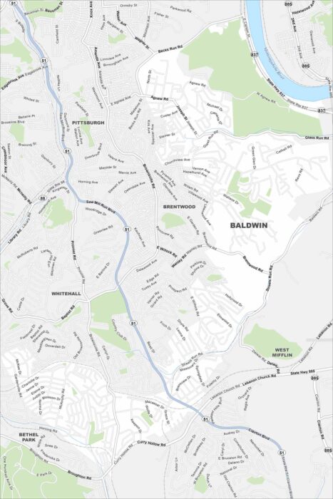
We’ve mapped Baldwin Borough with its streets, highways, and green spaces. The major highways here connect into Pittsburgh.
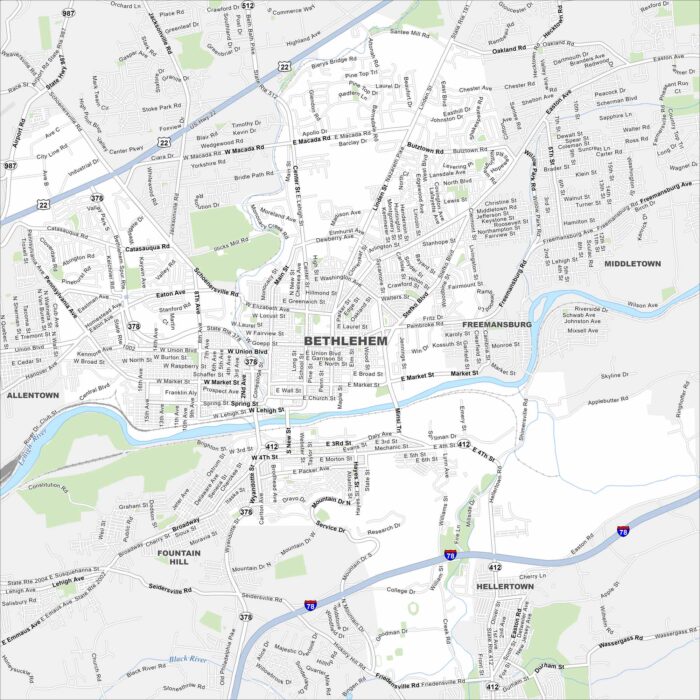
Our map of Bethlehem highlights the Lehigh River, bridges, and major highways. Neighborhood roads and green hills shape the layout.
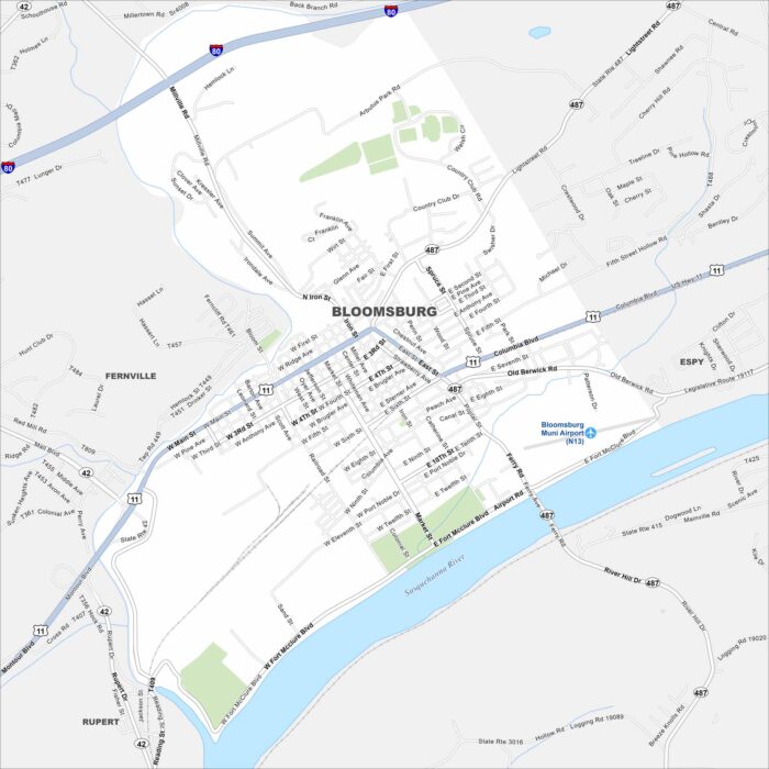
Our map of Bloomsburg shows the highways, streets, and rivers. Roads bend along the Susquehanna all the way to I-80 to the north.
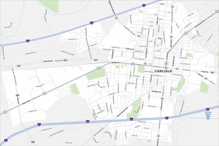
See Carlisle on our map, a small borough in south-central Pennsylvania. It’s known for its car shows because of its history with auto events.
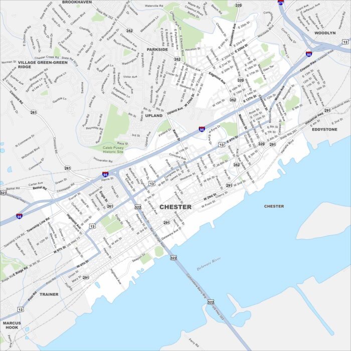
We’ve outlined Chester with its roads, riverfront and rail lines. Sitting on the Delaware River, it’s one of Pennsylvania’s oldest cities.
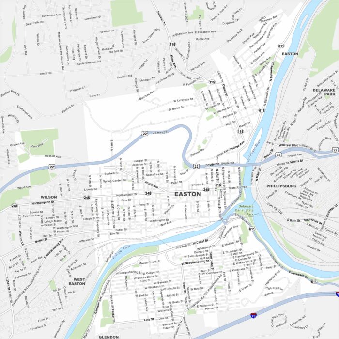
Easton is where the Delaware and Lehigh Rivers meet. On the map, you’ll notice the rivers shaping the city’s borders.
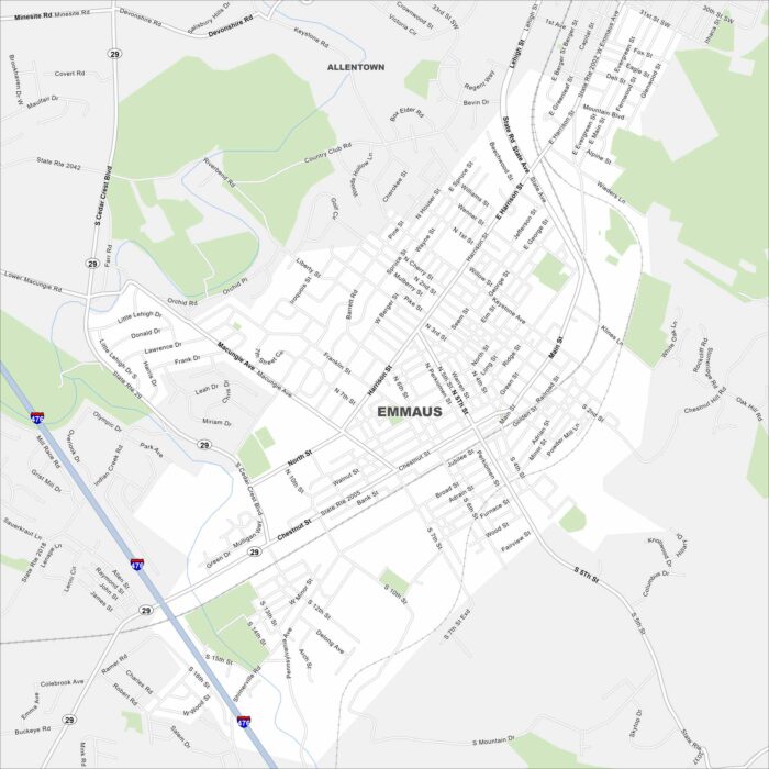
Look at Emmaus on our map just south of Allentown. Main roads like Chestnut Street and Cedar Crest Boulevard shape the borough.
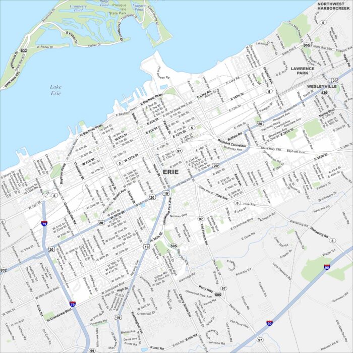
Erie lies on the southern shore of Lake Erie. Its downtown runs right up to Presque Isle Bay. The peninsula sheltering the bay is a landmark.
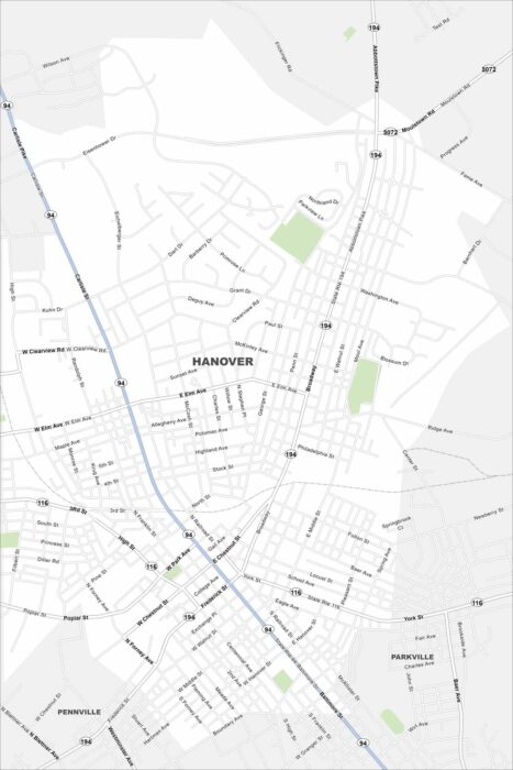
Hanover is located in southern Pennsylvania near the Maryland border. You’ll notice the compact street grid on our map.
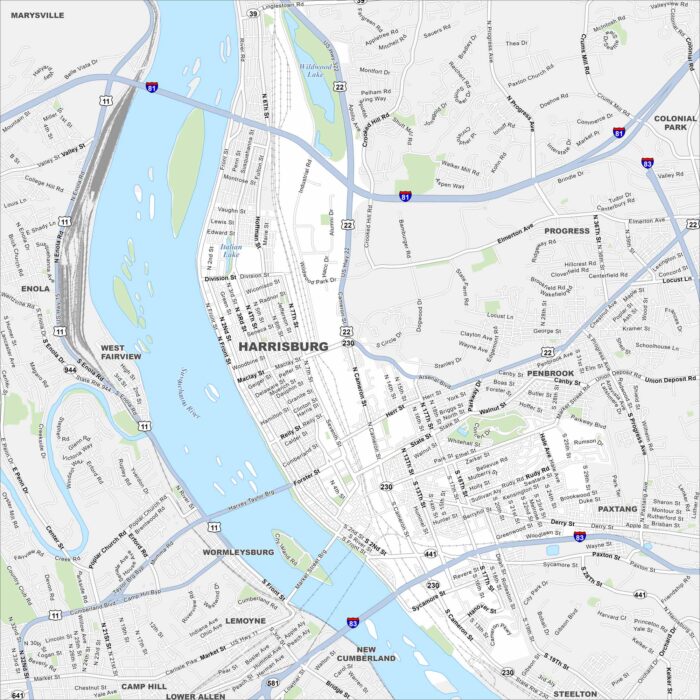
Harrisburg is along the Susquehanna River in south-central Pennsylvania. The city is the state capital so it’s a key place in Pennsylvania.

Our map of Lancaster highlights the compact historic core. Amish farmlands extend out in every direction. Major highways skirt the edges.
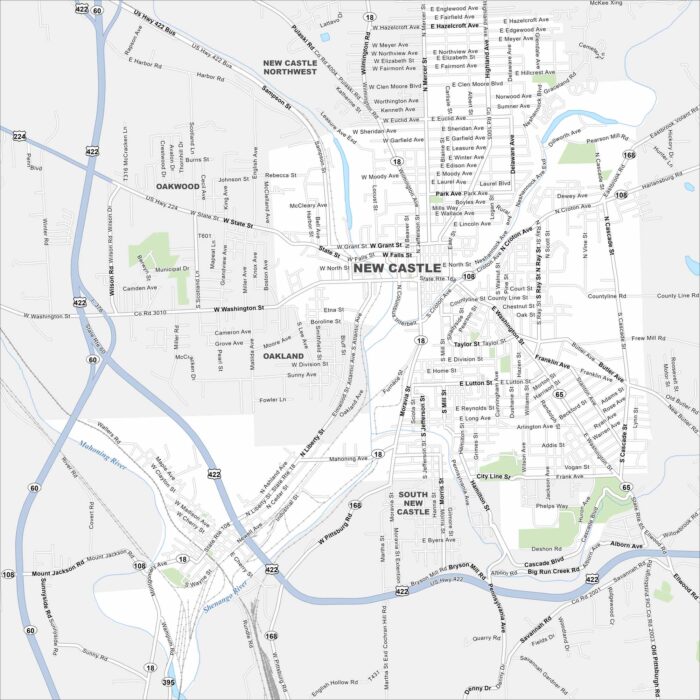
New Castle lies near the Ohio border in western Pennsylvania. Our map shows a compact downtown, river crossings, and neighborhoods.
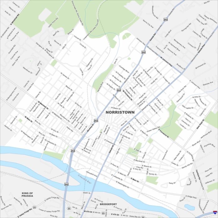
Norristown sits along the Schuylkill River northwest of Philadelphia. Take a look at this map to see its downtown streets and riverfront.
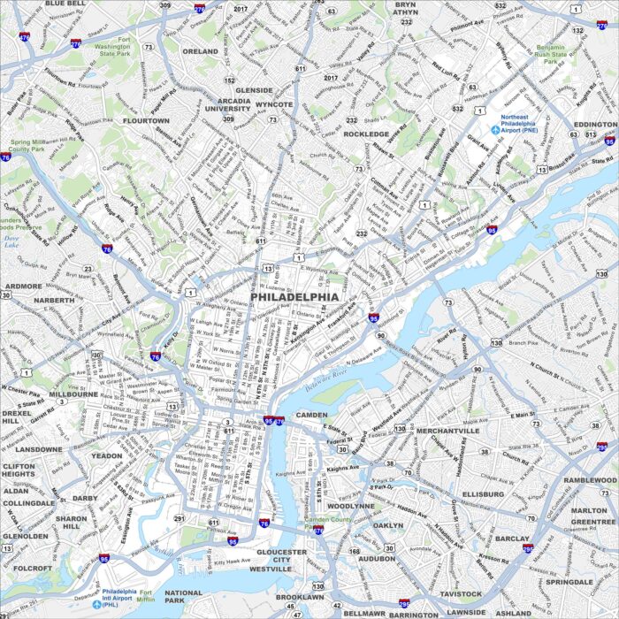
Philadelphia spreads along the Delaware River with a dense historic core. Our map of Philadelphia shows major highways and roads.