North Dakota Outline Map
North Dakota forms a clean rectangle with just a gentle curve on the eastern river border, which is from the Red River.
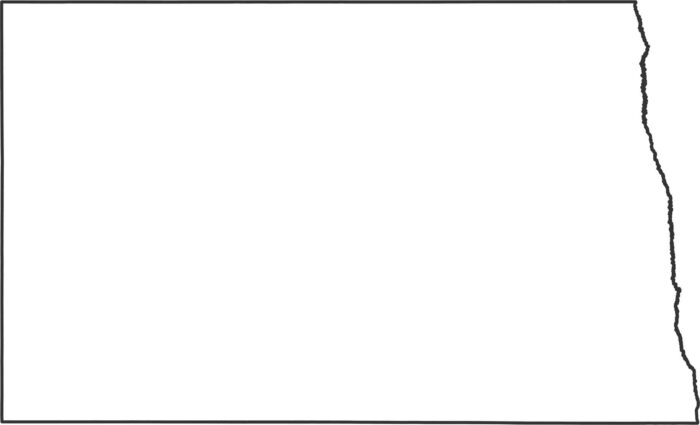
North Dakota forms a clean rectangle with just a gentle curve on the eastern river border, which is from the Red River.
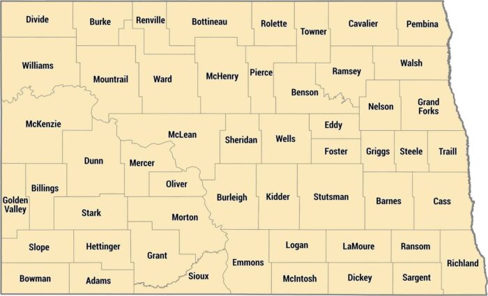
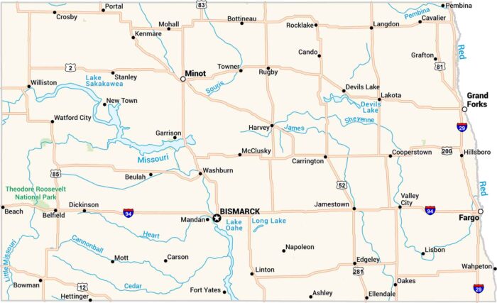
Fifty-three counties make up this sparsely populated prairie state. Cass County on the eastern border has Fargo, the biggest city by far.
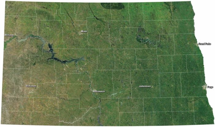
Vast prairies stretch out under wide skies. Fargo and Bismarck rise as the main hubs, but rivers like the Red River cut through the plains.
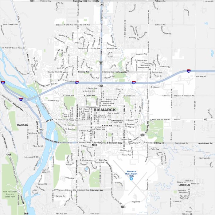
See the highways, streets, and rivers shown clearly here. Our map of Bismarck follows the Missouri River. It is the capital of North Dakota.
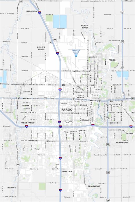
Fargo is on the Red River of the North, right on the Minnesota border. The map shows a flat, open landscape. Its position on the river is key.
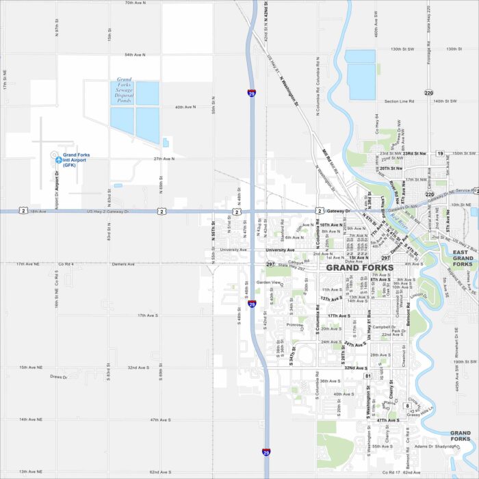
Our map of Grand Forks shows the Red River running along the border with Minnesota. Neighborhoods spread out from the downtown core.
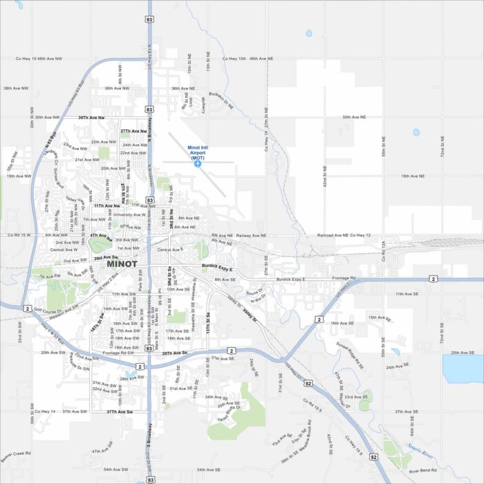
Discover Minot on our map of this north-central North Dakota city. The Souris River winds through town, shaping its layout.
Our North Dakota map brings wide plains and winding rivers into focus. You’ll see highways connecting toward small towns and open skies.
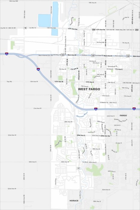
Check out West Fargo, one of the fastest-growing cities in the state. Our map shows its highways, parks, and easy routes into Fargo.
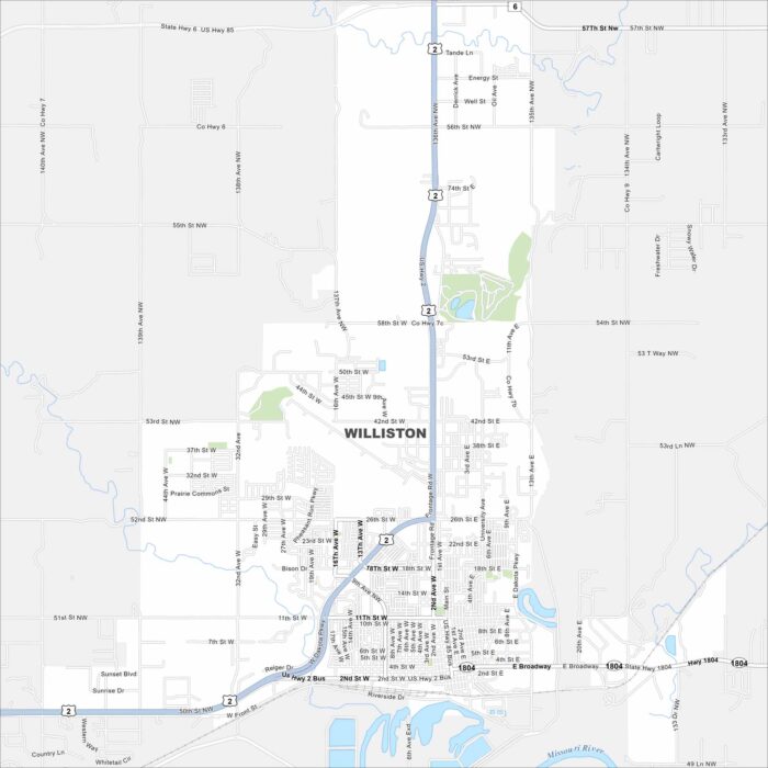
Our map of Williston, North Dakota highlights this city in the Bakken oil region. It’s a growing hub along the Missouri River to the south.