Maine Physical Map
Our physical map of Maine shows where New England gets serious. The Appalachian Mountains roll through the interior with Mount Katahdin.
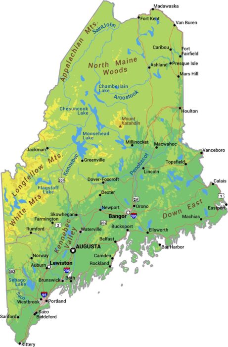
Our physical map of Maine shows where New England gets serious. The Appalachian Mountains roll through the interior with Mount Katahdin.
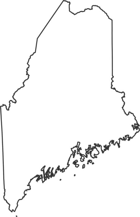
Here’s our Maine outline map. The Atlantic Ocean and Gulf of Maine create the entire south-eastern coastline. Most other lines are straight.
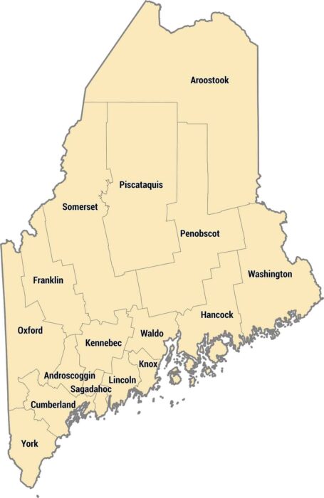
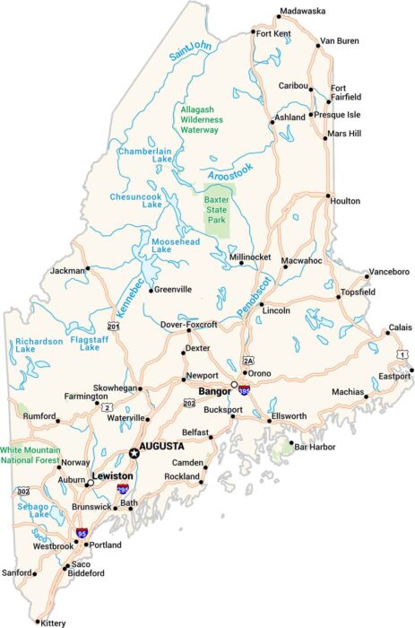
Our Maine county map shows 16 counties from the coast to the Canadian border. Aroostook County up north is huge and rural.
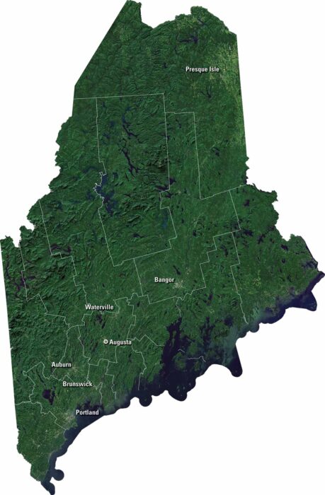
Maine is full of rugged coastline and dense forests. Our satellite map of Maine shows Penobscot Bay and countless lakes inland.

Our map of Bangor displays its highways, streets, and rivers. You can see how it connects to the Penobscot River on the east side.
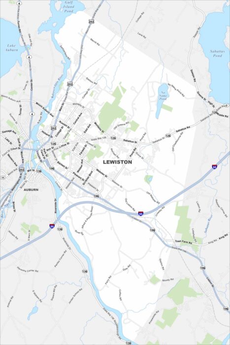
Check out Lewiston alongside the Androscoggin River. Bridges connect its downtown with Auburn just across the water.
Our Maine map brings the coast and countryside together. From Portland’s harbor lights to the deep forests up north, every part stands out.
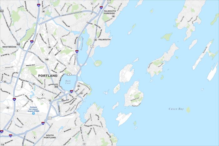
Portland hugs the coast with a busy harbor and peninsulas. Small islands lie just offshore. Use our map to see its highway and roads.
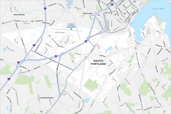
South Portland is known for its working waterfront and views of Casco Bay. Our map shows you around busy shopping districts and coastal parks.
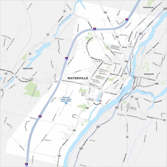
Want to see a map of Waterville? This Kennebec River city is home to Colby College and a growing arts scene.