Hawaii Zip Code Map
Explore the islands spread across the central Pacific. Our map shows ZIP codes across Oahu, Maui, Hawaii Island, and the smaller islands.
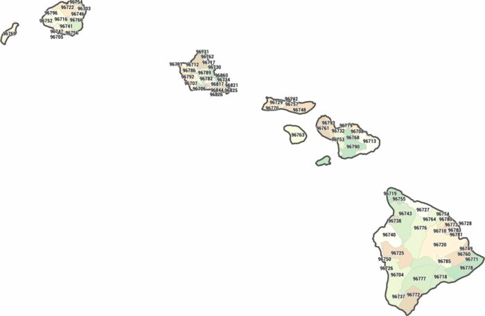
Explore the islands spread across the central Pacific. Our map shows ZIP codes across Oahu, Maui, Hawaii Island, and the smaller islands.
In Hawaii, counties align with island boundaries rather than land divisions. Cities cluster along coastlines, especially on Oahu
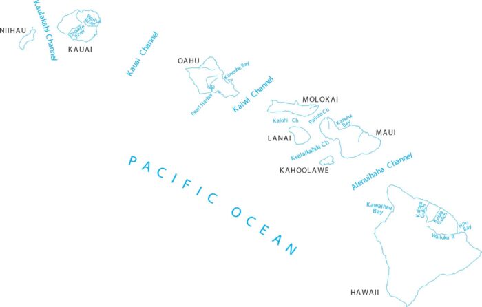
Here’s our map of Hawaii’s channels, bays and gulches. Located in the Pacific Ocean, we’ve mapped out each island and associated channel.
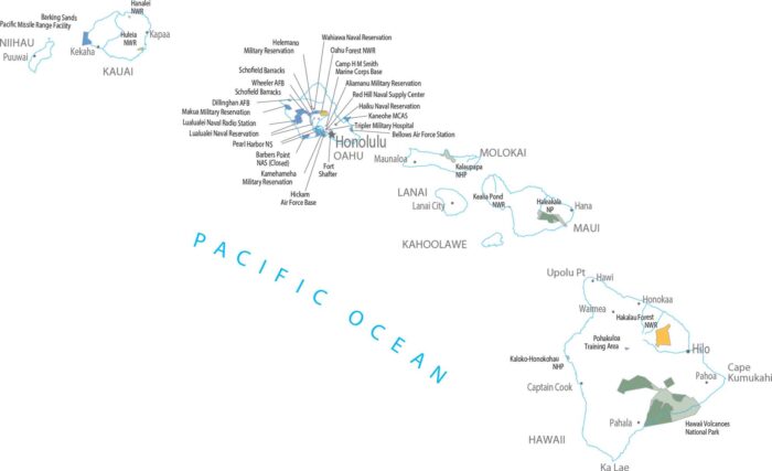
Hawaii Volcanoes National Park stands out instantly on our federal lands map. Protected land follows lava, not roads here in Hawaii.
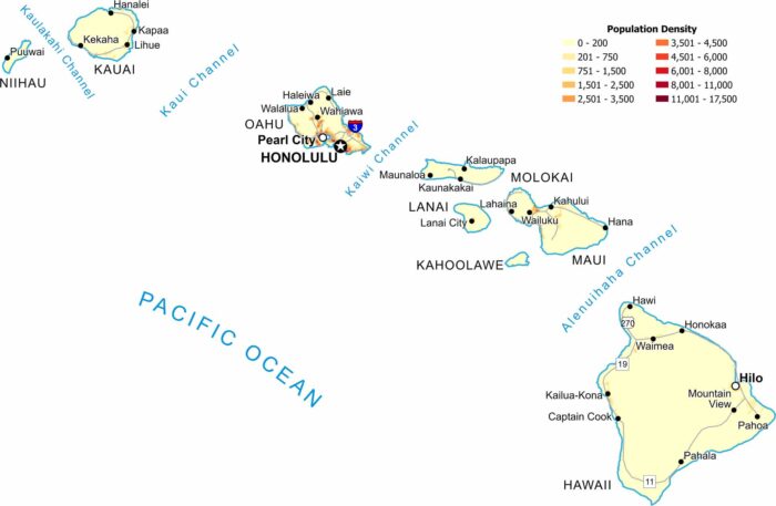
Population clusters tightly along island coastlines, especially near Honolulu. Mountain interiors show very low density.
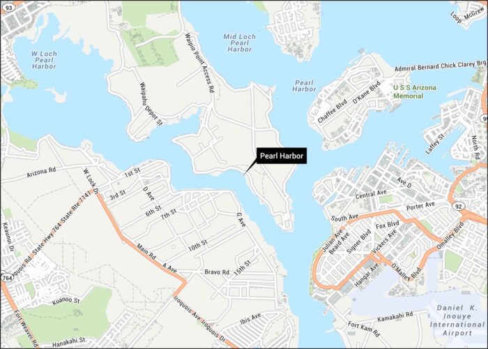
Here’s our map of Pearl Harbor showing harbor basins and surrounding roads. We’ve mapped the key routes that run along the shoreline.
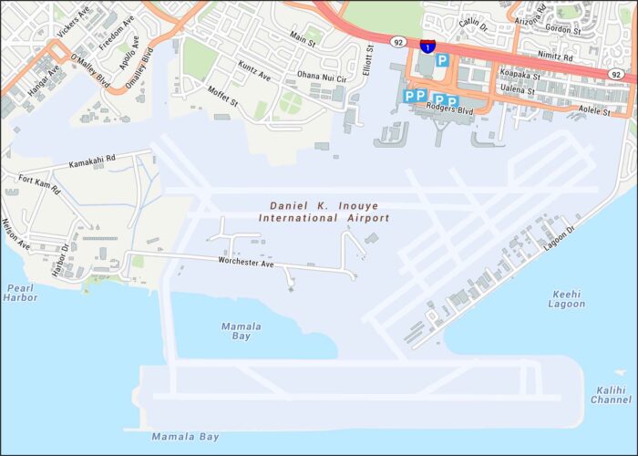
Aloha! Honolulu International Airport sits on Oahu. Our map shows terminals, runways, highways, parking, and streets.
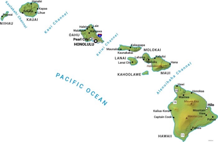
Our physical map of Hawaii shows these Pacific islands all built from volcanoes. Mauna Kea and Mauna Loa dominate the Big Island.
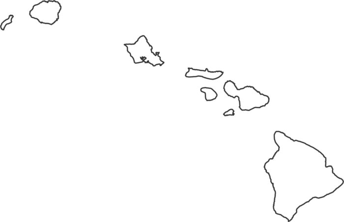
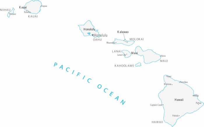
Our outline map of Hawaii shows eight main islands scattered across the Pacific. Each island has irregular coastline formed by volcanoes.
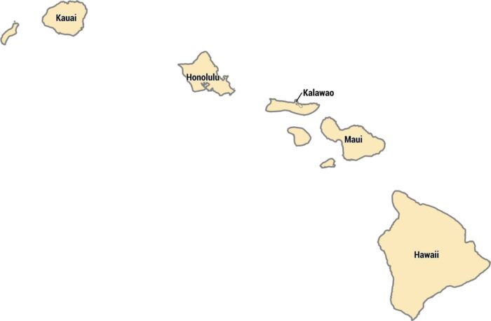
Hawaii’s 5 counties each cover different islands. Each county matches one of the islands, except for a small area on Molokai called Kalawao.
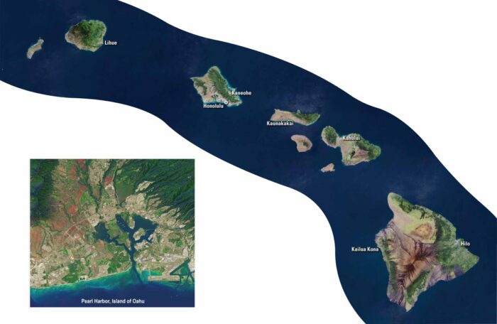
Look closer at Hawaii from above with our satellite map. This string of volcanic peaks rise from the deep blue Pacific Ocean waters.
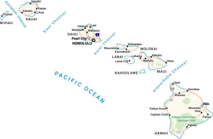
Here’s a map of Hawaii worth keeping. Every island, from Kauai to the Big Island, comes to life. You can see its channels, towns, and roads.
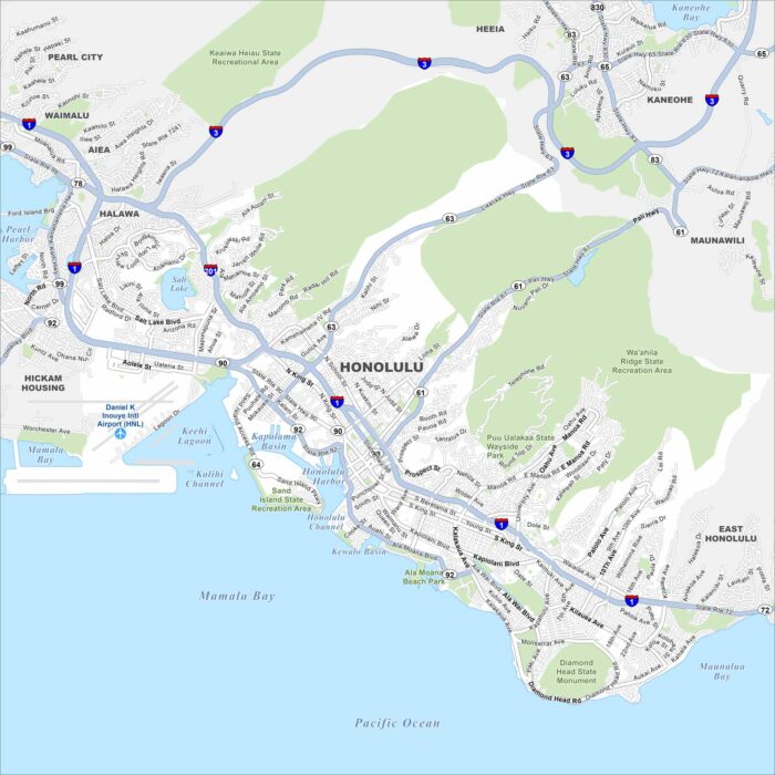
Honolulu is the heart of Oʻahu, stretching from Waikīkī to downtown. Our map helps you see beaches, landmarks, and mountain valleys together.