Map of Peachtree City, Georgia
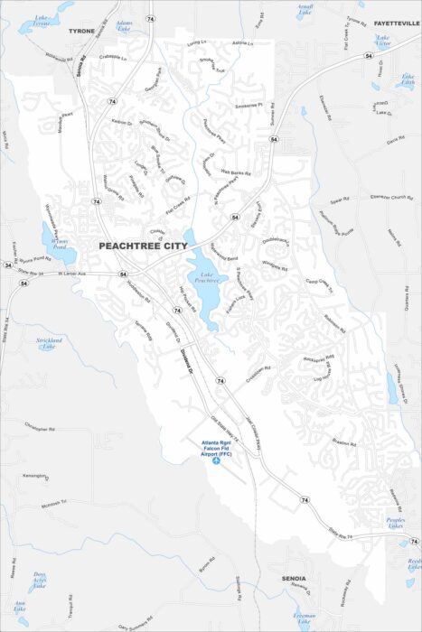
Our map of Peachtree City highlights a network of winding through neighborhoods. Lakes and greenbelts are everywhere here.
Our map of Peachtree City highlights a network of winding through neighborhoods. Lakes and greenbelts are everywhere here.
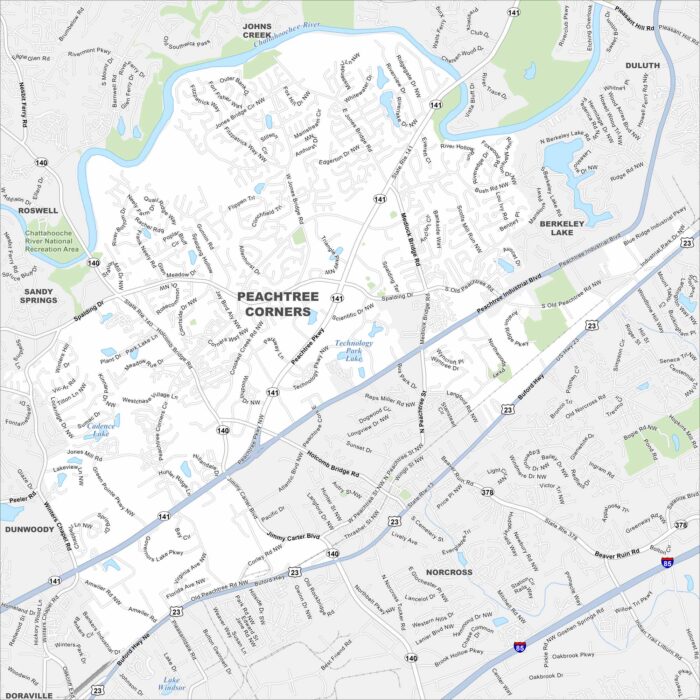
Peachtree Corners sits along the Chattahoochee River northeast of Atlanta. Check out the map to see its residential areas and business parks.
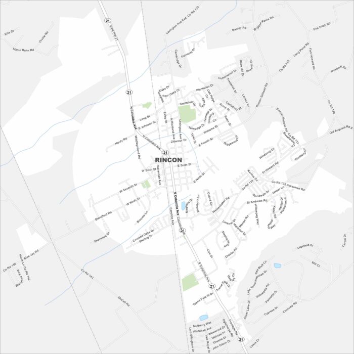
Our map of Rincon lays out the main streets and local neighborhoods. The town is close to Savannah so it’s easy to commute back and forth.
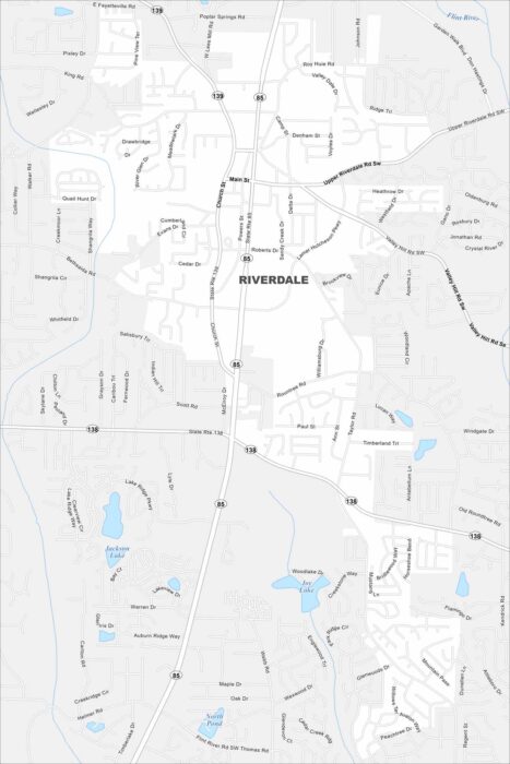
Our Riverdale map shows local streets and the city center. You can also see roads heading north toward Atlanta and surrounding neighborhoods.
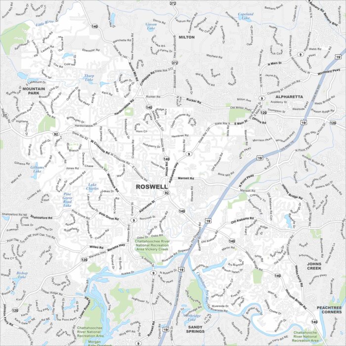
This map of Roswell highlights the historic district and the Chattahoochee River. You’ll see how neighborhoods branch out from downtown.
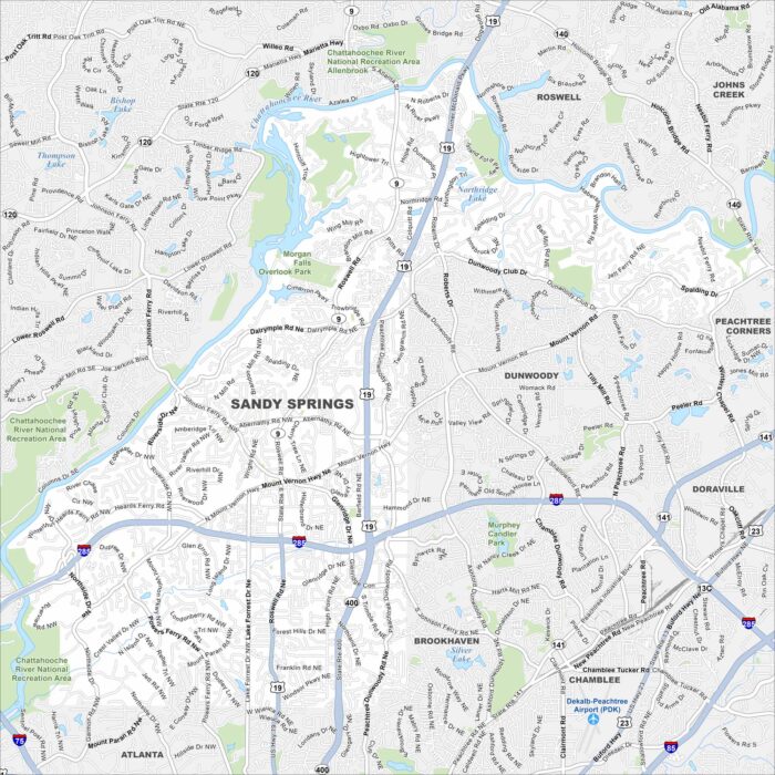
Our map of Sandy Springs guides you through its bucketload of parks and the banks of the Chattahoochee River.
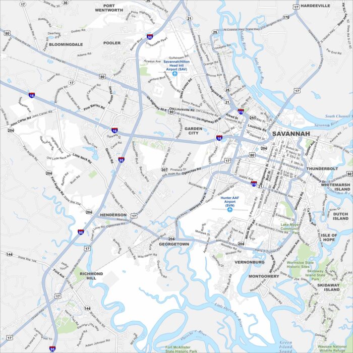
Our map of Savannah highlights the city’s famous squares, oak-lined streets, and riverfront. Walking or driving, it’s the perfect guide.
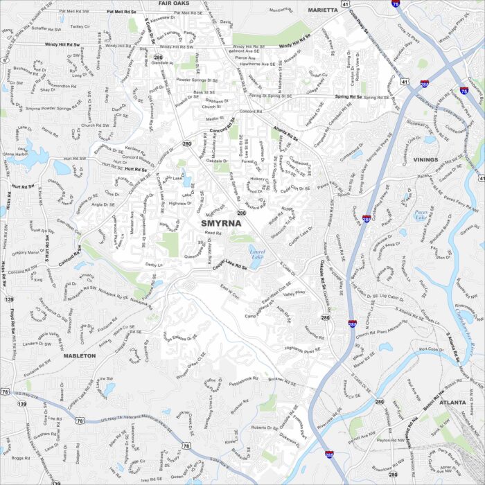
Here’s our map of Smyrna, a suburb near Atlanta. Located in Cobb County, it’s part of the inner ring of the Atlanta Metropolitan Area.
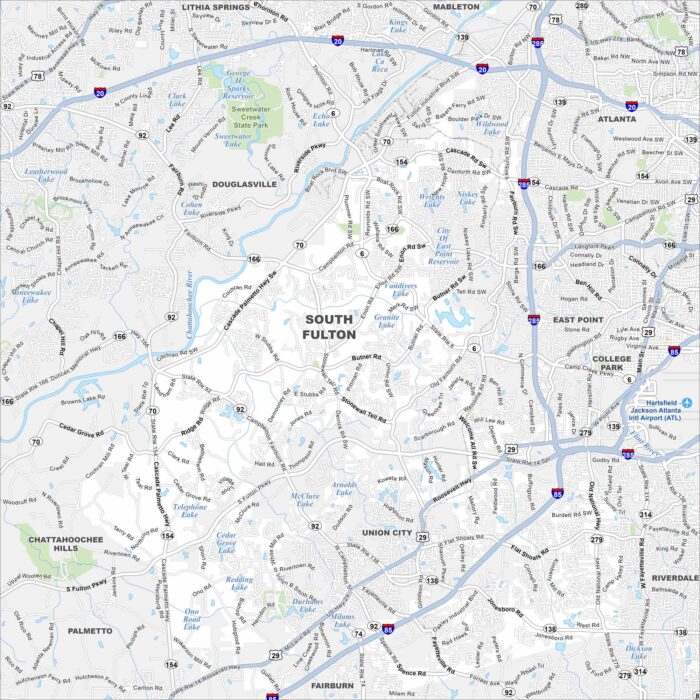
Familiarize yourself with South Fulton using our map. This newer city on Atlanta’s edge covers neighborhoods, parks, and green space.
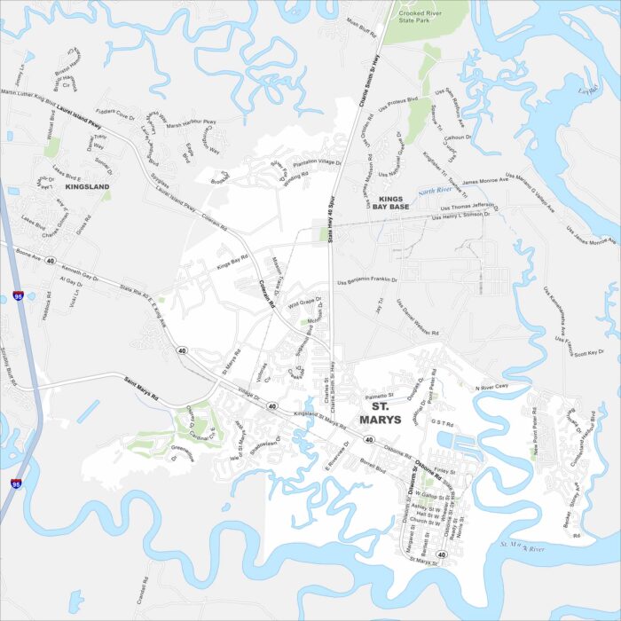
St. Marys is a quiet coastal town near the Florida line. Our map helps you explore its historic waterfront and roadways.
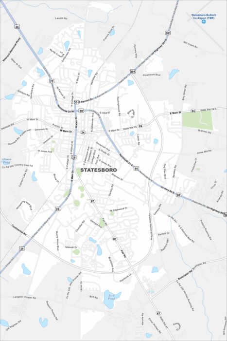
Here’s our map of Statesboro, a city tied closely to Georgia Southern University. US-80 and US-25 are the major highways here.
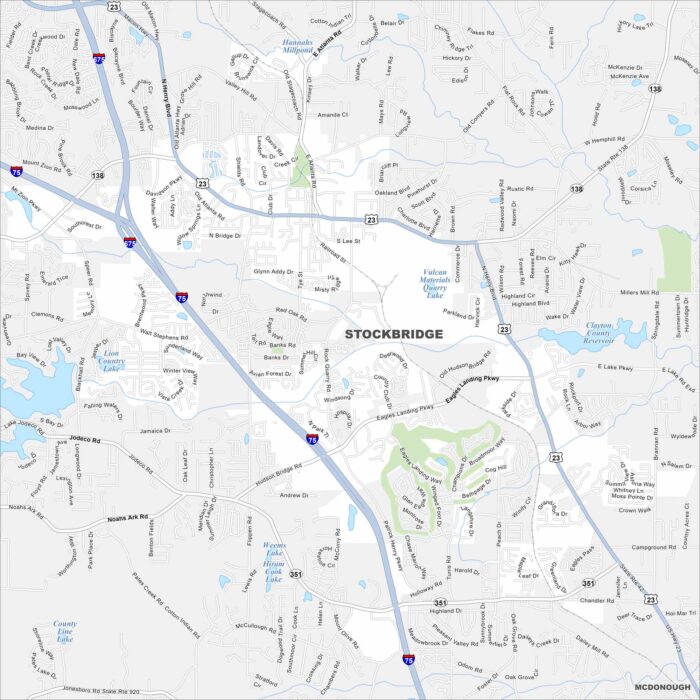
Our map of Stockbridge highlights a growing city just south of Atlanta. Panola Mountain State Park is one of its best outdoor escapes here.
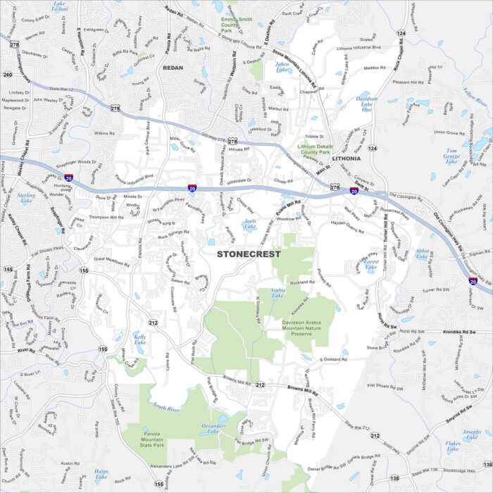
We’ve mapped out every major road in Stonecrest. You’ll see how this young city connects to Atlanta and nearby Arabia Mountain trails.
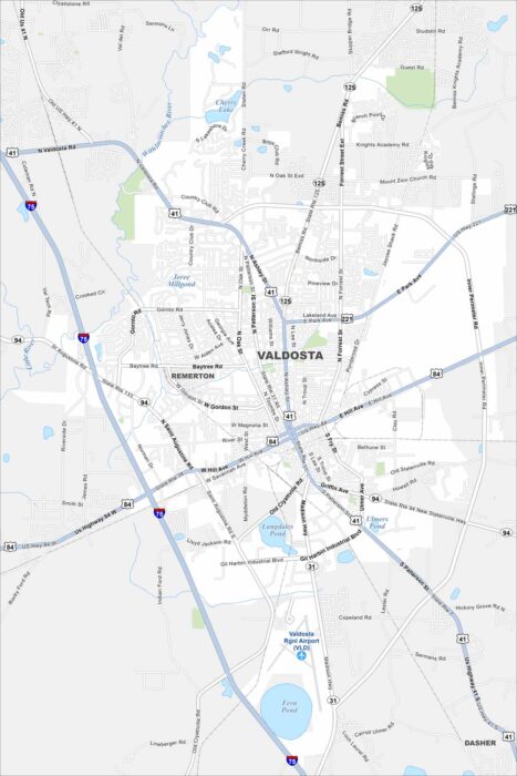
Valdosta is a South Georgia hub known as the “Azalea City”. Our map shows ponds/lakes like Fern and Langdales Pond.
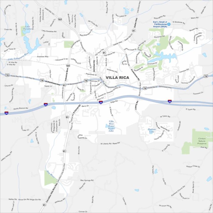
Our Villa Rica map highlights this historic gold-mining town. Today it’s a growing community west of Atlanta with deep roots.